A Brief Overview of the Juliana Trail
Looping around the Julian Alps in northwestern Slovenia and Italy is the stunning Juliana Trail. The Juliana Trail follows valleys, forest paths, and alpine meadows to weave its way through some of the most magical terrain in all of Europe. The design of the trail keeps hikers off of high-alpine routes on exposed ridgelines, making it accessible to strong hikers that are without technical mountaineering skills.t delivers many of the rewards of hiking in the Alps while remaining accessible to hikers without technical mountaineering experience.
The full loop covers around 270 kilometers (168 miles) and is typically completed in between twelve and sixteen days. The vast majority of hikers will allow for fourteen days of hiking, enough to soak in all the beauty, but still push yourself physically.
Each stage of the Juliana Trail drops you off in a town or small village with options for places to stay and a hearty meal to wrap up the day with. This makes logistics a breeze up against other long distance trails that require organizing with remote huts deep in the mountains.
The Juliana Trail stands out as one of Europe’s best long-distance treks because of its perfect combination of alpine scenery, culture, and comfort. The trail brings hikers past turquoise rivers, glacial valleys, flowing waterfalls, lakes, forests, farms, and so much more. It shows hikers what it’s like to live a slow, relaxed life in the heart of quiet villages not frequently visited. Any hiker who wants to hike amidst the scenery of the Julian Alps, without the technical difficulty of high mountaineering, can easily tackle this moderate trail and get the best of both worlds. For hikers planning a broader adventure, it’s worth exploring some of the other unforgettable hikes in Slovenia before finalizing your itinerary.
The Need-to-Know for Hiking the Juliana Trail
Distance and Elevation
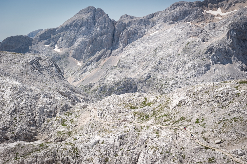
Covering just shy of 270 kilometers (269.9 to be precise), the Juliana Trail circumnavigates the mountain of Triglav, Slovenia’s highest peak. Although the trail doesn’t go as high as the mountain, it still covers a total elevation gain of 7,412 meters spread out over sixteen main stages of hiking. Each stage is between 10-25 kilometers in length, with the option of an additional southern extension to Solkan.
The trail is considered to be of moderate difficulty, not due to terrain complexity, but because of its cumulative distance. There are steady climbs and descents on each day, but you won’t find any abrupt and sustained steep ascents that may require ropes or scrambling.
Navigating the Juliana Trail
The Juliana Trail is well-marked, but it’s always advised to carry a backup form of navigation. If you carry a phone or GPS device with GPX tracks, you can double check direction at crossroads where there are multiple trail signs, or find your way through thickly forested areas when markings may be harder to locate. Overall, the trail is easy to follow, so long as you’re paying attention and ready for anything.
Wildlife on the Juliana
While there are plenty of different species of wildlife to be found along the trail, they aren’t considered a risk for hikers. There are chamois, ibex, marmots, deer, and so much more. Brown bears and wolves do live in Slovenia, however are extremely unlikely to be encountered while on this trail.
Without any recorded incidents on this route with larger wildlife, the real risks are ticks in the forests, insects in the summer, and sometimes the livestock on pastureland. All of these risks can be easily mitigated with repellent and the awareness of respecting livestock’s space.
A Mix of Terrain on the Juliana Trail
Every day you’ll experience a shift in the terrain while hiking the Juliana Trail. One day you could follow narrow forest paths with dense canopies above you, and the next you may walk along a gravel road next to farmland for a bit, and then a riverside path, and then an alpine meadow after a nice long climb.
There are no exposed ridges that you will walk along, nor is there any technical scrambling. The terrain of the Juliana Trail is suitable for most hikers that come prepared. The only time you’ll need trekking poles would be on long descents or after a long day of hiking. At the end of every day, and sometimes throughout the day, you’ll wind up in inhabited areas, meaning you’re never far from a village, road, farm, or some form of assistance if necessary.
Accommodation
The Juliana has a wide array of options for accommodation all the way along the trail. You’ll find guesthouses, small hotels, mountain huts, farm stays, and some hostels as you hike your route. Camping in Slovenia is quite limited and heavily regulated. While it can be difficult, there are some campsites in valleys and near towns, but they would require a shift in your daily stages and itinerary.
In the high season (July-August), it’s best to book in advance as the areas are highly touristic. You can find more flexibility in the shoulder season, but even the mountain huts will need reservations in the height of summer.
Due to the high level of accessible accommodation, you can easily hike this entire trail without carrying camping gear, so long as you plan your stops accordingly. This setup makes the route ideal as a self-guided walking holiday, allowing hikers to enjoy the scenery without carrying heavy camping equipment.
When to Hike the Juliana Trail
The best time to hike the Juliana Trail is between late May to September. In May and June, you may find snow still lingering at higher points, but there will be fewer crowds. July and August, on the other hand, are incredibly popular because of the immaculate weather patterns. September comes in as a great choice for anyone looking for a cooler and quieter trek, so long as you’re okay with a bit less daylight.
Early spring and late autumn are often not a great choice due to snow. Accommodations will close in the shoulder season and you’ll potentially wind up needing to hunt for a spot to sleep when you arrive at town. The shoulder season also comes with more frequent weather changes that happen in the blink of an eye, especially in high alpine regions. This can happen even in the summer, so be ready for potential rains and sudden temperature drops.
Getting to the Trail and Back
A great feature of this trail is that it’s a loop. A single point to start and finish from makes the logistics of getting to and from the trail so much easier. You also get more options of where you want to start and finish the trail.
Some common points of access are Kranjska Gora, Bled, or Bovec. All of these are easily reachable by public transport from Ljubljana and buses connect most of the towns the trail passes through. Even if you decide not to hike the whole loop, you can likely catch a bus to get back to where you started. The Juliana Trail is one of many incredible routes for those interested in hiking in Slovenia, from alpine adventures to scenic valley walks.
“First time on the trail? Hiking for Beginners has your back.”
The 16 Stages of the Juliana Trail
The most common pace for hiking the Juliana Trail is to complete the sixteen stages over fourteen days. There are plenty of areas in which you can combine parts of stages in order to hike the trail in fewer days, but the stages could also be followed as a clear 16-day itinerary if you want to take your time and soak it all in.
Stage 1: Kranjska Gora to Trenta
Distance: 16.6 kilometers
Elevation Gain: 240 m
Elevation Loss: 409 m
Average Time to Hike: 5 hr 30 min
Kranjska Gora sets the stage for the beginning of a stunning hike. As the home of Alpine World Cup competitions and a neighbor to major ski centers, this region serves as a massive tourist hub for those who love the mountains. The Juliana Trail takes you through Planica, one of these famous centers for ski jumping and ski flying. It’s also the trailhead for many high alpine tours if you are looking to add on something a bit more extreme right at the beginning.
The trail runs along the Sava Dolinka River, with a climb up to Srednji Vrh, which can be a mildly demanding climb, but is well worth it for the panoramic views. After the big climb, the trail descends back into the valley of Gozd Martuljek, with nearby Martuljški Slapovi waterfalls below Špik mountain.
All of these landmarks are seen from magnificent viewpoints along the trail. There are steep mountains surrounding the journey, but this stage itself is quite flat and easy to navigate for a first day’s hike.
Stage 2: Mojstrana to Jesenice
Distance: 20.5 kilometers
Elevation Gain: 691 m
Elevation Loss: 782 m
Average Time to Hike: 6 hr
The start of this stage, the Slovenian Alpine Museum, is next door to the trailhead of the northern route to climb Triglav. That being said, it sets the stage up for one that’s surrounded by beauty while walking along unpaved roads and an old, ancient mining trail.
This region is home to famous Slovenian mountaineers all the way back when the sport took hold in the Slovenian Alps. It’s a region well-known for its mountains, and the people who climbed them were well-loved.
The trail initially follows the Via Alpina Trail, but heads east after Dovje village towards Dovške Ravne. From there, you run through Plavški Rovt and Jeseniški Rovt above Jesenice, an old ironworks city. The trail down into Jesenice was used for almost 400 years to move iron ore from the mines to the settlement, which means you have a chance to walk through a historical, beautiful region, known for many different histories.
This stage is long and has few stops for grabbing a snack and a drink. With the first part of the trail setting you up with a long, 500-meter climb, it’s a good idea to bring plenty of food and water along with you.
Stage 3: Jesenice to Begunje
Distance: 16.6 kilometers
Elevation Gain: 444 m
Elevation Loss: 438 m
Average Time to Hike: 5 hr
The trail exits Jesenice after meandering through the new and old parts of the city. As you head east to Slovenski Javornik, you will cross the Sava Dolinka River, one of the first beautiful waterways you’ll encounter on your journey. Here, you’ll also find meadows and large grasslands, a terrain that you won’t see very often on the trail.
Along this stage, you have the chance to stop through many villages, including Stol, Žirovnica, and Rodine. These are the birthplaces of famous Slovenian writers and poets, and you can visit their childhood homes when you stop through.
After Rodine, there’s a steep climb up to the Sankaška koča alpine hut. Now that you’re up high, you can snag a stunning panoramic view from St Peter above Begunje, where you can see the entire Upper Sava River Valley, Lake Bled, and the Julian Alps, a sight that will be remembered for the rest of the trek. From here, you descend into Begunje for a good night’s rest.
Stage 4: Begunje to Bled
Distance: 15.1 kilometers
Elevation Gain: 95 m
Elevation Loss: 159 m
Average Time to Hike: 3 hr 40 min
After hiking three stages, stage 4 offers up a more level terrain that will give you the chance to rest your legs and get back at it the next day. Taking you from Begunje to the infamous shore of Lake Bled, this stage is well-loved. The trail passes through quiet forest paths and rural roads, but also gives you spectacular, sweeping views over lush green valleys.
The medieval town of Radovljica, known for a long tradition of beekeeping and charming old architecture, gives you the opportunity to take a short detour and take in some Slovenian culture.
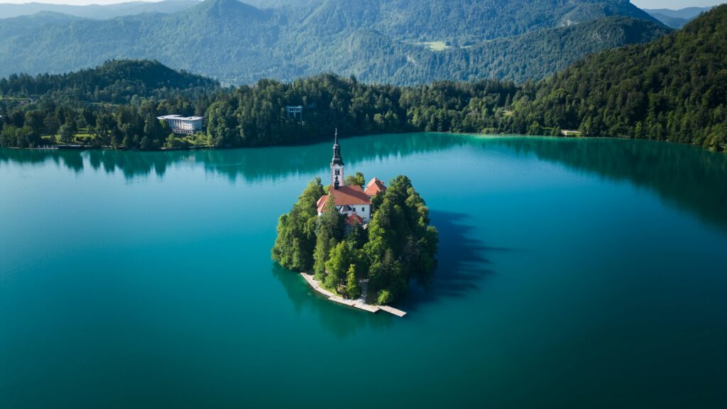
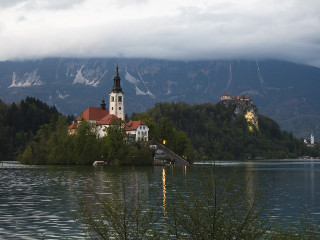
The descent toward Bled opens up and gives you magnificent views of the lake’s emerald green water and the little island church. Once you’ve arrived at Bled, you can explore the lakefront or take a small boat to the island. However, you must try the famous Bled cream cake. It makes all the hiking worth it.
Stage 5: Bled to Goreljek on Pokljuka
Distance: 21.4 kilometers
Elevation Gain: 867 m
Elevation Loss: 102 m
Average Time to Hike: 6 hr 40 min
This stage moves you from lakeside paths up onto high plateaus with forested mountain terrain. After leaving Bled, the trail passes the village Gorje and up to the Pokljuka Plateau. Here, you’ll see a high meadow and forested landscape that makes up the edge of the Triglav National Park.
Here, you’ll find some longer climbs that reward you with high overlooks of Lake Bled and the surrounding alpine ridges. The walk through old open pastures that have cattle grazing amongst a plethora of wildflowers in the summer is one that will challenge you with big climbs, but reward you with great views.
The day is long, but scenic, and it makes it clear that you’re in the Alps more than it may have seemed.
Stage 6: Goreljek on Pokljuka to Stara Fužina
Distance: 21.1 kilometers
Elevation Gain: 302 m
Elevation Loss: 1,027 m
Average Time to Hike: 6 hr
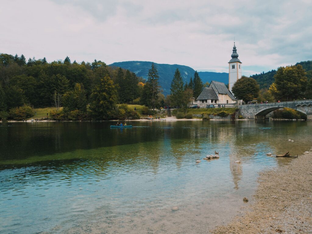
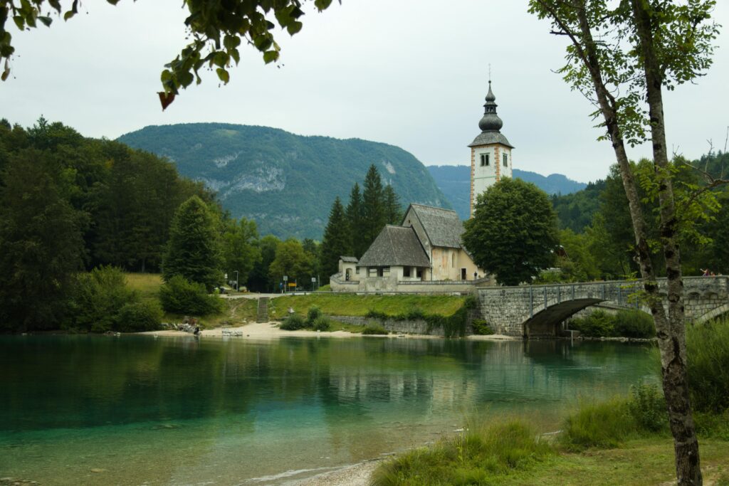
Today’s stage is a huge drop in elevation over a relatively long distance. The trail moves from the plateau of Pokljuka down into Bohinj valley. The earlier parts of the trail stick within the forested lands of Triglav National Park with the occasional alpine meadows and peat bog trails.
The day is overall a steady descent through mixed forest and wetlands as you transition slowly to the dramatic valley scenery of Lake Bohinj. As you move on, the views open up toward the mountains framing the lake in a picture-perfect world. The trail itself is well-maintained and the forest tracks give way to valley paths as you start dropping in elevation.
Stara Fužina serves as a great base for exploring around the lake or taking it easy and enjoying a riverside cafe.
“Plan less, walk more.” Pick a route, set your pace, and let Europe unfold under your boots: grab your free Walking Holiday ebook today”
Stage 7: Stara Fužina to Bohinjska Bistrica
Distance: 11.5 kilometers
Elevation Gain: 125 m
Elevation Loss: 147 m
Average Time to Hike: 3 hr
Stage seven gives you a much shorter and easier day to relax after a day spent descending. The path follows gentle terrain along the eastern shore of Lake Bohinj, and then moves inland toward Bohinjska Bistrica. The trail sticks to waterways and shaded paths, which makes this stage a great spot for recovery in a protected and cool environment.
This stage might not be as visually dramatic as others, but you still get the chance to relax in peaceful forests and catch a glimpse of the traditional shepherd and farm way of living.
Bohinjska Bistrica gives you a great chance to resupply before you move on the next day. However, it’s worth noting that if you are looking to complete the trail in a shorter time, the 7th stage is a great one to combine with stage 8 in order to shorten the overall time on the trail.
Stage 8: Bohinjska Bistrica to Podbrdo
Distance: 13.6 kilometers
Elevation Gain: 792 m
Elevation Loss: 788 m
Average Time to Hike: 5 hr 30 min
Stretching across the old mountain pass Vrh Bače, stage eight provides a solid challenge for hikers looking to push themselves. You move upwards from Bohinjska Bistrica to the abandoned ski slope of Kobla. Here you move past the forest and up under the high saddle of Vrh Bače.
From this vantage point you can see over Baška grapa, Porezen, and a number of other alpine peaks. There’s a hunting lodge where you can take a break after the long climb and check out the old remains of the war.
The descent to Podbrdo takes you quickly down across rugged foothills and some rockier paths. Podbrdo itself is the largest settlement in Baška grapa, so there are some available shops to buy food and drinks. Brunarica Slap is only a kilometer away where you can grab a nice hearty lunch or dinner after a solid day of hiking.
Stage 9: Podbrdo to Grahovo ob Bači
Distance: 16.8 kilometers
Elevation Gain: 975 m
Elevation Loss: 1,179 m
Average Time to Hike: 6 hr 30 min
Seclusion inside of deep valley terrain continues throughout stage nine as you climb up and out of Podbrdo toward Kalarsko Brdo ridge. The initial ascent gets you high up away from modern civilization and into the land of alpine meadows and forested hillsides with tiny, traditional mountain villages.
This stage is much quieter than other parts of the Juliana Trail as there are fewer hikers and much calmer, uninterrupted natural spaces. There are panoramic views over the ridges of Baška grapa before you hit a descent to the settlement of Grahovo ob Bači. This small village offers up basic services and a huge amount of rustic charm.
Stage 10: Grahovo ob Bači to Most na Soči
Distance: 16.5 kilometers
Elevation Gain: 704 m
Elevation Loss: 841 m
Average Time to Hike: 6 hr
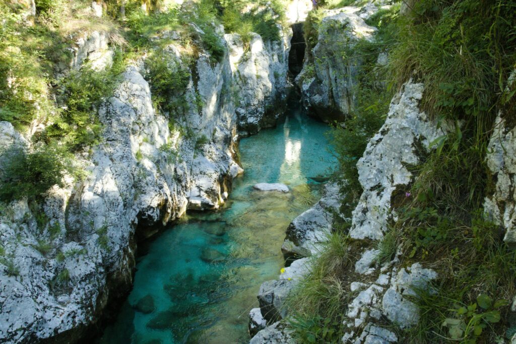
The mix of ridge and river valley scenery along stage ten makes it a huge contender for the favorite stage of many hikers. The trail rises and falls through quiet forest tracks along the first stretch of the stage before it drops toward the Soča River’s lower valley.
Alpine foothills and dense spruce forests make up the backdrop for your walk and frame the views of the valley even further beyond.
The Soča river is a steady stream of stunning turquoise waters that give you a song to walk with as you move from the woods to riverside paths. At the end of this stage, Most na Soči gives you a calm and relaxed village atmosphere to end the day.
Stage 11: Most na Soči to Tolmin
Distance: 8.1 kilometers
Elevation Gain: 254 m
Elevation Loss: 213 m
Average Time to Hike: 3 hr
Although this stage is significantly shorter, it’s filled with scenery that’s unforgettable. The trail follows riverbanks and low hills toward Tolmin. This larger town has plenty of services and connections to transport.
The hike itself follows the Soča River before slowly climbing toward the ridges that give the birdseye view of the river below. For anyone that needs a less demanding day to take a rest, this is the perfect stage for it. You keep the beautiful scenery, but lose the tough climbs and long days under foot.
If you’re looking to get the hike done in a shorter time, combining stages 11 and 12 is common to make a longer, but still only moderate day.
Stage 12: Tolmin to Kobarid
Distance: 17.3 kilometers
Elevation Gain: 179 m
Elevation Loss: 138 m
Average Time to Hike: 4 hr
Easily combined with the previous day, stage twelve is a rather flat stage that takes you deep into the Soča Valley’s cultural heart. The rolling countryside and valley paths pass through World War I heritage sites with interpretive signage informing hikers all about what once happened here.
With the history, you still have the vibrant waters of the Soča around you, and the trails are softer underfoot. In the right season, you’ll walk amongst blooming wildflowers that add even more color to the scenery.
Kobarid is full of museums and cafes with full services. So, if you choose to hike this stage after completing stage eleven, you have a perfect spot to rest after a longer day.
Stage 13: Kobarid to Bovec
Distance: 22.9 kilometers
Elevation Gain: 547 m
Elevation Loss: 315 m
Average Time to Hike: 7 hr
The thirteenth stage is one of the standout stages while hiking the Juliana Trail. Riverside and hillside paths move you upstream the Soča River with whitewater rapids and limestone bluffs surrounding you.
The trail is visually dynamic throughout this region. You have river gorges, waterfalls, and scattered pastures all along the way, providing a diverse array of imagery. Parts of the trail run along packed gravel or forest tracks with only an occasional move up rocky steps along the riverbanks.
Bovec is a huge outdoor hub for the entire country. There’s plenty of accommodations, gear shops, and extra activities to try out like rafting and canyoning. It’s a fantastic spot to check out, and well worth spending as much time in the region as possible.
Stage 14: Bovec to Log pod Mangartom
Distance: 11.1 kilometers
Elevation Gain: 344 m
Elevation Loss: 157 m
Average Time to Hike: 4 hr
After a time well spent in Bovec, the trail moves on with a gradual climb up and out of the valley floor to quiet mountain terrain with some steeper slopes early on. Forested footpaths lead you across mountain views with some great up close looks of the surrounding limestone walls.
As you get higher, the trail becomes more isolated and starts to show its true nature with more cascading creeks and shady groves. At the end of this short section, you come across a small community called Log pod Mangartom. There are very few services available here as you get ready to cross into northern Italy.
Stage 15: Log pod Mangartom to Tarvisio
Distance: 18.3 kilometers
Elevation Gain: 717 m
Elevation Loss: 611 m
Average Time to Hike: 7 hr
Crossing from Slovenia into northern Italy makes stage fifteen a memorable one. There’s a steady climb right at the beginning toward Predel Pass, where you will find sweeping ridge views to the Julian Alps behind you. Up high, you’ll find open grasslands and rocky outcrops until you cross the border and find your way into the alpine town of Tarvisio.
Tarvisio shows off a subtle, yet clear cultural shift after a long time spent hiking Slovenia. Here, you get a full taste of Italy with plenty of available services. It’s a great spot to celebrate the crossing while also preparing for the end.
Stage 16: Tarvisio to Kranjska Gora
Distance: 20.2 kilometers
Elevation Gain: 209 m
Elevation Loss: 154 m
Average Time to Hike: 5 hr 30 min
The final stage closes the loop as you move back into Slovenian landscapes. The early parts of the final stage are gentle with lush farmlands and gentle trails. It will take you up and over rolling hills and minor passes until you begin the descent into the Sava Dolinka Valley where you find familiar alpine terrain.
There’s no technical hiking in the final stage, and you only cover 209 meters of elevation over 20.2 kilometers, so it’s quite flat and easy walking. There’s so much space for reflecting on your journey while wrapping it up. Finally, the trail guides you back into the alpine resort at Kranjska Gora, a great place to celebrate the completion of your long-distance trek in Slovenia.
Before heading out, it’s worth reviewing the essentials of planning a trek in Europe, including accommodation logistics, transport options, budgeting, and seasonal considerations.
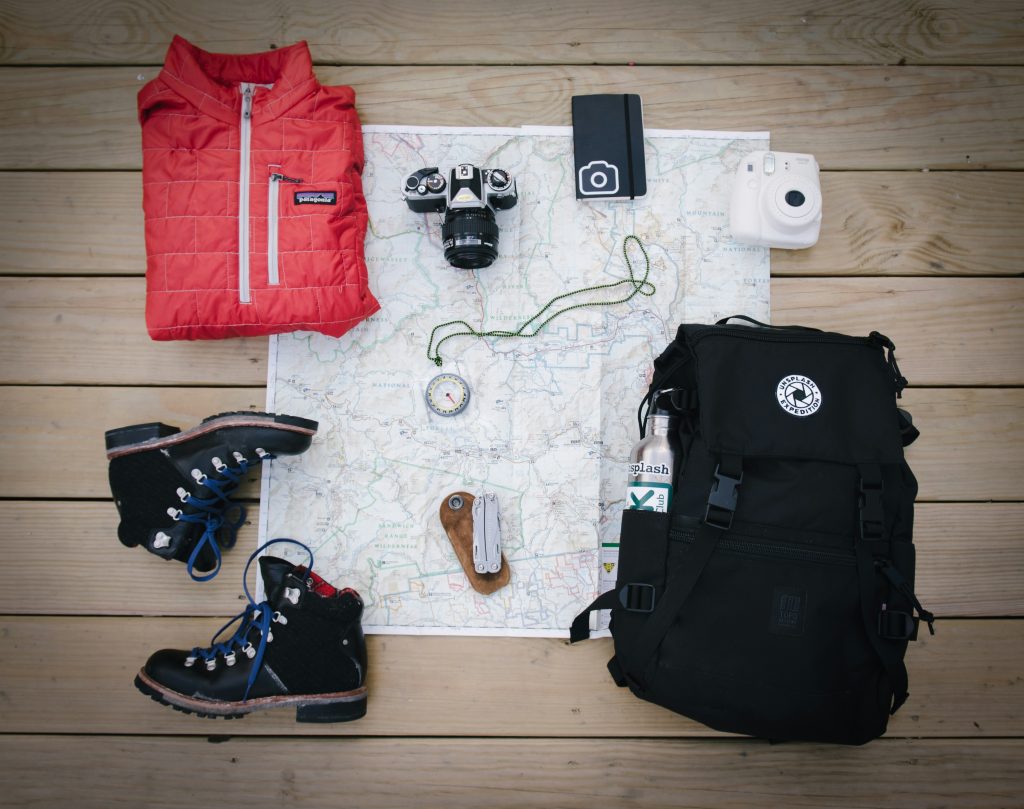
What to Pack to Hike the Juliana Trail
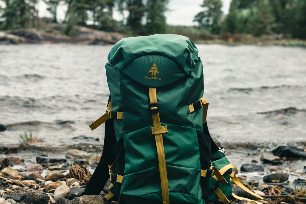
Backpack
For the Juliana Trail, a smaller backpack of 30-40 liters is perfect because there’s no camping along the way. This gets rid of the need to carry a tent and sleeping bag, greatly reducing the volume of your bag.Learning how to pack a hiking backpack efficiently can make a huge difference in comfort over two weeks on the trail. Additionally, you have multiple options, sometimes per day, to resupply your food and don’t need to carry a mass amount of food for any long stretches.
Footwear
Trail runners or light hiking boots are great picks for the Juliana Trail. Choosing between the two comes down to personal need and preference. Trail runners are great if you want to go lighter, but hiking boots provide much more ankle support that trail runners simply can’t. Either way, ensure that the soles have good grip for the rocky terrain you will come across.
Clothing
Even in the summer, the weather on the Juliana Trail can turn sideways fast. To be ready for this, you need to have the right clothing system packed and ready to go. That means a solid layering system that consists of a base layer, a middle insulation layer, and a waterproof shell on the outside, at the minimum.
This way, you can switch up your layers as quickly as the weather changes and continue to hike in almost anything. It’s also a great idea to pack a hat to protect yourself from the high alpine sun that always feels stronger than it does back at sea level.
Rain Gear
A waterproof jacket and pants are a must when packing for the Juliana Trail. Storms can come at any time and staying dry is going to be one of your top priorities. Even on the days where you’re ending in a hotel, staying dry is critical to your overall health while out hiking.
Navigation Tools
Like we talked about earlier, it’s a good idea to have multiple options ready for navigation on the trail. A phone with GPX files downloaded offline, a battery pack to keep your phone charged, and offline maps are a good combination of tools. Be sure to learn how to read and navigate with paper maps before heading out!

Food & Water
Each day you should try to hike with around two liters of water, especially in the summer. There’s plenty of spots to refill along the trail, but it’s important to have it with you along the way. You can resupply food daily from the towns you cross, and will need to carry a large number of snacks as you work hard to put the distance underfoot.
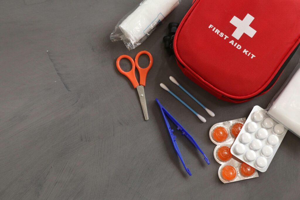
First Aid & Safety
A simple first aid kit can go a long way in an emergency during a thru hike. Even for the little things, it comes in handy and shouldn’t be left behind. Include blister care, basic medicines, and a personal first aid kit with everything you need for wound care.
🗒️ Free Checklist: “Never forget the essentials — grab your free Ultimate Hiking Packing List.”
Electronics
While optional, many choose to bring along their electronics while hiking. You’ll have service and wifi available in most towns, but will likely lose it out on the trail. A power bank and charging cables will be useful, especially if you rely on your phone for navigation.
Optional Comfort Items
Many of the same hiking essentials apply on the Juliana Trail, although you’ll want additional clothing and supplies for a multi-day journey
Trekking poles, additional footwear, and a compact towel are all optional items but can really give a lot more comfort than you may think when at the end of a long day filled with hiking and climbing.
Where to Next?
- Ultimate Guides – your gateway to hiking across Europe
- Hikes & Trails – curated lists of the best hikes and local gems
- Walking Holidays – extended journeys for when a single day just isn’t enough
- General Blog – all the extras: gear reviews, planning tips, and personal stories
FAQ
How difficult is the Juliana Trail?
While there are some long days, the Juliana Trail is considered to be of moderate difficulty. There’s no technical terrain and the trail is highly accessible for most levels of hikers.
Can beginners hike the Juliana Trail?
With the right preparation and fitness level, the Juliana Trail is a great choice for beginner hikers and backpackers.
Is wild camping allowed on the Juliana Trail?
Unfortunately, wild camping is restricted along the Juliana Trail and you must stick to designated campsites or accommodation in towns and villages.
What gear is essential for the Juliana Trail?
Good footwear, rain gear, and navigation tools are some of the most important parts of your hiking gear list to keep yourself safe and happy while hiking the Juliana Trail.
How long does it take to hike the Juliana Trail?
Many people will take between 12 and 16 days to hike the Juliana Trail. Most people will plan for a 14 day hike, combining some stages but still taking their time.
What is the best part of the Juliana Trail?
While it’s tough to say what the best part is, many hikers agree that the Soča Valley is unforgettable, as well as any part of the trail that runs through the Julian Alps.
What not to miss on the Juliana Trail?
Soča River viewpoints, small alpine villages, and WWI sites are what make the Juliana Trail unique, which means they are all worth exploring and taking your time when in those regions.
Summary
Hiking the Juliana Trail in Slovenia and Italy is an experience that’s designed to make long-distance thru hiking in Europe accessible for hikers of all levels. It passes by the more technical sections of the Julian Alps, but doesn’t leave behind the stunning scenery and rich cultural heritage of the area.If the Juliana Trail leaves you wanting more Alpine scenery, the Alpe Adria Trail offers another spectacular long-distance hiking experience through this region of Europe. This trail is one that is well-worth putting on your list and working hard to get all of the kilometers strapped under your belt!