For those of you who like your walks with a side of jaw-dropping views and some hearty mountain lunches (and that smug sense of accomplishment that only comes after a good climb) then Tyrol is basically your dream destination.
This part of Austria is literally made for hiking!
So if you’re already picturing yourself standing at a summit with the wind in your hair and a sandwich in hand, keep reading!
The routes below cover everything from short waterfall walks and family-friendly gorge trails to full mountain days and a classic hut-to-hut trek.
Most are accessible from established Tyrolean bases, although difficulty and seasonal conditions vary considerably.
For help choosing where to stay, when to visit and how to get around, see our broader guide to hiking in Tyrol.
- How We Chose These Hikes
- Zirbenweg Trail: Best Easy Panoramic Hike in Tyrol
- Schleierwasserfall Circular Hike: Best Waterfall Hike in Tyrol
- Olpererhütte from Schlegeis Reservoir: Best Iconic Mountain Hike in Tyrol
- Rofanspitze from Erfurter Hütte: Best Summit Hike in Tyrol
- Leutasch Spirit Gorge: Best Family Hike in Tyrol
- Innsbruck to Hungerburg: Best Urban-to-Alpine Walk in Tyrol
- Berliner Höhenweg: Best Multi-Day Hike in Tyrol
- What to Bring for Hiking in Tyrol
- Conclusion: Choosing the Best Hike in Tyrol
- Where to Next?
How We Chose These Hikes
These routes were selected to show the range of hiking available across Tyrol rather than simply collecting its hardest or most famous trails.
The list includes accessible panoramic walks, waterfalls, mountain huts, family-friendly scenery, a summit route and one classic multi-day trek, with options spread across several of the region’s main hiking areas.
| Hike | Difficulty | Distance | Time | Elevation gain |
|---|---|---|---|---|
| Zirbenweg Trail | Easy | 7 km | 2.5–3 hours | Approx. 300 m |
| Schleierwasserfall Circular Hike | Moderate | 5.5 km | Around 3 hours | 520 m |
| Olpererhütte from Schlegeis Reservoir | Moderate | 6.1 km | Around 3 hours | 600 m |
| Rofanspitze from Erfurter Hütte | Moderate | 7.1 km | Around 3.5 hours | 485 m |
| Leutasch Spirit Gorge | Moderate | 5 km | Around 2.5 hours | 255 m |
| Innsbruck to Hungerburg | Easy | 3.5 km one way | Around 1 hour | 327 m |
| Berliner Höhenweg | Difficult | 71 km | Around 7 days | 5,300 m ascent |
“Every hiker starts somewhere — grab your free Hiking for Beginners guide.”
Zirbenweg Trail: Best Easy Panoramic Hike in Tyrol
For those of you who want big alpine views without a big alpine effort, the Zirbenweg Trail is an absolute winner.
Sitting just above Innsbruck in the Tux Alps, this hike delivers sweeping panoramas over the Inn Valley, a peaceful forest of ancient stone pine trees (zirben, if you want to sound local), and more than a few benches that practically beg for a snack break.
It’s like the kind of trail that feels wildly remote, but thanks to a couple of well-placed cable cars, it’s entirely doable in a relaxed half day.
It’s also perfect for a morning outing before hitting a lakeside lunch, or, let’s be honest, before doing absolutely nothing the rest of the day.
One of the best parts? You can start and end with a lift ride, making it friendly for beginners, families, or those of you who prefer your elevation gain delivered by gondola.
- Average Time: 2.5 to 3 hours
- Distance: 7 km / 4.3 miles
- Difficulty: Easy
- Elevation Gain: Approx 300m
- Trail Type: Point-to-point (with cable car connections at both ends)
- Starting Point: Patscherkofel Cable Car (Igls)
- Ending Point: Glungezerbahn (Tulfes)
- Bonus Tip: Grab a pine schnapps at one of the huts along the way, it’s basically forest therapy in a glass.
Schleierwasserfall Circular Hike: Best Waterfall Hike in Tyrol
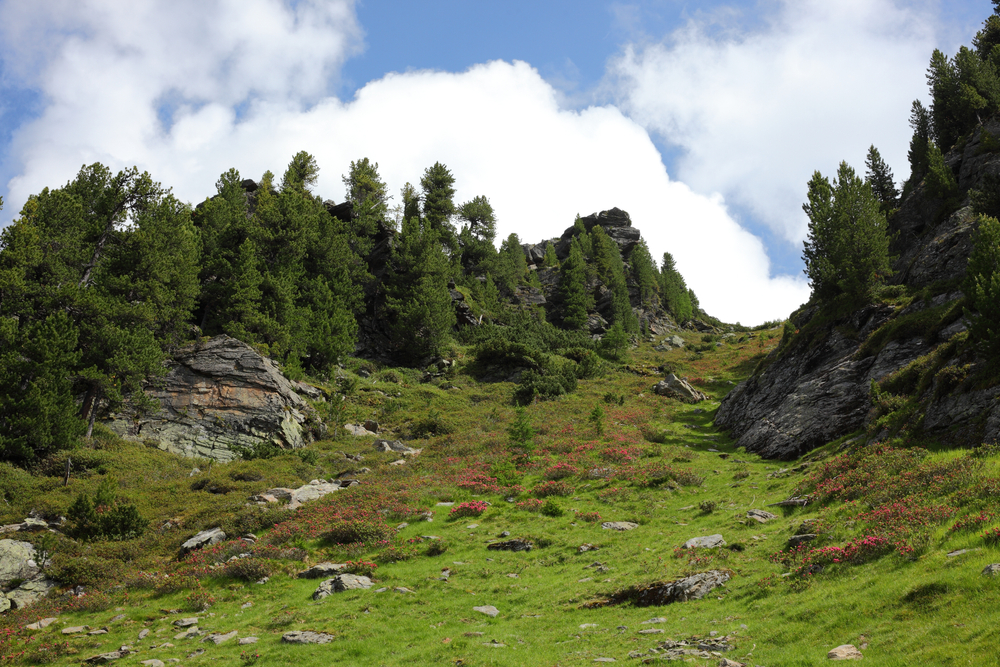
For those of you who love a walk with a bit of drama (the good kind), the Schleierwasserfall Trail serves up a perfect blend of forest path, limestone cliffs, and one seriously impressive waterfall.
Tucked away near Going in the Wilder Kaiser region, this moderate circular hike blends a steady mountain climb with forest paths, limestone cliffs and one seriously impressive waterfall.
It’s relatively short in distance, but with more than 500 metres of elevation gain and some narrower mountain paths, it still feels like a proper outing.
For confident walkers, active families and anyone looking for a rewarding half-day route, it punches well above its weight.
- Average Time: Around 3 hours
- Distance: 5.5 km / 3.4 miles
- Difficulty: Moderate
- Elevation Gain: 520 m / 1,706 ft
- Trail Type: Circular route
- Starting and Ending Point: Hüttling hiking car park, Going
- Bonus Tip: Stop at one of the nearby mountain inns before or after the hike for coffee, homemade pastries and views of the Wilder Kaiser.
- Important Note: The route includes narrow mountain paths and requires some sure-footedness.
Olpererhütte from Schlegeis Reservoir: Best Iconic Mountain Hike in Tyrol
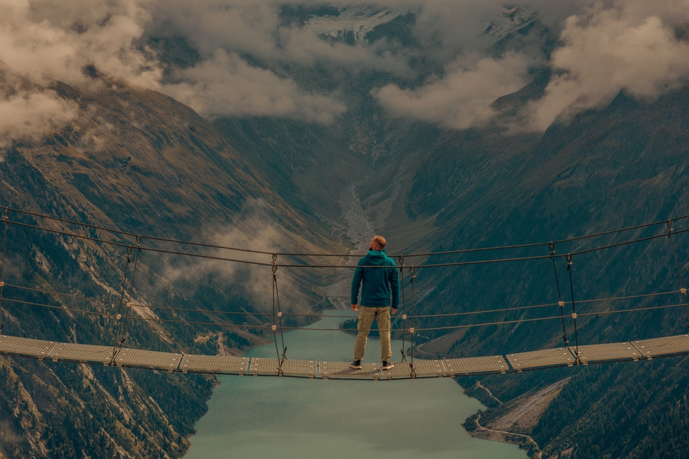
For those of you who want the alpine photo (yes, the one with the suspension bridge and the glacier-fed lake below) then this is your trail.
The Olpererhütte hike in the Zillertal Alps is one of Tyrol’s most iconic routes, and for good reason.
Starting from the Schlegeis reservoir, the trail winds its way up through rocky terrain, wildflower meadows, and sweeping views until you reach the legendary bridge near the Olpererhütte.
Spoiler: it looks like you’re floating above the world!
This one’s definitely more on the “mountain hike” end of the spectrum, but it’s totally doable for anyone with a decent level of fitness and a willingness to take their time on the ascent.
Plus, the hut at the top serves warm food and a front-row seat to some of the most jaw-dropping scenery in Austria.
If alpine hiking is your thing, you may also love exploring more routes in the Austrian Alps.
- Average Time: Around 3 hours
- Distance: 6.1 km / 3.8 miles
- Difficulty: Moderate
- Elevation Gain: 600 m / 1,969 ft
- Trail Type: Out and back
- Starting and Ending Point: Schlegeis Reservoir
- Highest Point: Olpererhütte, approximately 2,390 m
- Bonus Tip: Get there early—the trail is popular, and the bridge doesn’t photograph nearly as well with 40 people on it.
Rofanspitze from Erfurter Hütte: Best Summit Hike in Tyrol
For those of you who want a scenic summit hike without committing the entire day, the route from Erfurter Hütte to Rofanspitze absolutely delivers.
Starting from the shores of Lake Achensee, this hike kicks off with a cable car ride (you’re welcome) and then weaves through rocky alpine landscapes, wildflower-strewn meadows, and sweeping views across the Karwendel and Zillertal Alps.
The summit of Rofanspitze offers a panoramic reward that’s hard to beat; think jagged peaks on one side and then deep blue lakes on the other.
This is one of those “best of both worlds” hikes. It is substantial enough to feel like a proper mountain outing, but the cable-car-assisted start and manageable distance keep it from becoming a full-day suffer-fest.
Bonus: the Erfurter Hütte near the start is a great spot to fuel up before or wind down after the loop.
- Average Time: Around 3.5 hours
- Distance: 7.1 km / 4.4 miles
- Difficulty: Moderate
- Elevation Gain: 485 m / 1,591 ft
- Trail Type: Out and back
- Starting and Ending Point: Upper station of the Rofan cable car, near Erfurter Hütte
- Highest Point: Rofanspitze, 2,259 m
- Bonus Tip: If you still have energy on the return, detour to the nearby Gschöllkopf summit for another round of panoramic views.
Leutasch Spirit Gorge: Best Family Hike in Tyrol
For those of you hiking with kids (or just young-at-heart walkers who love a good story) the Leutaschklamm (Leutasch Gorge), which is also known as the Ghost Gorge, is a definite must.
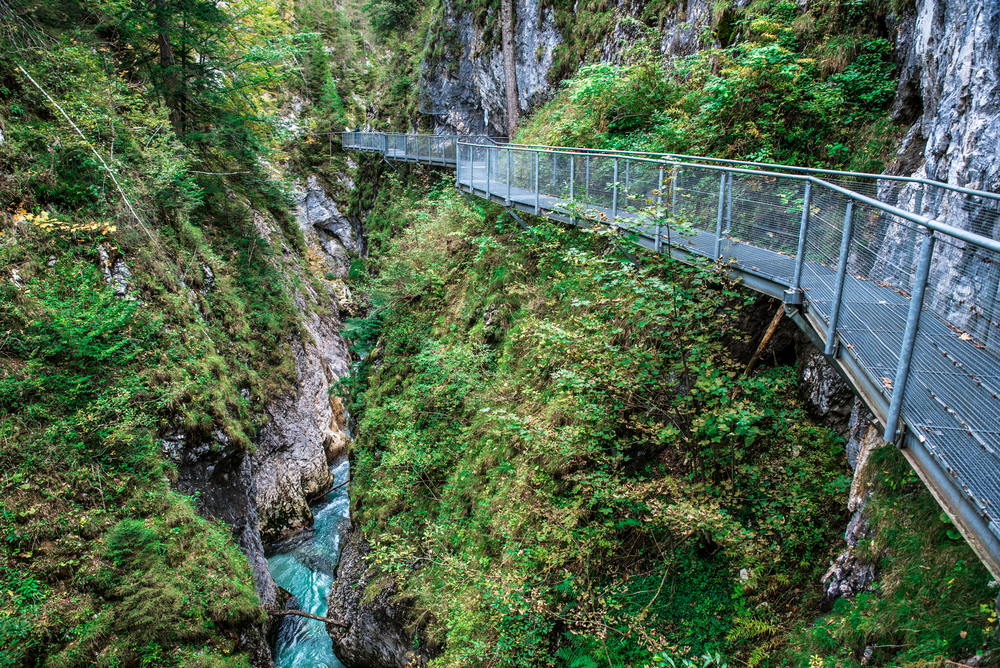
This fun and fantastically scenic trail blends natural beauty with a bit of local legend, winding along metal walkways high above a roaring turquoise river, through narrow cliff faces, waterfalls, and a gorge that’s steeped in fairy tale vibes.
And yes, there’s an actual “ghost” of the gorge with storyboards and whimsical signs along the way, which makes it feel more like an adventure than a standard day hike.
It’s ideal for families, thanks to the safe and sturdy paths, interactive elements, and plenty of places to stop for snacks, photos, or enthusiastic ghost-spotting.
The walk never feels too steep, but it definitely feels exciting, and especially when you look down into the rushing water from the bridges and catwalks.
- Average Time: 2.5 to 3 hours
- Distance: 5 km / 3.1 miles
- Difficulty: Moderate
- Elevation Gain: 255m
- Trail Type: Loop (with optional extensions)
- Starting Point: Leutaschklamm Parkplatz near Mittenwald or Leutasch
- Bonus Tip: Bring a euro or two since there’s a small fee to access one of the bridges, but it’s absolutely worth it for the views (and the ghost story payoff).
- Family Note: The established walkways are family-friendly, but the full circuit still includes steps and elevation.
Innsbruck to Hungerburg: Best Urban-to-Alpine Walk in Tyrol
For those of you who like your hikes with a side of espresso and cobblestones and a cable car shortcut, this urban-to-alpine route is a unique gem.
Starting right in the heart of Innsbruck, this route is ideal if you also want to explore more hiking in and around Innsbruck during your trip.
You can walk from the city’s colorful Old Town up through leafy neighborhoods and into the forested foot of the Nordkette mountains.
It’s a rare mix of culture and climb, and one where medieval streets slowly give way to pine-scented switchbacks and, eventually, some serious altitude.
The walk finishes at Hungerburg, where you can connect to the Nordkette cable cars and continue towards Seegrube or Hafelekar, nearly 2,300 metres above sea level.
From there, it’s just a short walk to panoramic ridgelines that look out over both the city and the Karwendel Mountains.
It really is urban hiking at its finest, and with the kind of views that make Innsbruck feel like the coolest mountain town in Europe.
The snapshot below covers the defined walk from Innsbruck to Hungerburg. From there, you can continue higher by cable car and explore shorter trails around Seegrube or Hafelekar.
- Average Time: Around 1 hour one way
- Distance: 3.5 km / 2.2 miles
- Difficulty: Easy
- Elevation Gain: 327 m / 1,073 ft
- Trail Type: Point-to-point
- Starting Point: Hans-Psenner-Steg, within walking distance of central Innsbruck
- Ending Point: Hungerburg
- Transport Note: Return by the Hungerburgbahn or continue towards Seegrube and Hafelekar using the Nordkette cable cars.
- Bonus Tip: Stop at Alpenzoo along the way if you’re interested in Alpine wildlife—you’ll get mountain animals and city views in one stop.
Berliner Höhenweg: Best Multi-Day Hike in Tyrol
For those of you who hear “multi-day trek” and immediately think of mountain huts with glacier views and the glorious soreness of day-two legs, then the Berliner Höhenweg is calling your name most likely.
This is one of Tyrol’s most legendary hut-to-hut hikes; it’s a high-alpine loop through the Zillertal Alps that feels like a greatest hits album of everything Austrian hiking does best.
If hut-to-hut hiking has caught your attention, here are some of Europe’s best destinations for this style of adventure.
We’re talking hanging valleys, glacial rivers, dramatic ridgelines, and cozy mountain huts where the soup is hot, the beer is cold, and the views are outrageous.
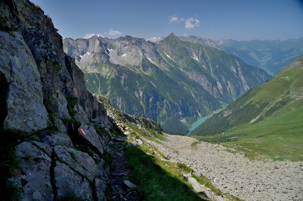
The complete route is normally tackled over around seven days, although experienced hikers can use its access points to create shorter journeys between huts such as Greizer Hütte, Berliner Hütte and Kasseler Hütte.
It’s not for the faint of heart since there’s some serious elevation, exposed sections, and long daily distances, but it rewards every step with scenery that feels almost too perfect.
- Average Time: Around 7 days
- Distance: Approximately 71 km / 44 miles
- Difficulty: Difficult
- Total Elevation Gain: Approximately 5,300 m / 17,388 ft
- Trail Type: Multi-day high-alpine route
- Starting Point: Finkenberg, with several possible access and exit points
- Bonus Tip: Book huts early during peak summer and bring a sleeping bag liner, as one is required in Austrian Alpine Club sleeping areas.
- Experience Required: Suitable for experienced mountain hikers with strong fitness, sure-footedness and a head for heights.
For more ambitious long-distance routes, these Austrian trekking adventures are worth adding to your list.
What to Bring for Hiking in Tyrol
What you need will depend on whether you are taking a short gorge walk or heading into high-alpine terrain, but Tyrol’s changeable mountain weather makes a few essentials useful on almost every route.
- Supportive hiking footwear – Choose boots or trail shoes with reliable grip for rocky paths, forest tracks and long descents.
- A waterproof hiking jacket – Even a clear morning can turn wet at altitude, so carry a packable waterproof shell.
- A small hiking daypack – A 20–30 litre pack should provide enough room for water, food, extra clothing and safety equipment on most day hikes.
- A practical layering system – Carry a breathable base layer, warm mid-layer and something insulating for cooler conditions higher on the mountain.
- Trekking poles – These are especially useful on routes with substantial climbing or long, uneven descents.
- Navigation and safety equipment – Bring an offline map or GPS device, charged phone, compact first-aid kit and headtorch.
- Water, sun protection and trail food – Carry enough for the planned route rather than relying entirely on huts or cable-car stations being open.
🗒️ Free Checklist: Planning your next hiking trip?? Download our printable hiking checklist to make sure you don’t miss the essentials.
Conclusion: Choosing the Best Hike in Tyrol
Tyrol offers everything from easy panoramic walks and family-friendly gorge trails to demanding summit days and multi-day hut-to-hut adventures.
The Zirbenweg is the strongest choice for relaxed views, Olpererhütte for iconic Alpine scenery and Rofanspitze for a proper summit day.
Families may prefer Leutasch Spirit Gorge, while experienced hikers looking for a longer challenge can take on the Berliner Höhenweg.
Whichever route you choose, check current trail conditions, lift schedules and weather before setting out.
The Alps are accessible, but they still deserve proper preparation.
For help choosing a base, planning transport and deciding when to visit, see our broader guide to hiking in Tyrol.
Where to Next?
Continue planning your Austrian hiking trip with these related guides:
Hiking in Tyrol
Plan where to stay, when to visit, how to get around and which hiking region best suits your trip.
Innsbruck: A City Guide for Hikers
Learn how to combine city sightseeing with easy access to the Nordkette and surrounding trails.
Best Hikes in Innsbruck
Compare the strongest day hikes and scenic walks within easy reach of the Tyrolean capital.
Ultimate Guide to Hiking in Austria
Explore Austria’s main hiking regions, trail styles and practical planning considerations.
Eagle Walk
Take a closer look at one of Tyrol’s best-known long-distance routes and what to expect along the way.
An Introduction to Hut-to-Hut Hiking in Austria
Learn how Austria’s mountain huts work and how to prepare for a multi-day route through the Alps.