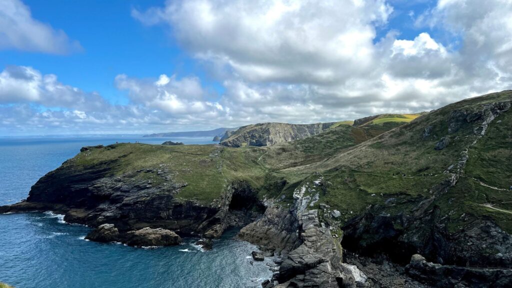
Cornwall has some of England’s best coastal hiking, with rugged sections of the South West Coast Path, dramatic headlands and wilder inland routes across Bodmin Moor.
These five hikes cover everything from challenging cliff walks between Cornish villages to panoramic circuits around the Lizard and Cornwall’s highest point.
- Why Hike in Cornwall?
- 1. Best Rugged Coast Walk: St Ives to Zennor
- 2. Best Village-to-Village Coast Walk: Tintagel to Boscastle
- 3. Best Lizard Peninsula Walk: Kynance Cove and Lizard Point Circular
- 4. Best Inland Hike: Rough Tor and Brown Willy
- 5. Best West Cornwall Coast Hike: Cape Cornwall to Land’s End
- When Is the Best Time to Hike in Cornwall?
- What to Bring for Hiking in Cornwall
- Stretching Your Legs in Cornwall
- More Hiking in Cornwall
Why Hike in Cornwall?
Cornwall may be most famous for its beaches and fishing villages, but it’s also one of the UK’s best walking destinations.
With the South West Coast Path circling the entire peninsula, inland moors dotted with tors, and ancient sites steeped in legend, Cornwall has trails that will challenge your legs while feeding your soul.
These are not short pub-to-pub strolls. These are the hikes that leave you satisfyingly tired, sun-kissed, and maybe a little windswept.
Also, for more info on what to do in Cornwall once you visit, be sure to check out our Hiking in Cornwall guide here!
1. Best Rugged Coast Walk: St Ives to Zennor
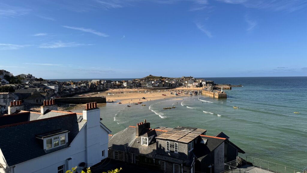
If dramatic cliffs and wild seas are your thing, the St Ives to Zennor section of the South West Coast Path is about as good as it gets.
Starting from the artistic hub of St Ives, the trail quickly leaves behind galleries and harbors and plunges into rugged coastal scenery.
You can fully expect steep ups and downs, narrow paths, and plenty of rocky footing.
Since you’re likely to be on the trail for five to six hours, plan your water supply ahead of time and check how much water to take on a hike before you leave.
The views, though, make every calf burn worth it. You’ll find turquoise water below, seabirds circling above, and headlands that seem to roll on endlessly.
Zennor itself is a reward, with its ancient church and a legendary connection to the tale of the Mermaid of Zennor. There’s even a welcoming pub to rest your tired legs.
This route is considered one of the hardest day hikes near St Ives, but it’s also one of the most rewarding for walkers who want the full Cornish coastal experience.
St Ives to Zennor Details
- Difficulty: Difficult
- Average time: Approx. 4–6 hours
- Distance: Approx. 11.2–12 km / 7–7.5 miles one way
- Elevation gain: Approx. 500–550 m / 1,640–1,805 ft
- Elevation loss: Approx. 450–500 m / 1,476–1,640 ft
- Route type: Linear
- Start: St Ives
- End: Zennor
- Best for: Rugged coastal walking and experienced day hikers
- Highlights: Clodgy Point, rocky coves, Atlantic views and Zennor
- Trail highlight: The constantly changing cliff scenery between St Ives and Zennor makes this feel much wilder than the distance suggests.
- Don’t Miss: The Mermaid of Zennor carving inside the village church
“First time on the trail? Hiking for Beginners has your back.”
2. Best Village-to-Village Coast Walk: Tintagel to Boscastle
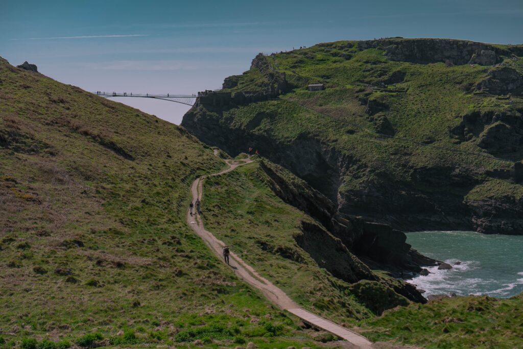
This is the hike for those who love a story with their scenery. Tintagel is forever linked with King Arthur, and the trail begins with the dramatic Tintagel Castle ruins clinging to the cliffs.
From there, the South West Coast Path winds north toward Boscastle, which is another village steeped in legend and history.
The walk is full of steep ascents and descents, so you can fully expect your legs to feel it.
Boscastle itself is a gem with a picturesque harbor and narrow streets. The Museum of Witchcraft and Magic adds a quirky twist to the finish.
For walkers who enjoy a blend of myth and tough coastal terrain, this is one of the best full day hikes from Tintagel.
Tintagel to Boscastle Details
- Difficulty: Moderate to difficult
- Average time: Approx. 3–4 hours
- Distance: Approx. 7 km / 4.3 miles one way
- Elevation gain: Approx. 400 m / 1,312 ft
- Elevation loss: Approx. 400 m / 1,312 ft
- Route type: Linear
- Start: Tintagel
- End: Boscastle
- Best for: Coastal scenery, history and a village-to-village hike
- Highlights: Tintagel Castle, high sea cliffs, Rocky Valley and Boscastle
- Trail highlight: The combination of Arthurian Tintagel and Boscastle’s harbour gives this walk as much character at either end as it has along the coast.
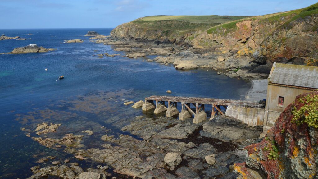
3. Best Lizard Peninsula Walk: Kynance Cove and Lizard Point Circular
If you want Cornwall’s south coast at its most spectacular, you should head to the Lizard Peninsula.
Starting at Kynance Cove, one of the most photographed beaches in the UK, the route follows the coast towards Lizard Point (which is the southernmost spot in mainland Britain) before looping inland through Lizard village and back towards the cove.
(which is the southernmost spot in mainland Britain), as well as Kynance Cove, which is one of the most photographed beaches in the UK.
The path runs along high cliffs with views across turquoise seas and rugged rock formations, before dropping down to sandy coves.
The walk is less about endless miles and more about jaw-dropping scenery.
For those of you who really enjoy hikes that combine natural drama with manageable distances, this is one of the best coastal hikes from Lizard village.
The mix of wildlife, geology, and iconic landmarks makes it a must!
Kynance Cove and Lizard Point Circular Details
- Difficulty: Moderate
- Average time: Approx. 3–4 hours
- Distance: 11.2 km / 7 miles
- Elevation gain: Approx. 220 m / 722 ft
- Elevation loss: Approx. 220 m / 722 ft
- Route type: Circular
- Start/end: Kynance Cove
- Best for: Classic Cornish coastal scenery
- Highlights: Kynance Cove, Lizard Point, Lizard Lighthouse and dramatic clifftop scenery
- Trail highlight: Walking between Kynance Cove and mainland Britain’s most southerly point gives you some of the strongest coastal scenery in Cornwall.
4. Best Inland Hike: Rough Tor and Brown Willy
For a change of pace from the coast, you can head inland to Bodmin Moor. The terrain is more remote, so make sure you’re carrying the essentials and know how to pack your hiking backpack efficiently before setting out
The hike to Brown Willy, which is Cornwall’s highest point, is a leg-stretcher that swaps sea spray for windswept granite tors and wide-open views.
Starting from Rough Tor car park, the path climbs over rough ground and past ancient stone circles before finally reaching the summit of Rough Tor and then on to Brown Willy.
This is one of the best mountain-style hikes in Cornwall, though at 420 meters (1,378 ft) it’s hardly alpine. Still, the sense of space and history is powerful.
On a clear day, you can see all the way across the county. For those who enjoy wild, remote walking with a dash of archaeology, this route is hard to beat.
Rough Tor and Brown Willy Details
- Difficulty: Moderate
- Average time: Approx. 3–4 hours
- Distance: Approx. 8.4 km / 5.2 miles
- Elevation gain: Approx. 300 m / 984 ft
- Elevation loss: Approx. 300 m / 984 ft
- Route type: Circular
- Start/end: Rough Tor car park
- Highest point: Brown Willy, 420 m / 1,378 ft
- Best for: Moorland scenery and a break from Cornwall’s coast
- Highlights: Rough Tor, Brown Willy, prehistoric remains and wide Bodmin Moor views
- Trail highlight: Linking Cornwall’s two highest hills gives this relatively short route a much wilder feel than the numbers suggest.
Note: Bodmin Moor can become surprisingly difficult to navigate when cloud or poor weather rolls in, so carry reliable navigation rather than relying only on visible landmarks.
5. Best West Cornwall Coast Hike: Cape Cornwall to Land’s End
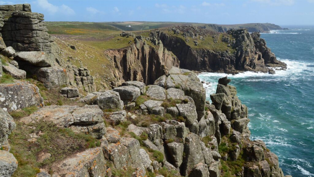
Few stretches of Cornwall feel as dramatic as the coast between Cape Cornwall and Land’s End.
Starting at Cape Cornwall, the path follows the rugged west coast south through old mining country and hidden coves before reaching the wide sands of Sennen Cove.
From Sennen, the final stretch climbs back onto the cliffs and continues towards Land’s End, where granite headlands and Atlantic views provide a suitably dramatic finish.
This is a great choice for those of you who want one walk to combine Cornwall’s mining history, beaches and famous western coastline without turning the day into an enormous trek.
Cape Cornwall to Land’s End Details
- Difficulty: Moderate
- Average time: Approx. 3–4 hours
- Distance: Approx. 8–10 km / 5–6 miles depending on start point
- Elevation gain: Approx. 250–350 m / 820–1,148 ft
- Elevation loss: Approx. 250–350 m / 820–1,148 ft
- Route type: Linear
- Start: Cape Cornwall
- End: Land’s End
- Best for: West Cornwall scenery, mining heritage and famous landmarks
- Highlights: Cape Cornwall, Cot Valley, Sennen Cove and Land’s End
- Trail highlight: Reaching Land’s End after following the quieter coast south from Cape Cornwall gives the famous landmark a much better sense of arrival.
When Is the Best Time to Hike in Cornwall?
Late spring through early autumn generally offers the best conditions for hiking in Cornwall, with longer days, greener landscapes and more reliable weather for exposed coastal routes.
May and June are particularly good months. The coast is colourful with spring and early-summer vegetation, daylight hours are long and the busiest summer period hasn’t quite arrived.
July and August usually bring the warmest conditions, but popular places such as St Ives, Kynance Cove and Land’s End can become very busy. Starting early gives you a much better chance of enjoying the trail before the biggest crowds arrive.
September is another favourite. The days are still reasonably long, the summer rush begins to ease and the sea often holds onto some of its summer colour.
Autumn and winter can make Cornwall feel wonderfully wild, but Atlantic weather also becomes a much bigger consideration. Strong winds, heavy rain and slippery cliff paths can turn an otherwise manageable route into something far less enjoyable.
Cornwall’s coast is exposed, so always check the forecast before setting out and be prepared to change plans if conditions on the cliffs look worse than expected.
What to Bring for Hiking in Cornwall
Cornwall doesn’t have particularly high mountains, but don’t let that fool you into thinking every walk is easy.
The South West Coast Path is famous for its constant ups and downs, while Bodmin Moor adds exposed ground, mud and fast-changing weather into the mix.
For most of these hikes, consider bringing:
- Walking shoes or hiking boots with reliable grip for rocky coastal paths, mud and uneven ground
- A waterproof jacket because Atlantic weather can arrive surprisingly quickly
- A simple layering system for exposed headlands, cooler mornings and changing conditions
- A comfortable daypack for food, water and spare clothing
- Reliable navigation, particularly on Bodmin Moor or quieter sections of the coast
- Enough water for the day, especially on longer summer walks
- Trekking poles if you prefer a little extra support on Cornwall’s repeated coastal climbs and descents
Sun protection is worth carrying too. A windy day beside the Atlantic can make it surprisingly easy to underestimate how much sun you’re getting.
You can also browse the full collection of hiking buyer guides if you’re putting together your walking kit.
🗒️ Free Checklist: “Pack light, pack right — download The Ultimate Hiking Packing List.”
Stretching Your Legs in Cornwall
ornwall is a place where hikes are never just about distance. They’re about legends, landscapes and the unique rhythm of walking beside the sea.
One day you can be working your way across rugged cliffs between St Ives and Zennor, and the next you can leave the coast behind completely for the open space of Bodmin Moor.
There’s history almost everywhere too. Old mining landscapes sit beside famous headlands, villages come wrapped in stories of mermaids and King Arthur, and sections of the coast feel remarkably wild considering how popular Cornwall can be.
These five hikes are very different from one another, but that’s exactly the point. Cornwall gives you hard coastal days, manageable scenic circuits and quieter inland walking without needing to travel huge distances between them.
Pick the route that suits the weather, leave yourself enough time to stop and actually enjoy the views, and don’t be surprised if the coast makes you work slightly harder than you expected.
More Hiking in Cornwall
Planning more time on foot around the county? These guides are the natural next step:
- Hiking in Cornwall — explore the wider region, walking bases, landscapes and practical planning information.
- South West Coast Path Guide — plan more sections of England’s longest National Trail through Cornwall and beyond.
- St Ives for Hikers — useful if you eventually build a smaller-town cluster around St Ives.