Everyone who comes to the Julian Alps walks around Lake Bled. Most of them stop there. Which is a bit like going to a concert and leaving after the warm-up act.
Because within an hour or so of Bled’s lakeside cafés, there are river gorges, a valley that hides the source of a river, a lake trail that empties out by mid-afternoon, and a limestone mountain that Slovenia put on its flag.
These seven hikes run from a flat lakeside loop to the climb up Triglav, in that order, so for those of you just finding your mountain legs, start at the top of the list and work your way down.
Our guide to hiking in the Julian Alps covers the bases, seasons and getting around.
- The Hikes at a Glance
- Lake Bled Loop: Best Easy Hike
- Planica Valley Trail: Best Quiet Valley Hike
- Vintgar Gorge: Best Short Hike from Bled
- Lake Bohinj Circuit: Best Lake Hike
- Soča Trail: Best River Hike
- Seven Triglav Lakes: Best Alpine Lakes Hike
- Triglav via Prag: Best Multi-Day Summit Hike
- When Should You Do These Hikes?
- What to Bring
- FAQs About the Best Hikes in the Julian Alps
- Conclusion
- Where to Next?
- Where This Information Comes From
The Hikes at a Glance
These hikes range from a 2-hour lake loop to a 13-hour climb that most people split over two days; five of the seven take half a day or less.
Lake Bled, Vintgar Gorge and Lake Bohinj are easy to reach by bus, and the difficulty ratings follow Triglav National Park’s own (easy, moderate, very difficult) where the park gives them.
| Lake Bled Loop | 6.5 km loop | 2 h | Easy | The easiest first walk: flat all the way round, no car needed |
| Planica Valley Trail | 7.4 km loop | 2 h | Easy | A quiet valley away from the crowds |
| Vintgar Gorge | 5.7 km loop | 1 h 50 min | Easy | River walkways; no car (free shuttle from Bled); cool on hot days |
| Lake Bohinj Circuit | 11.5 km loop | 3 h | Moderate | A longer lake day |
| Soča Trail | 25 km linear | 8–10 h (or in sections) | Easy to moderate | The turquoise river: a long day in full, or short sections by the water on hot days |
| Seven Triglav Lakes | About 12 km return (estimate) | About 3 h up | Challenging | The best views, once you’re over the steep climb |
| Triglav via Prag | 15.8 km return | 13 h, usually 2 days | Very difficult | The hardest: Slovenia’s highest summit |
Lake Bled Loop: Best Easy Hike
The hike around Lake Bled is one of Slovenia’s most famous, and for good reason.
This relatively easy loop takes you around the stunning lake, and it offers cool views of Bled Island with its picturesque church and the impressive Bled Castle perched on the cliff above.
The hike is perfect for those looking for a leisurely day surrounded by natural beauty, and it’s especially magical at sunrise or sunset.
What you’ll pass: the lakeshore path below Bled Castle, with the island church in view the whole way round. For a higher view, Triglav National Park suggests the nearby viewpoints of Mala Osojnica, Velika Osojnica and Straža.
| Difficulty | Easy |
| Average time | 2 hours |
| Distance | 6.5 km (4 miles) |
| Route type | Loop |
| Start and end | Bled town centre |
| Elevation gain | 33 m (110 ft) |
| Getting there | Buses from Ljubljana to Bled; the walk starts from the lakeside in town |
| Best time and nearest base | Year-round; early morning in summer to beat the crowds. Base: Bled |
| Trail note | Flat lakeside path and pavement, busy in July and August |
| Don’t miss | The island church framed against the Julian Alps from the western shore |
Planica Valley Trail: Best Quiet Valley Hike
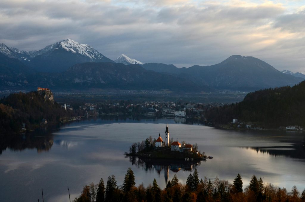
Planica is where Kranjska Gora keeps its quietest valley. It’s best known for its giant ski jumps, which makes it all the more surprising that a few minutes’ walk away, a stream comes out of the mountain as a waterfall, runs down the valley, and then simply disappears into the ground.
That stream is the Nadiža, and it doesn’t stay lost: it resurfaces further down at Zelenci, as the source of the Sava Dolinka.
Rivers that play hide-and-seek, mountains on three sides, and hardly a crowd in sight. For those of you who want a properly alpine setting without the alpine effort, this is the one.
What you’ll pass: the trail starts at the Planica Nordic Centre and follows the valley floor along the Nadiža, with its 10-metre waterfall below the slopes of Zadnja Ponca, before looping back.
| Difficulty | Easy |
| Average time | 2 hours |
| Distance | 7.4 km (4.6 miles) |
| Route type | Loop |
| Start and end | Planica Nordic Centre |
| Elevation gain | 170 m (560 ft) |
| Getting there | From Kranjska Gora, by car or bike to the Nordic Centre; check local bus options |
| Best time and nearest base | Late spring to autumn; base: Kranjska Gora |
| Trail note | Wide valley paths; little shade in the upper valley |
| Don’t miss | The Nadiža waterfall at the head of the valley |
“First time on the trail? Hiking for Beginners has your back.”
Vintgar Gorge: Best Short Hike from Bled
Vintgar is what happens when a river decides the easiest way through a hill is straight down the middle of it.
The Radovna has cut a slot through the rock just north of Bled, and since 1893 there have been walkways, bridges and galleries bolted to the cliffs so you can follow it.
The gorge path is one-way, so there’s no doubling back once you’re in; you return on forest paths above.
It’s short, it’s spectacular, and it’s busy, which is why it now runs on timed tickets. Book ahead, arrive early, and let everyone else fight over the selfie spots.
What you’ll pass: the Vintgar entrance near Podhom, then the 1.6 km gorge path above the rapids and pools of the Radovna, before forest paths take you back to the start.
| Difficulty | Easy |
| Average time | 1 hour 50 minutes |
| Distance | 5.7 km (3.5 miles) |
| Route type | Loop (the gorge section is one-way) |
| Start and end | Vintgar entrance, near Podhom |
| Elevation gain | 150 m (490 ft) |
| Getting there | Free shuttle bus from Bled’s main bus station in season, or walk from Bled; timed tickets must be booked on the official Vintgar site |
| Best time and nearest base | Spring to late autumn (closed in winter); base: Bled |
| Trail note | Wet, slippery walkways in places; no turning back inside the gorge |
| Don’t miss | The narrowest stretch of galleries, right above the water |
Steep, wet steps are tough on your feet. If your toes take a battering on the way down, here’s what to know about hiker’s toe.

Lake Bohinj Circuit: Best Lake Hike
Lake Bohinj is Bled’s bigger, quieter sibling, and walking all the way round it is a proper half-day rather than an after-lunch stroll.
The path runs below steep forested slopes with peaks rising straight out of the far end, and by mid-afternoon you can have long stretches of it to yourself.
The lake fills a basin carved by a glacier and holds nearly 100 million cubic metres of water, which, if you’ve ever wondered, is a lot.
And if your legs vote against finishing the loop, the panoramic boat will happily ferry you back.
What you’ll pass: the trail starts at Ribčev Laz on the eastern shore and circles the lake, past the far western end near Ukanc, before returning along the opposite shore.
| Difficulty | Moderate |
| Average time | 3 hours |
| Distance | 11.5 km (7.1 miles) |
| Route type | Loop |
| Start and end | Ribčev Laz, Lake Bohinj |
| Elevation gain | 100 m (330 ft) |
| Getting there | Bus to Ribčev Laz; the panoramic boat can shorten the walk |
| Best time and nearest base | Late spring to autumn; base: Bohinj |
| Trail note | Mix of lakeside path and forest trail; some rooty sections |
| Don’t miss | The view back along the lake from the western end |
Want to turn the lake walks into a trip? Our guide to a walking holiday in Slovenia has a six-night Bled and Bohinj plan built around the Lake Bled Loop, Vintgar Gorge and this circuit.
Soča Trail: Best River Hike
For a hike that combines spectacular views with an easy pace, the Soča Trail is a must.
This trail follows the stunning Soča River through the emerald-green valleys of Slovenia’s western Alps. Known for its striking colour, the Soča River offers some of the most beautiful landscapes in the country.
This trail is easy to moderate, making it accessible to hikers of most fitness levels. The path is well maintained, and the terrain is mostly gentle.
The full trail is long, but you can hike shorter sections if you prefer, and the valley buses make that easy.
A good warm-up makes the difference on a long day like this, so try a few of these dynamic warm-ups for hikers before you set off.
If one valley isn’t enough, the Alpe-Adria Trail follows the same river on its way from Austria to the Adriatic, with stages from Trenta to Bovec and on down the Soča Valley to Tolmin.
What you’ll pass: the trail starts at the hut by the source of the Soča and follows the river down the Trenta Valley to Na Logu, where the Triglav National Park information centre is, then on past Marka Bridge and the small and big troughs, where the river has cut deep pools into the rock, to Lepena and finally Bovec.
| Difficulty | Easy to moderate |
| Average time | 8–10 hours for the whole trail; about 2 hours 30 minutes for the first section, from the source to Na Logu |
| Distance | 25 km (15.5 miles) |
| Route type | Linear (most people walk it in sections) |
| Start and end | Hut by the source of the Soča, Trenta, to Bovec |
| Elevation gain | Not published; the trail mostly descends with the river |
| Getting there | Bus up the Trenta Valley to the turn-off for the source (then about 30 minutes on foot), or to Na Logu; buses back from Bovec or along the valley road. Check the Soča Trail route sheet for the sections |
| Best time and nearest base | Late spring to autumn; base: Bovec |
| Trail note | Rocky riverside paths with bridges; easy to shorten at road crossings |
| Don’t miss | The big troughs, where the river squeezes through a narrow channel of white rock |
Seven Triglav Lakes: Best Alpine Lakes Hike
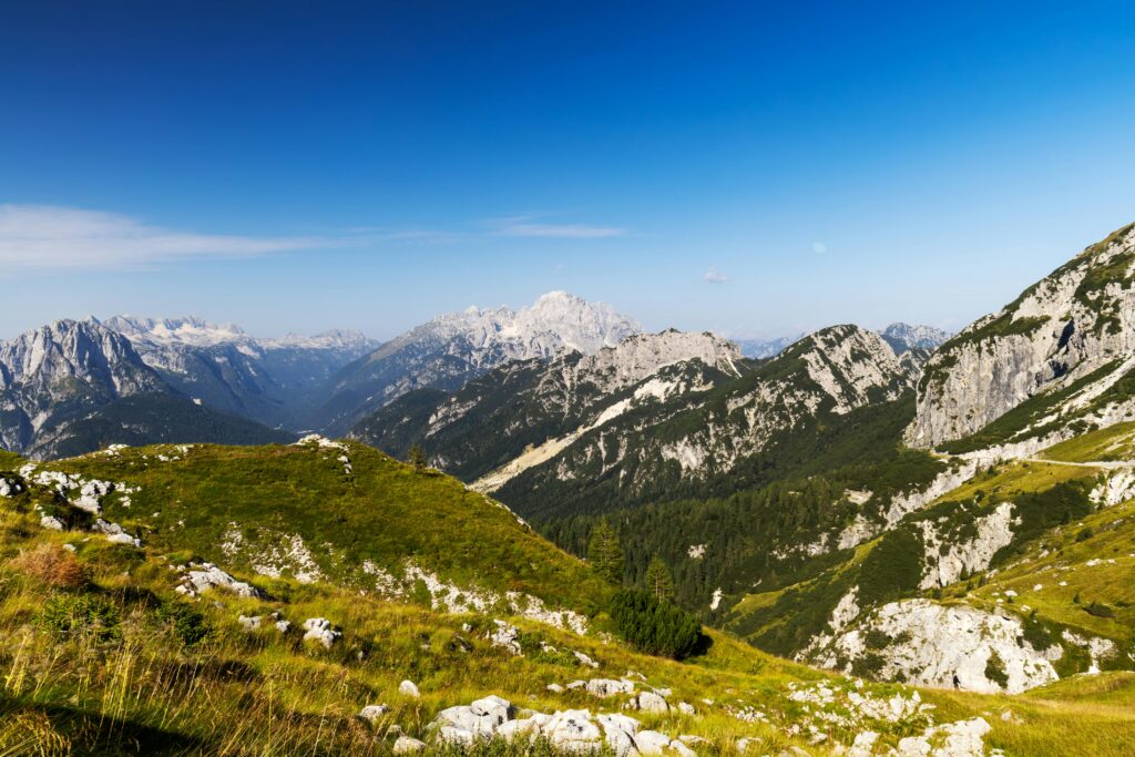
For those who want to explore Slovenia’s alpine beauty without the intense challenge of summiting Triglav, the hike to the Seven Triglav Lakes is a fantastic option. It takes you up into the protected heart of Triglav National Park, a glacial valley that has been protected for over a century.
Don’t be fooled by the word “lakes”: this is no lakeside stroll. The climb from the Savica hut up the Komarča wall is steep and long, and the park itself describes the walk from the valley to the high lakes as long and demanding.
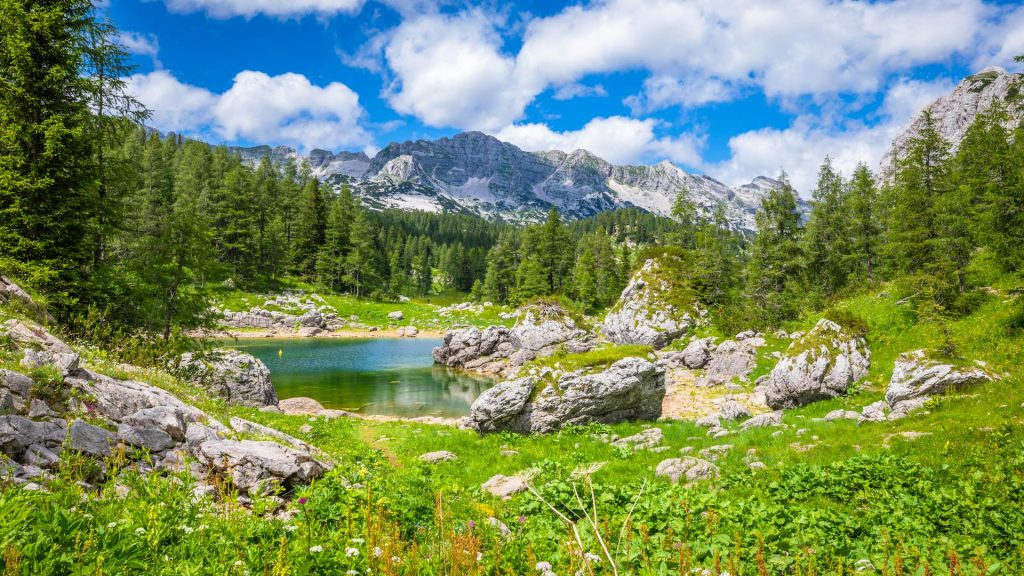
The Triglav Lakes are a true highlight of this trail. These glacial lakes are surrounded by dramatic peaks and offer some of the most picturesque alpine scenery in Slovenia. And despite the name, there are more than seven lakes, lakelets and pools, though some dry up in summer.
What you’ll pass: from Koča pri Savici (667 m), the path climbs the Komarča headwall to Črno jezero, the Black Lake, which feeds the Savica Waterfall below.
It continues to the Triglav Lakes hut (1,685 m), between the Double Lake and Lake Močivec, with Veliko jezero, the largest and deepest of the lakes, also in the valley.
| Difficulty | Challenging (long and steep) |
| Average time | About 3 hours up to the Triglav Lakes hut; allow a full day return |
| Distance | About 12 km (7.5 miles) return (estimate) |
| Route type | Out-and-back (or onward to the huts and passes) |
| Start and end | Koča pri Savici, at the western end of Lake Bohinj |
| Elevation gain | About 1,020 m (3,350 ft) to the hut |
| Getting there | Car to the Savica car park at the western end of the lake; check current transport options and parking |
| Best time and nearest base | July to September, when the hut is open (book ahead); base: Bohinj |
| Trail note | Steep, rocky climb up Komarča; carry plenty of water. Swimming in the lakes is not allowed |
| Don’t miss | The first sight of the Double Lake from the hut |
Triglav via Prag: Best Multi-Day Summit Hike
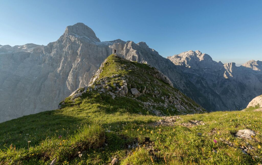
There’s climbing a mountain, and there’s climbing Triglav. It’s the highest peak in the Julian Alps and in Slovenia, at 2,864 m, it’s on the national flag, and the route up from the Vrata valley takes you right past the foot of its enormous north face.
The Prag route is the classic way up from the north: a long, steep climb up the headwall below the north face to the Kredarica hut, then a narrow, exposed ridge with steel cables and pegs to the summit and its tiny metal tower.
The park grades it very difficult, takes 13 hours for the round trip, and recommends a licensed mountain guide for anyone who isn’t at home on that kind of ground. Most people sleep at Kredarica, which takes guests by reservation only.
The park lists two other official ways up: from Rudno polje on the Pokljuka plateau (26 km return, 1,789 m of climb, about 13 hours 30 minutes) and a circular route from Stara Fužina in Bohinj (35.35 km, 2,812 m, about 15 hours).
Both are also graded very difficult. For the bigger picture, including Stol and Velika Planina, see our guide to the best hikes in Slovenia.
What you’ll pass: Aljažev dom in the Vrata valley (1,015 m), the foot of Triglav’s north face, the Prag headwall, Triglavski dom na Kredarici (2,515 m), then the secured summit ridge to Triglav and the Aljaž Tower.
| Difficulty | Very difficult (park grade) |
| Average time | 13 hours return; usually two days with a night at Kredarica |
| Distance | 15.8 km (9.8 miles) return |
| Route type | Out-and-back |
| Start and end | Aljažev dom, Vrata valley |
| Elevation gain | 1,910 m (6,270 ft) |
| Getting there | From Mojstrana up the Vrata valley road; access is controlled by a barrier and parking rules, so check the current traffic arrangements |
| Best time and nearest base | July to September, when the huts are open; base: Mojstrana or Kranjska Gora |
| Trail note | Exposed, cable-protected rock near the top; via ferrata set and helmet recommended. Book Kredarica through the Alpine Association’s hut system or the hut’s own booking |
| Don’t miss | Triglav’s north face from the Vrata valley at the start |
When Should You Do These Hikes?
June to September for the Seven Triglav Lakes and Triglav, when the high huts are open (usually from June to the end of September) and the snow has mostly cleared.
The lake loops, Vintgar and the Soča Trail are best from late spring to autumn; Vintgar closes for winter, and early starts beat the summer crowds at Bled.
What to Bring
- Walking boots for the Seven Triglav Lakes and Triglav; trail shoes are fine for the lake loops.
- A headtorch for Triglav’s early start from Vrata or the dawn walk to the summit from Kredarica.
- A via ferrata set and helmet for Triglav’s summit ridge.
- Plenty of water and food: there’s nowhere to refill on the climb up Komarča.
- A sleeping sheet for a night at Kredarica or the Triglav Lakes hut. For the rest of the day-pack basics, see our list of things to bring on a day hike.
🗒️ Free Checklist: “Never forget the essentials — grab your free Ultimate Hiking Packing List.”
FAQs About the Best Hikes in the Julian Alps
Can you walk the whole Soča Trail in one day?
Yes, if you’re fit: the full 25 km from the source to Bovec takes about 8 to 10 hours. Most people split it into sections and use the valley buses.
How long does it take to walk around Lake Bohinj?
About 3 hours for the 11.5 km loop from Ribčev Laz. You can cut it short with the lake’s panoramic boat.
Can you do the Seven Triglav Lakes as a day hike?
Yes, from Koča pri Savici, but it’s a long, steep day: about 3 hours up to the Triglav Lakes hut and around 1,020 m of climb. A night at the hut (booked ahead) makes it far more relaxed.
Which official routes go up Triglav?
Triglav National Park lists three: from the Vrata valley via Prag (15.8 km return), from Rudno polje (26 km return), and a circular route from Stara Fužina (35.35 km). All three are graded very difficult.
Conclusion
Lake Bled will always be the headline act. But the Julian Alps save their best material for those of you who keep walking: the river that hides underground, the gorge with no way back, and the mountain at the top of the list.
Start easy. Work your way down the page.
The mountains will wait.
Where to Next?
Picked your hikes? Here’s where to plan the rest.
More in the Julian Alps and Slovenia
- Hiking in the Julian Alps: bases, seasons, transport and the park rules.
- Best Hikes in Slovenia: Stol, Velika Planina, the Strunjan coast and the Karst.
- Juliana Trail: the 270 km loop around the Julian Alps, stage by stage.
More Best Hikes Nearby
- Best Hikes in Tyrol: big alpine days and hut-to-hut routes in Austria.
- Best Hikes in Austria: alpine ridges and lake walks just over the Karavanke.
Where This Information Comes From
Last checked: 15 October 2026.
- The Soča Trail, Triglav National Park and Soča Valley Tourism (PDF) and Soča–Trenta tourism: the Soča Trail sections
- Vintgar Gorge official site
- Alpine Association of Slovenia (PZS): mountain huts
- Wikipedia: Triglav Lakes Lodge and Wikipedia: Aljaž Lodge in the Vrata Valley