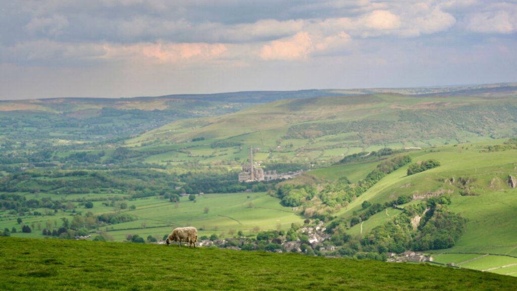
Sheep grazing on a green hillside overlooking a valley with fields and a small village in the distance under a cloudy sky

The Ultimate Pennine Way Guide: One of UK’s Most Iconic Long Distance Treks

Spanning 268 miles from the village of Edale to the Scottish border village of Kirk Yetholm, the Pennine Way sets the standard from which all UK long-distance treks are measured. This route officially opened in April of 1965 and, over 60 years later, still stands as one of the toughest and most iconic trails in the entire United Kingdom. This is a path that humbles, challenges, and transforms walkers, no matter their skill level. 

The idea for the Pennine Way came from a journalist, Tom Stephenson. Born from the inspiration of the Appalachian Trail in the US, he wrote an article proposing the trail and spent the following thirty years championing public access and lobbying Parliament to transform the trail from idea to reality. The history of the Pennine Way makes the journey one that’s as much about political history as it is about the physical landscape. The 1932 Mass Trespass, an event where hundreds of walkers went against landowners and the police to assert the right to walk on open moorland, marks the start of the trail at Kinder Scout.

Often called the backbone of England, the Pennine ridge marks the main path of the Pennine Way. The ridge runs through three National Parks: the Peak District, the Yorkshire Dales, and Northumberland. If you’re planning to explore more of the country’s iconic trails, our Ultimate Guide to Hiking in England covers the best hiking destinations beyond the Pennine Way. Every step along the route invites you to stop, stare, and simply appreciate what you have in front of you. 

Each year, there are over 15,000 people who step foot on the trail, but only around 3,500 of those will complete the route in its entirety. This is a guide to help you plan your own adventure along the Pennine Way, from the logistics of getting there and back, to a day-to-day itinerary that can be the first step in transforming a dream into reality, just like the trail itself. 

Table Of Contents
  1. The Need-To-Know for Hiking the Pennine Way
  2. Navigation along the Pennine Way
  3. The Terrain of the Pennine Way
  4. When to Hike the Pennine Way
  5. Getting There and Back
  6. A 16-Day Itinerary for the Pennine Way
  7. Day 1: Edale to Crowden
  8. Day 2: Crowden to Standedge
  9. Day 3: Standedge to Hebden Bridge
  10. Day 4: Hebden Bridge to Cowling
  11. Day 5: Cowling to Malham
  12. Day 6: Malham to Horton-in-Ribblesdale
  13. Day 7: Horton-in-Ribblesdale to Hawes
  14. Day 8: Hawes to Keld
  15. Day 9: Keld to Bowes
  16. Day 10: Bowes to Middleton-in-Teesdale
  17. Day 11: Middleton-in-Teesdale to Dufton
  18. Day 12: Dufton to Alston
  19. Day 13: Alston to Greenhead (Hadrian's Wall)
  20. Day 14: Greenhead to Bellingham
  21. Day 15: Bellingham to Byrness
  22. Day 16: Byrness to Kirk Yetholm
  23. What to Pack to Hike the Pennine Way
  24. FAQ
  25. How long does it take to hike the Pennine Way?
  26. What is the best part of the Pennine Way?
  27. The Need-To-Know for Hiking the Pennine Way
  28. Distance and Elevation Change
  29. Navigation along the Pennine Way
  30. The Terrain of the Pennine Way
  31. Finding Accommodation
  32. When to Hike the Pennine Way
  33. Getting There and Back
  34. A 16-Day Itinerary for the Pennine Way
  35. Day 1: Edale to Crowden
  36. Day 2: Crowden to Standedge
  37. Day 3: Standedge to Hebden Bridge
  38. Day 4: Hebden Bridge to Cowling
  39. Day 5: Cowling to Malham
  40. Day 6: Malham to Horton-in-Ribblesdale
  41. Day 7: Horton-in-Ribblesdale to Hawes
  42. Day 8: Hawes to Keld
  43. Day 9: Keld to Bowes
  44. Day 10: Bowes to Middleton-in-Teesdale
  45. Day 11: Middleton-in-Teesdale to Dufton
  46. Day 12: Dufton to Alston
  47. Day 13: Alston to Greenhead (Hadrian's Wall)
  48. Day 14: Greenhead to Bellingham
  49. Day 15: Bellingham to Byrness
  50. Day 16: Byrness to Kirk Yetholm
  51. What to Pack to Hike the Pennine Way
  52. FAQ
  53. Summary
  54. Where to Next?

The Need-To-Know for Hiking the Pennine Way

Distance and Elevation Change

Officially, the Pennine Way is 268 miles (431 kilometers) long, but your total distance can vary slightly depending on where you choose to sleep each night and what alternative routes or detours you may pursue. For example, the Bowes Loop, an alternative route around the Bowes area, can add a few extra miles, and the summit of The Cheviot can add another mile and a half of climbing and descent on either side. Most thru-hikers will rack up anywhere between 265 and 275 miles in total. 

Over these ~270 miles, the elevation changes a surprising amount. The total gain is around 40,000 feet (12,000 meters), which is roughly equivalent to climbing Mount Everest 1.3 times from sea level. This is the part of hiking the Pennine Way that gives it its reputation as one of the most challenging treks in England. There’s no singular mountain that defines the route, rather it grinds through moorland climbs, valley descents, and exposed ridge crossings that build over three weeks of walking. The highest point of the trail is found at Cross Fell, at 893 meters, which is far from an alpine summit, but often proves to be a challenge with brutal weather. 

Navigation along the Pennine Way

The Pennine Way is a waymarked National Trail, which sets it apart from other challenging trails like the Cape Wrath Trail, but helps to make navigation a much simpler task. If you’re looking for a gentler National Trail after completing the Pennine Way, the Cotswolds Way offers a very different long-distance walking experience.. It’s important to note that while a waymarked trail can make navigation easier, it doesn’t make it a guaranteed thing when weather can roll in and make finding the navigational markers nearly impossible through the fog. 

On the high moorland sections, posts and markers can often be buried in snow, invisible through heavy mist and fog, or could have simply disappeared from the test of time. Bleaklow Head, the Black Hill section, and the High Cross Fell plateau are all famous for having navigation difficulties. The last day on the trail can give you a final challenge in the Cheviot Hills if the weather is poor. With poor visibility always as a possibility, the ability to navigate with a map in these conditions is a basic prerequisite for completing the trail. 

For navigation, it’s recommended that you carry with you the following:

  • The Cicerone guidebook by Paddy Dillon
  • Two-sheet Harvey Maps Pennine Way set
  • An offline device with the OS Maps app or Gaia GPS loaded with the Pennine Way GPX track
  • Physical compass

This system allows for you to rely on technology, but have a second reliable backup system for when technology inevitably has its challenges out in nature. 

The Terrain of the Pennine Way

Across the route, the terrain varies much more than you may expect. The trail shifts in character between the southern, central, and northern sections. The trail begins with dark millstone grit moorland in the Peak District that is complemented by wet, peaty, and often trackless sections at higher elevations. Here, the peat bogs of Kinder Scout and Bleaklow are incredibly ferocious, giving them a well-earned reputation as such. There are flagstone paths that have been laid across many of the worst sections to control erosion, but a lot of the bog walking is still highly demanding without any infrastructure to support you. 

In the central Yorkshire Dales, there is a varied array of landscape that moves between limestone pavements, green valley floors, dramatic waterfalls, and the rolling uplands of Swaledale. As the most scenically diverse section of the trail, it is home to many highlights of the trail and makes up the majority of the “Best of the Pennine Way” lists. The North Pennines near Cross Fell is the trail’s high point and brings a serious feeling of vast, lonely remoteness that can feel like you’ve been transported to a completely different world. Hadrian’s Wall is famous for its Roman history, but is also home to some of the best ridge walking on the entire route along the Whin Sill escarpment. 

The northern section is defined by the rolling green lands of Northumberland and Cheviot. The Cheviots are a stark contrast to the rest of the trail with rounded, grassy hills that have boggy summits with tremendous views. The final stage across the border ridge into Scotland is a peak experience of the trail where you may have wet feet the entire way, but the views around you make you quickly forget. 

Finding Accommodation

The Pennine Way has a wide spread of accommodation options spaced out along the route. In the summer months, there’s a lot of forward planning needed both in high-traffic areas and the more remote sections of the North Pennines and Northumbrian hills. The trail winds its way through plenty of small towns and villages, making it easy to find a bed to sleep in each night, but some gaps are larger and require more planning. 

Along the route there are full-service hotels and B&Bs in the larger towns (Hebden Bridge, Hawes, Alston, Bellingham) but you can also find camping barns and bunkhouses in the smaller communities. Some villages (Edale, Crowden, Mankinholes, Hawes, Keld, and Dufton) have youth hostels that can give a community feel with a roof over your head. For more detailed information, the Pennine Way Association and the official National Trails website maintain up-to-date directories so you can easily make bookings ahead of your arrival (strongly recommended in July and August). 

Wild camping along the route is an option, however it is technically only allowed on private land with the landowner’s permission. The wild camping rules differ between England and Scotland, so it’s important to understand where you’re legally allowed to sleep and where it may just be tolerated. For example, wild camping is widely tolerated and practiced on the high ground away from roads and houses, but it can be easy to find campgrounds and camping barns that provide a fully legal alternative. 

Resupply on the Pennine Way is much more straightforward than along some wilder and more remote routes. Most accommodation stops are within walking distance to shops or pubs and the trail passes through plenty of market towns (Hawes, Middleton-in-Teesdale, Alston, Bellingham) which allow for easy resupply at frequent intervals. The longest stretch without a reliable shop is inside of the North Pennines and Northumberland sections, so you may need to carry two to three days worth of food. 

When to Hike the Pennine Way

Mid-May to September is the recommended window from most sources for a lot of reasons. The days are long, the worst winter conditions have passed, the moorland is at its most navigable, and the bogs have drained enough to be more passable. May and June are a bit more appealing simply because there is a freshness to the landscape that comes with a quieter trail before the peak summer months. 

If you’re looking to simply find the best weather and longest days, July and August may be a better choice. It’s warmer, but a lot of other people are taking advantage of that as well. There’s more competition for accommodation, and there’s unexpected competition with midges in the high northern sections. There can be a drier feeling to the southern moors if the summer has been dry, but overall, the trail is still beautiful. September is also a fantastic time to hike the Pennine Way as the heather is in full bloom, school-holiday crowds have gone home, and the Northumberland section takes on stunning fall colors. 

Walking the Pennine Way in April is possible, but it takes a certain level of expertise to make it safe. There are potentially wintry conditions on the northern sections and winter walking isn’t always a great choice for beginners. The days are shorter in April, so your hiking speed needs to increase, and the high ground can be genuinely dangerous in the ice and snow. 

Getting There and Back

The southern starting point, Edale, is easily accessible via the train. The village sits directly on the Sheffield to Manchester rail line, with regular services from both directions. From the Edale station, you only need to walk ten minutes to The Old Nag’s Head, the official start of the Pennine Way, to be on your way. There is, however, no bus service to Edale, so a train is the best option. 

At the terminus of the trail in Kirk Yetholm, a thru-hiker is faced with a bit more challenge. There is no train station, with the nearest being in Berwick-upon-Tweed which is 25 miles away. The bus goes infrequently from Kirk Yetholm to Kelso where more connections are available, so you need to check the timetable before your finish day. Many walkers will arrange a taxi to Berwick or Jedburgh where more easily accessible onward travel options exist. This is more expensive, but it’s a much faster way and significantly less stressful after finishing a huge trek. 

A 16-Day Itinerary for the Pennine Way

A sixteen-day trek on the Pennine Way is generally regarded as the minimum number of days you want to take if you are an experienced and fit hiker. The Cicerone guidebook gives 20 stages of the trail, but many of the shorter stages are combined into single days in order to make the trip a bit shorter. If you have the time, splitting some of these days up and following the 20 stages can make for a more relaxed walk along the Pennine Way, however a sixteen-day itinerary is achievable for many hikers. 

DayRouteDistanceElev. GainElev. LossEst. Time
Day 1Edale to Crowden16.5 miles (26.5 km)2,280 ft (695 m)1,870 ft (570 m)7–9 hours
Day 2Crowden to Standedge11 miles (18 km)1,640 ft (500 m)1,640 ft (500 m)5–6 hours
Day 3Standedge to Hebden Bridge14 miles (22.5 km)1,870 ft (570 m)2,100 ft (640 m)6–7 hours
Day 4Hebden Bridge to Cowling15 miles (24 km)2,460 ft (750 m)2,300 ft (700 m)6–8 hours
Day 5Cowling to Malham14 miles (22.5 km)1,970 ft (600 m)1,800 ft (550 m)6–7 hours
Day 6Malham to Horton-in-Ribblesdale14.5 miles (23 km)2,790 ft (850 m)2,460 ft (750 m)6–8 hours
Day 7Horton-in-Ribblesdale to Hawes14 miles (22.5 km)2,625 ft (800 m)2,625 ft (800 m)6–8 hours
Day 8Hawes to Keld12 miles (19 km)2,130 ft (650 m)2,000 ft (610 m)5–7 hours
Day 9Keld to Bowes14 miles (22.5 km)1,640 ft (500 m)1,970 ft (600 m)6–7 hours
Day 10Bowes to Middleton-in-Teesdale13 miles (21 km)1,310 ft (400 m)1,310 ft (400 m)5–6 hours
Day 11Middleton-in-Teesdale to Dufton21 miles (34 km)2,625 ft (800 m)2,790 ft (850 m)8–10 hours
Day 12Dufton to Alston20 miles (32 km)4,100 ft (1,250 m)4,265 ft (1,300 m)8–10 hours
Day 13Alston to Greenhead (Hadrian’s Wall)16 miles (26 km)1,970 ft (600 m)2,130 ft (650 m)6–8 hours
Day 14Greenhead to Bellingham22 miles (35 km)2,300 ft (700 m)2,460 ft (750 m)8–10 hours
Day 15Bellingham to Byrness15 miles (24 km)1,970 ft (600 m)2,000 ft (610 m)6–7 hours
Day 16Byrness to Kirk Yetholm27 miles (43 km)4,265 ft (1,300 m)4,430 ft (1,350 m)10–13 hours

Day 1: Edale to Crowden

Distance: 16.5 miles (26.5 km)

Elevation Gain: 2,280 ft (695 m)

Elevation Loss: 1,870 ft (570 m)

Average Time to Hike: 7–9 hours

The historic start of the Pennine Way takes place at Kinder Scout. This gritstone plateau was the site of the 1932 Mass Trespass, a defining moment in the public access movement in England, and is now used to celebrate that success even further. 

This start isn’t a gradual introduction to the difficult trek ahead, it throws you right into the deep end. The ascent from the Old Nag’s Head is steep and unrelenting through a navigational journey through peat haggs and groughs that can be nearly impossible to find your way through in the heavy mist. The descent from Bleakflow Head will put your legs to the test after a difficult climb, but you’ll find a hostel and campsite waiting for you at the end in Crowden.

Day 2: Crowden to Standedge

Distance: 11 miles (18 km)

Elevation Gain: 1,640 ft (500 m)

Elevation Loss: 1,640 ft (500 m)

Average Time to Hike: 5–6 hours

The second day on the trail helps your body adapt to the rhythm of consistent movement on the trail. The shorter distance takes you across Saddleworth Moor and through some of the most atmospheric moorland in the southern Pennines. Here, you hit Standedge, one of the higher points in the southern section, at 450 meters. At the end of the day, you will cross the A62 and hit civilization right before the trail dips down in the landscape of West Yorkshire.

Day 3: Standedge to Hebden Bridge

Distance: 14 miles (22.5 km)

Elevation Gain: 1,870 ft (570 m)

Elevation Loss: 2,100 ft (640 m)

Average Time to Hike: 6–7 hours

In West Yorkshire, the trail passes through mill towns and reservoirs, providing a unique landscape that is unlike the rest of the trail.The Stoodley Pike monument can be found here, above Hebden Bridge, an obelisk from 1856 that is used as a landmark for miles. Hebden Bridge is likely the most vibrant town to be found directly on the Pennine Way. It has independent bookshops, delicious cafes, and a strong community that is always willing to help out. If you want a day to regroup, Hebden Bridge is a great option for a quick rest day early on. 

Day 4: Hebden Bridge to Cowling

Distance: 15 miles (24 km)

Elevation Gain: 2,460 ft (750 m)

Elevation Loss: 2,300 ft (700 m)

Average Time to Hike: 6–8 hours

As you leave the cozy town of Hebden Bridge, the route climbs immediately onto the exposed moorland, the defining landscape of the South Pennines. This landscape is stark, windswept, and atmospheric, which can give it an eerie feel alongside remarkable views. With a short detour from the trail, you can visit the ruins of Top Withins, the farmhouse that served as the inspiration for Wuthering Heights, and it’s well worth the short trip. The end of the day lands you in the small but lively village of Cowling. 

Day 5: Cowling to Malham

Distance: 14 miles (22.5 km)

Elevation Gain: 1,970 ft (600 m)

Elevation Loss: 1,800 ft (550 m)

Average Time to Hike: 6–7 hours

The Yorkshire Dales transition you from dark milestone grit to bright, pale limestone that now defines the landscape around you. Halfway through the day, the trail reaches Malham Cove. This 260-foot curved limestone cliff is a breathtaking moment on the trail that sticks with you for the rest of the walk. If you take a short detour to Gordale Scar, you’ll find something even more remarkable waiting for you there. Once you arrive in Malham, there are plenty of pubs and options for accommodation alongside a National Park visitor center to learn more about what you’re immersed in. 

Day 6: Malham to Horton-in-Ribblesdale

Distance: 14.5 miles (23 km)

Elevation Gain: 2,790 ft (850 m)

Elevation Loss: 2,460 ft (750 m)

Average Time to Hike: 6–8 hours

Today is a day filled with significant Pennine Way landmarks. The route passes Pen-y-Ghent, one of the Yorkshire Three Peaks. At 694 meters, Pen-y-Ghent has a stepped profile that creates one of the most recognizable silhouettes in English upland walking. There’s a steep and rocky ascent, but the path is well-kept, and the views at the top are remarkable. Horton-in-Ribblesdale is a classic Pennine Way stop where you can stay at the famous Crown Hotel and get everything you need to refresh for another day. 

Day 7: Horton-in-Ribblesdale to Hawes

Distance: 14 miles (22.5 km)

Elevation Gain: 2,625 ft (800 m)

Elevation Loss: 2,625 ft (800 m)

Average Time to Hike: 6–8 hours

One week in and hiking the Pennine Way doesn’t stop bringing remarkable views and plenty of highlights. Today, it’s the crossing of Great Shunner Fell (716 meters). This is a long and gradual ascent across frequently boggy terrain that demands hard work, but rewards you with open sky views across the North Yorkshire moorland. The descent leads into Wensleydale and the small market town of Hawes. There’s a good handful of accommodation options and plentiful options for resupply, so save some time to arrive and get your shopping done. 

Day 8: Hawes to Keld

Distance: 12 miles (19 km)

Elevation Gain: 2,130 ft (650 m)

Elevation Loss: 2,000 ft (610 m)

Average Time to Hike: 5–7 hours

While today’s walk is a bit shorter than others, the scenery doesn’t come up short. From Hawes, the trail crosses to Hardraw. Hadraw Force is the highest single-drop waterfall above ground in England, a sight to see before beginning the long ascent of the northern shoulder of Great Shunner Fell. The descent into upper Swaledale brings you to the hamlet of Thwaite and then on to Keld. Here, the Pennine Way crosses Alfred Wainwright’s Coast to Coast Walk, bringing a load of long-distance hikers into one spot. The legendary overnight option is Tan Hill Inn, Britain’s highest pub, for those who are willing to push a few miles further north. 

Day 9: Keld to Bowes

Distance: 14 miles (22.5 km)

Elevation Gain: 1,640 ft (500 m)

Elevation Loss: 1,970 ft (600 m)

Average Time to Hike: 6–7 hours

The trail climbs back onto the moorland as soon as you leave Keld and passes by Tan Hill Inn, if you hadn’t already stayed there the night before. From there, the route enters the North Pennines AONB and follows the high moorland before dropping into the isolated settlement of Sleightholme. The main route goes further north to cross God’s Bridge, a natural limestone crossing of the River Greta. The final stretch takes you into Bowes, a small village with an old Norman castle and welcoming pub. 

Day 10: Bowes to Middleton-in-Teesdale

Distance: 13 miles (21 km)

Elevation Gain: 1,310 ft (400 m)

Elevation Loss: 1,310 ft (400 m)

Average Time to Hike: 5–6 hours

With very little elevation today, you get to take a slight rest for your legs while enjoying some of the trail’s best scenery. You start by crossing open pastoral moorland over to field paths and tracks that take you to the River Tees. Here, you find Middleton-in-Teesdale, a charming market town with a good range of accommodation and services. This is the gateway to the magical waterfall country ahead of you. 

Day 11: Middleton-in-Teesdale to Dufton

Distance: 21 miles (34 km)

Elevation Gain: 2,625 ft (800 m)

Elevation Loss: 2,790 ft (850 m)

Average Time to Hike: 8–10 hours

Frequently referred to as the most beautiful day on the Pennine Way, the long stretch out of Middleton-in-Teesdale lives up to the name. The route heads upstream alongside the River Tees through a succession of waterfalls. You see Low Force, High Force (England’s most powerful waterfall), and Cauldron Snout. These final falls are a crashing, tumbling cascade about Cow Green Reservoir that is hard to beat. After the falls, you climb up a glacial valley to the summit of High Cup Nick. The view down into the void from here is astonishing. Your day ends in Dufton, a red-sandstone estate village home to a youth hostel and pub that will be well-loved after 21 miles of hiking. 

Day 12: Dufton to Alston

Distance: 20 miles (32 km)

Elevation Gain: 4,100 ft (1,250 m)

Elevation Loss: 4,265 ft (1,300 m)

Average Time to Hike: 8–10 hours

While the previous day was long, today is harder. With 1,250 meters of climbing, this stage is easily the hardest day on the Pennine Way, and one of the hardest on any of the English National Trails. The route crosses the High Cross Fell massif, the highest point on the Pennine Way at 893 meters, as well as Great Dun Fell and Little Dun Fell, the adjacent peaks. The descent along the Maiden Way is long, relentless, and seemingly never-ending. Fortunately, the day does end in Alston, England’s highest market town. Be ready for a long, but beautiful day. 

Day 13: Alston to Greenhead (Hadrian’s Wall)

Distance: 16 miles (26 km)

Elevation Gain: 1,970 ft (600 m)

Elevation Loss: 2,130 ft (650 m)

Average Time to Hike: 6–8 hours

Today you make your way toward another historic landmark and long-distance trek, Hadrian’s Wall. The route follows the South Tyne valley and crosses the North Pennine moorland to get there, and once you’re there, it’s one of the most iconic Pennine Way experiences. The Wall section follows the crest of the Whin Sill escarpment while passing Roman forts, turrets, and milecastles. The day ends and you can hop into The Twice Brewed in near Once Brewed for a legendary Pennine Way stop and night of rest. 

Day 14: Greenhead to Bellingham

Distance: 22 miles (35 km)

Elevation Gain: 2,300 ft (700 m)

Elevation Loss: 2,460 ft (750 m)

Average Time to Hike: 8–10 hours

Another long day takes you along the rest of Hadrian’s Wall before entering Northumberland National Park. Here, you follow the wall for eight more miles before leaving the stones at Rapishaw Gap and heading north through Wark Forest. The trail changes here into an emptier, greener, but more solitary experience. Bellingham is a lovely small market town with a good cluster of services before you get into the more remote sections. 

Day 15: Bellingham to Byrness

Distance: 15 miles (24 km)

Elevation Gain: 1,970 ft (600 m)

Elevation Loss: 2,000 ft (610 m)

Average Time to Hike: 6–7 hours

Today is a big transitional day with a crossing of Padon Hill and the edge of Redesdale Forest to get to the remote valley of River Rede. Byrness is a small settlement, but it’s also your final stop before taking on the final big day. There’s a village pub and hostel that does just enough to prepare you for one more day of walking. Many hikers will split the final stage across two days, staying at the refuge hut in Uswayford, but it’s totally doable in one go, but you need to get a good rest in Byrness before heading out. 

Day 16: Byrness to Kirk Yetholm

Distance: 27 miles (43 km)

Elevation Gain: 4,265 ft (1,300 m)

Elevation Loss: 4,430 ft (1,350 m)

Average Time to Hike: 10–13 hours

Day 16 is by far the longest day on the trail, and one of the longest of any English National Trail, but it’s one that you’ve been preparing for this entire time. The route crosses Cheviot Hills, following a border ridge between England and Scotland. The optional summit of The Cheviot (815 meters) will add a mile and a half of walking, but is worth it in good conditions. There are two remote refuges here for emergency shelter if needed. 

The final descent into Kirk Yetholm is an emotional one for just about every hiker on the Pennine Way. The Border Hotel marks the official finish and you can take home a certificate of completion along with your free half pint first promised by Alfred Wainwright.

What to Pack to Hike the Pennine Way

Before setting off, make sure your load is organized efficiently with our guide on how to pack a hiking backpack.This is a gear breakdown to match the specific demands of the trail. 

Backpack

A 45-60 liter backpack is perfect for Pennine Way Walkers. There are plenty of options for accommodation and resupply along the way, so you can pack smaller and stay in B&Bs along the way. A hiker wanting to wild camp may lean toward the larger end of the scale to fit a tent and sleeping gear. 

Footwear

The greatest debate of long-distance hiking is what to wear on your feet. Waterproof leather or synthetic hiking boots tend to be the best bet for hiking the Pennine Way. There are so many peat bogs and boggy moorlands that your feet need full waterproofing and ankle support.

Clothing

Choosing the right clothing system is essential for the Pennine Way’s unpredictable weather. Our layering system guide explains how to stay comfortable in changing conditions.

Rain Gear

High-quality rain gear is a non-negotiable for the Pennine Way. You need to protect your insulating layers, so look for the top-notch gear when possible. Both a rain jacket and rain pants are necessary to keep yourself dry and safe.

Navigation Tools

As mentioned before, a clear set of navigation tools can save your life on the Pennine Way. A good map, compass, GPS device, or a smartphone with the GPX track pre-loaded will be just what you need. Always bring a backup to electronics so you can follow the guidebook without relying on tech. 

Food and Water

Unsure how much to carry? Our guide on how much water to take on a hike can help you estimate your needs based on distance and weather. You’ll need space in your bag to carry a minimum two liters of water at a time with sufficient snacks for the day. 

First Aid

Being prepared for anything is a must on any long-distance trek. The Pennine Way is rather accessible for emergency services, but having what you need at the moment is a must. A small first aid kit for the Pennine Way must include:

  • Blister treatment
  • Ibuprofen and paracetamol
  • Bandages and wound care
  • Antiseptic wipes
  • Personal prescription medications

While the Pennine Way requires gear for a multi-day trek, many of the essentials also appear in our complete day hiking packing checklist.

FAQ

How difficult is the Pennine Way?

The Pennine Way is generally rated as moderately difficult to difficult. It is the toughest of England’s National Trails by almost any measure. 

Can beginners hike the Pennine Way?

If you’re working toward your first multi-day trek, these backpacking tips for beginners are a great place to build the necessary skills before attempting the Pennine Way.

Is wild camping allowed on the Pennine Way?

While England doesn’t have the same legal right to wild camp as Scotland does, the Pennine Way is still friendly to wild campers. You must camp on private land only after receiving the landowner’s permission and take great care when on public lands. 

What gear is essential for the Pennine Way?

The non-negotiables for hiking the Pennine Way are waterproof hiking boots, a high-quality waterproof rain jacket and rain pants, a warm insulating layer, a reliable navigation setup, and a first aid kit. 

How long does it take to hike the Pennine Way?

For most hikers, it takes around 16 to 22 days to complete the Pennine Way.

What is the best part of the Pennine Way?

Just like any thru-hike, the Pennine Way will interest hikers in different ways and many sections will become favorites for certain types of hikers, while others will Spanning 268 miles from the village of Edale to the Scottish border village of Kirk Yetholm, the Pennine Way sets the standard from which all UK long-distance treks are measured. This route officially opened in April of 1965 and, over 60 years later, still stands as one of the toughest and most iconic trails in the entire United Kingdom. This is a path that humbles, challenges, and transforms walkers, no matter their skill level. 

The idea for the Pennine Way came from a journalist, Tom Stephenson. Born from the inspiration of the Appalachian Trail in the US, he wrote an article proposing the trail and spent the following thirty years championing public access and lobbying Parliament to transform the trail from idea to reality. The history of the Pennine Way makes the journey one that’s as much about political history as it is about the physical landscape. The 1932 Mass Trespass, an event where hundreds of walkers went against landowners and the police to assert the right to walk on open moorland, marks the start of the trail at Kinder Scout.

Often called the backbone of England, the Pennine ridge marks the main path of the Pennine Way. The ridge runs through three National Parks: the Peak District, the Yorkshire Dales, and Northumberland. The trail takes you through some of England’s most celebrated landscapes, such as the treacherous peat plateau of Kinder Scout, the limestone spectacle of Malham Cove, the stunning Roman engineering at Hadrian’s Wall, the waterfalls of Teesdale, and so much more. Every step along the route invites you to stop, stare, and simply appreciate what you have in front of you. 

Each year, there are over 15,000 people who step foot on the trail, but only around 3,500 of those will complete the route in its entirety. This is a guide to help you plan your own adventure along the Pennine Way, from the logistics of getting there and back, to a day-to-day itinerary that can be the first step in transforming a dream into reality, just like the trail itself. 

The Need-To-Know for Hiking the Pennine Way

Distance and Elevation Change

Officially, the Pennine Way is 268 miles (431 kilometers) long, but your total distance can vary slightly depending on where you choose to sleep each night and what alternative routes or detours you may pursue. For example, the Bowes Loop, an alternative route around the Bowes area, can add a few extra miles, and the summit of The Cheviot can add another mile and a half of climbing and descent on either side. Most thru-hikers will rack up anywhere between 265 and 275 miles in total. 

Over these ~270 miles, the elevation changes a surprising amount. The total gain is around 40,000 feet (12,000 meters), which is roughly equivalent to climbing Mount Everest 1.3 times from sea level. This is the part of hiking the Pennine Way that gives it its reputation as one of the most challenging treks in England. There’s no singular mountain that defines the route, rather it grinds through moorland climbs, valley descents, and exposed ridge crossings that build over three weeks of walking. The highest point of the trail is found at Cross Fell, at 893 meters, which is far from an alpine summit, but often proves to be a challenge with brutal weather. 

Navigation along the Pennine Way

The Pennine Way is a waymarked National Trail, which sets it apart from other challenging trails like the Cape Wrath Trail, but helps to make navigation a much simpler task. The white acorn symbol of the National Trails system can be found in abundance along the way, helping guide walkers at most junctions. It’s important to note that while a waymarked trail can make navigation easier, it doesn’t make it a guaranteed thing when weather can roll in and make finding the navigational markers nearly impossible through the fog. 

On the high moorland sections, posts and markers can often be buried in snow, invisible through heavy mist and fog, or could have simply disappeared from the test of time. Bleaklow Head, the Black Hill section, and the High Cross Fell plateau are all famous for having navigation difficulties. The last day on the trail can give you a final challenge in the Cheviot Hills if the weather is poor. With poor visibility always as a possibility, the ability to navigate with a map in these conditions is a basic prerequisite for completing the trail. 

For navigation, it’s recommended that you carry with you the following:

  • The Cicerone guidebook by Paddy Dillon
  • Two-sheet Harvey Maps Pennine Way set
  • An offline device with the OS Maps app or Gaia GPS loaded with the Pennine Way GPX track
  • Physical compass

This system allows for you to rely on technology, but have a second reliable backup system for when technology inevitably has its challenges out in nature. 

The Terrain of the Pennine Way

Across the route, the terrain varies much more than you may expect. The trail shifts in character between the southern, central, and northern sections. The trail begins with dark millstone grit moorland in the Peak District that is complemented by wet, peaty, and often trackless sections at higher elevations. Here, the peat bogs of Kinder Scout and Bleaklow are incredibly ferocious, giving them a well-earned reputation as such. There are flagstone paths that have been laid across many of the worst sections to control erosion, but a lot of the bog walking is still highly demanding without any infrastructure to support you. 

In the central Yorkshire Dales, there is a varied array of landscape that moves between limestone pavements, green valley floors, dramatic waterfalls, and the rolling uplands of Swaledale. As the most scenically diverse section of the trail, it is home to many highlights of the trail and makes up the majority of the “Best of the Pennine Way” lists. The North Pennines near Cross Fell is the trail’s high point and brings a serious feeling of vast, lonely remoteness that can feel like you’ve been transported to a completely different world. Hadrian’s Wall is famous for its Roman history, but is also home to some of the best ridge walking on the entire route along the Whin Sill escarpment. 

The northern section is defined by the rolling green lands of Northumberland and Cheviot. The Cheviots are a stark contrast to the rest of the trail with rounded, grassy hills that have boggy summits with tremendous views. The final stage across the border ridge into Scotland is a peak experience of the trail where you may have wet feet the entire way, but the views around you make you quickly forget. 

Finding Accommodation

The Pennine Way has a wide spread of accommodation options spaced out along the route. In the summer months, there’s a lot of forward planning needed both in high-traffic areas and the more remote sections of the North Pennines and Northumbrian hills. The trail winds its way through plenty of small towns and villages, making it easy to find a bed to sleep in each night, but some gaps are larger and require more planning. 

Along the route there are full-service hotels and B&Bs in the larger towns (Hebden Bridge, Hawes, Alston, Bellingham) but you can also find camping barns and bunkhouses in the smaller communities. Some villages (Edale, Crowden, Mankinholes, Hawes, Keld, and Dufton) have youth hostels that can give a community feel with a roof over your head. For more detailed information, the Pennine Way Association and the official National Trails website maintain up-to-date directories so you can easily make bookings ahead of your arrival (strongly recommended in July and August). 

Wild camping along the route is an option, however it is technically only allowed on private land with the landowner’s permission. The wild camping rules differ between England and Scotland, so it’s important to understand where you’re legally allowed to sleep and where it may just be tolerated. For example, wild camping is widely tolerated and practiced on the high ground away from roads and houses, but it can be easy to find campgrounds and camping barns that provide a fully legal alternative. 

Resupply on the Pennine Way is much more straightforward than along some wilder and more remote routes. Most accommodation stops are within walking distance to shops or pubs and the trail passes through plenty of market towns (Hawes, Middleton-in-Teesdale, Alston, Bellingham) which allow for easy resupply at frequent intervals. The longest stretch without a reliable shop is inside of the North Pennines and Northumberland sections, so you may need to carry two to three days worth of food. 

When to Hike the Pennine Way

Mid-May to September is the recommended window from most sources for a lot of reasons. The days are long, the worst winter conditions have passed, the moorland is at its most navigable, and the bogs have drained enough to be more passable. May and June are a bit more appealing simply because there is a freshness to the landscape that comes with a quieter trail before the peak summer months. 

If you’re looking to simply find the best weather and longest days, July and August may be a better choice. It’s warmer, but a lot of other people are taking advantage of that as well. There’s more competition for accommodation, and there’s unexpected competition with midges in the high northern sections. There can be a drier feeling to the southern moors if the summer has been dry, but overall, the trail is still beautiful. September is also a fantastic time to hike the Pennine Way as the heather is in full bloom, school-holiday crowds have gone home, and the Northumberland section takes on stunning fall colors. 

Walking the Pennine Way in April is possible, but it takes a certain level of expertise to make it safe. There are potentially wintry conditions on the northern sections and winter walking isn’t always a great choice for beginners. The days are shorter in April, so your hiking speed needs to increase, and the high ground can be genuinely dangerous in the ice and snow. 

Getting There and Back

The southern starting point, Edale, is easily accessible via the train. The village sits directly on the Sheffield to Manchester rail line, with regular services from both directions. From the Edale station, you only need to walk ten minutes to The Old Nag’s Head, the official start of the Pennine Way, to be on your way. There is, however, no bus service to Edale, so a train is the best option. 

At the terminus of the trail in Kirk Yetholm, a thru-hiker is faced with a bit more challenge. There is no train station, with the nearest being in Berwick-upon-Tweed which is 25 miles away. The bus goes infrequently from Kirk Yetholm to Kelso where more connections are available, so you need to check the timetable before your finish day. Many walkers will arrange a taxi to Berwick or Jedburgh where more easily accessible onward travel options exist. This is more expensive, but it’s a much faster way and significantly less stressful after finishing a huge trek. 

A 16-Day Itinerary for the Pennine Way

A sixteen-day trek on the Pennine Way is generally regarded as the minimum number of days you want to take if you are an experienced and fit hiker. The Cicerone guidebook gives 20 stages of the trail, but many of the shorter stages are combined into single days in order to make the trip a bit shorter. If you have the time, splitting some of these days up and following the 20 stages can make for a more relaxed walk along the Pennine Way, however a sixteen-day itinerary is achievable for many hikers. 

DayRouteDistanceElev. GainElev. LossEst. Time
Day 1Edale to Crowden16.5 miles (26.5 km)2,280 ft (695 m)1,870 ft (570 m)7–9 hours
Day 2Crowden to Standedge11 miles (18 km)1,640 ft (500 m)1,640 ft (500 m)5–6 hours
Day 3Standedge to Hebden Bridge14 miles (22.5 km)1,870 ft (570 m)2,100 ft (640 m)6–7 hours
Day 4Hebden Bridge to Cowling15 miles (24 km)2,460 ft (750 m)2,300 ft (700 m)6–8 hours
Day 5Cowling to Malham14 miles (22.5 km)1,970 ft (600 m)1,800 ft (550 m)6–7 hours
Day 6Malham to Horton-in-Ribblesdale14.5 miles (23 km)2,790 ft (850 m)2,460 ft (750 m)6–8 hours
Day 7Horton-in-Ribblesdale to Hawes14 miles (22.5 km)2,625 ft (800 m)2,625 ft (800 m)6–8 hours
Day 8Hawes to Keld12 miles (19 km)2,130 ft (650 m)2,000 ft (610 m)5–7 hours
Day 9Keld to Bowes14 miles (22.5 km)1,640 ft (500 m)1,970 ft (600 m)6–7 hours
Day 10Bowes to Middleton-in-Teesdale13 miles (21 km)1,310 ft (400 m)1,310 ft (400 m)5–6 hours
Day 11Middleton-in-Teesdale to Dufton21 miles (34 km)2,625 ft (800 m)2,790 ft (850 m)8–10 hours
Day 12Dufton to Alston20 miles (32 km)4,100 ft (1,250 m)4,265 ft (1,300 m)8–10 hours
Day 13Alston to Greenhead (Hadrian’s Wall)16 miles (26 km)1,970 ft (600 m)2,130 ft (650 m)6–8 hours
Day 14Greenhead to Bellingham22 miles (35 km)2,300 ft (700 m)2,460 ft (750 m)8–10 hours
Day 15Bellingham to Byrness15 miles (24 km)1,970 ft (600 m)2,000 ft (610 m)6–7 hours
Day 16Byrness to Kirk Yetholm27 miles (43 km)4,265 ft (1,300 m)4,430 ft (1,350 m)10–13 hours

Day 1: Edale to Crowden

Distance: 16.5 miles (26.5 km)

Elevation Gain: 2,280 ft (695 m)

Elevation Loss: 1,870 ft (570 m)

Average Time to Hike: 7–9 hours

The historic start of the Pennine Way takes place at Kinder Scout. This gritstone plateau was the site of the 1932 Mass Trespass, a defining moment in the public access movement in England, and is now used to celebrate that success even further. 

This start isn’t a gradual introduction to the difficult trek ahead, it throws you right into the deep end. The ascent from the Old Nag’s Head is steep and unrelenting through a navigational journey through peat haggs and groughs that can be nearly impossible to find your way through in the heavy mist. The descent from Bleakflow Head will put your legs to the test after a difficult climb, but you’ll find a hostel and campsite waiting for you at the end in Crowden.

Day 2: Crowden to Standedge

Distance: 11 miles (18 km)

Elevation Gain: 1,640 ft (500 m)

Elevation Loss: 1,640 ft (500 m)

Average Time to Hike: 5–6 hours

The second day on the trail helps your body adapt to the rhythm of consistent movement on the trail. The shorter distance takes you across Saddleworth Moor and through some of the most atmospheric moorland in the southern Pennines. Here, you hit Standedge, one of the higher points in the southern section, at 450 meters. At the end of the day, you will cross the A62 and hit civilization right before the trail dips down in the landscape of West Yorkshire.

Day 3: Standedge to Hebden Bridge

Distance: 14 miles (22.5 km)

Elevation Gain: 1,870 ft (570 m)

Elevation Loss: 2,100 ft (640 m)

Average Time to Hike: 6–7 hours

In West Yorkshire, the trail passes through mill towns and reservoirs, providing a unique landscape that is unlike the rest of the trail.The Stoodley Pike monument can be found here, above Hebden Bridge, an obelisk from 1856 that is used as a landmark for miles. Hebden Bridge is likely the most vibrant town to be found directly on the Pennine Way. It has independent bookshops, delicious cafes, and a strong community that is always willing to help out. If you want a day to regroup, Hebden Bridge is a great option for a quick rest day early on. 

Day 4: Hebden Bridge to Cowling

Distance: 15 miles (24 km)

Elevation Gain: 2,460 ft (750 m)

Elevation Loss: 2,300 ft (700 m)

Average Time to Hike: 6–8 hours

As you leave the cozy town of Hebden Bridge, the route climbs immediately onto the exposed moorland, the defining landscape of the South Pennines. This landscape is stark, windswept, and atmospheric, which can give it an eerie feel alongside remarkable views. With a short detour from the trail, you can visit the ruins of Top Withins, the farmhouse that served as the inspiration for Wuthering Heights, and it’s well worth the short trip. The end of the day lands you in the small but lively village of Cowling. 

Day 5: Cowling to Malham

Distance: 14 miles (22.5 km)

Elevation Gain: 1,970 ft (600 m)

Elevation Loss: 1,800 ft (550 m)

Average Time to Hike: 6–7 hours

The Yorkshire Dales transition you from dark milestone grit to bright, pale limestone that now defines the landscape around you. Halfway through the day, the trail reaches Malham Cove. This 260-foot curved limestone cliff is a breathtaking moment on the trail that sticks with you for the rest of the walk. If you take a short detour to Gordale Scar, you’ll find something even more remarkable waiting for you there. Once you arrive in Malham, there are plenty of pubs and options for accommodation alongside a National Park visitor center to learn more about what you’re immersed in. 

Day 6: Malham to Horton-in-Ribblesdale

Distance: 14.5 miles (23 km)

Elevation Gain: 2,790 ft (850 m)

Elevation Loss: 2,460 ft (750 m)

Average Time to Hike: 6–8 hours

Today is a day filled with significant Pennine Way landmarks. The route passes Pen-y-Ghent, one of the Yorkshire Three Peaks. At 694 meters, Pen-y-Ghent has a stepped profile that creates one of the most recognizable silhouettes in English upland walking. There’s a steep and rocky ascent, but the path is well-kept, and the views at the top are remarkable. Horton-in-Ribblesdale is a classic Pennine Way stop where you can stay at the famous Crown Hotel and get everything you need to refresh for another day. 

Day 7: Horton-in-Ribblesdale to Hawes

Distance: 14 miles (22.5 km)

Elevation Gain: 2,625 ft (800 m)

Elevation Loss: 2,625 ft (800 m)

Average Time to Hike: 6–8 hours

One week in and hiking the Pennine Way doesn’t stop bringing remarkable views and plenty of highlights. Today, it’s the crossing of Great Shunner Fell (716 meters). This is a long and gradual ascent across frequently boggy terrain that demands hard work, but rewards you with open sky views across the North Yorkshire moorland. The descent leads into Wensleydale and the small market town of Hawes. There’s a good handful of accommodation options and plentiful options for resupply, so save some time to arrive and get your shopping done. 

Day 8: Hawes to Keld

Distance: 12 miles (19 km)

Elevation Gain: 2,130 ft (650 m)

Elevation Loss: 2,000 ft (610 m)

Average Time to Hike: 5–7 hours

While today’s walk is a bit shorter than others, the scenery doesn’t come up short. From Hawes, the trail crosses to Hardraw. Hadraw Force is the highest single-drop waterfall above ground in England, a sight to see before beginning the long ascent of the northern shoulder of Great Shunner Fell. The descent into upper Swaledale brings you to the hamlet of Thwaite and then on to Keld. Here, the Pennine Way crosses Alfred Wainwright’s Coast to Coast Walk, bringing a load of long-distance hikers into one spot. The legendary overnight option is Tan Hill Inn, Britain’s highest pub, for those who are willing to push a few miles further north. 

Day 9: Keld to Bowes

Distance: 14 miles (22.5 km)

Elevation Gain: 1,640 ft (500 m)

Elevation Loss: 1,970 ft (600 m)

Average Time to Hike: 6–7 hours

The trail climbs back onto the moorland as soon as you leave Keld and passes by Tan Hill Inn, if you hadn’t already stayed there the night before. From there, the route enters the North Pennines AONB and follows the high moorland before dropping into the isolated settlement of Sleightholme. The main route goes further north to cross God’s Bridge, a natural limestone crossing of the River Greta. The final stretch takes you into Bowes, a small village with an old Norman castle and welcoming pub. 

Day 10: Bowes to Middleton-in-Teesdale

Distance: 13 miles (21 km)

Elevation Gain: 1,310 ft (400 m)

Elevation Loss: 1,310 ft (400 m)

Average Time to Hike: 5–6 hours

With very little elevation today, you get to take a slight rest for your legs while enjoying some of the trail’s best scenery. You start by crossing open pastoral moorland over to field paths and tracks that take you to the River Tees. Here, you find Middleton-in-Teesdale, a charming market town with a good range of accommodation and services. This is the gateway to the magical waterfall country ahead of you. 

Day 11: Middleton-in-Teesdale to Dufton

Distance: 21 miles (34 km)

Elevation Gain: 2,625 ft (800 m)

Elevation Loss: 2,790 ft (850 m)

Average Time to Hike: 8–10 hours

Frequently referred to as the most beautiful day on the Pennine Way, the long stretch out of Middleton-in-Teesdale lives up to the name. The route heads upstream alongside the River Tees through a succession of waterfalls. You see Low Force, High Force (England’s most powerful waterfall), and Cauldron Snout. These final falls are a crashing, tumbling cascade about Cow Green Reservoir that is hard to beat. After the falls, you climb up a glacial valley to the summit of High Cup Nick. The view down into the void from here is astonishing. Your day ends in Dufton, a red-sandstone estate village home to a youth hostel and pub that will be well-loved after 21 miles of hiking. 

Day 12: Dufton to Alston

Distance: 20 miles (32 km)

Elevation Gain: 4,100 ft (1,250 m)

Elevation Loss: 4,265 ft (1,300 m)

Average Time to Hike: 8–10 hours

While the previous day was long, today is harder. With 1,250 meters of climbing, this stage is easily the hardest day on the Pennine Way, and one of the hardest on any of the English National Trails. The route crosses the High Cross Fell massif, the highest point on the Pennine Way at 893 meters, as well as Great Dun Fell and Little Dun Fell, the adjacent peaks. The descent along the Maiden Way is long, relentless, and seemingly never-ending. Fortunately, the day does end in Alston, England’s highest market town. Be ready for a long, but beautiful day. 

Day 13: Alston to Greenhead (Hadrian’s Wall)

Distance: 16 miles (26 km)

Elevation Gain: 1,970 ft (600 m)

Elevation Loss: 2,130 ft (650 m)

Average Time to Hike: 6–8 hours

Today you make your way toward another historic landmark and long-distance trek, Hadrian’s Wall. The route follows the South Tyne valley and crosses the North Pennine moorland to get there, and once you’re there, it’s one of the most iconic Pennine Way experiences. The Wall section follows the crest of the Whin Sill escarpment while passing Roman forts, turrets, and milecastles. The day ends and you can hop into The Twice Brewed in near Once Brewed for a legendary Pennine Way stop and night of rest. 

Day 14: Greenhead to Bellingham

Distance: 22 miles (35 km)

Elevation Gain: 2,300 ft (700 m)

Elevation Loss: 2,460 ft (750 m)

Average Time to Hike: 8–10 hours

Another long day takes you along the rest of Hadrian’s Wall before entering Northumberland National Park. Here, you follow the wall for eight more miles before leaving the stones at Rapishaw Gap and heading north through Wark Forest. The trail changes here into an emptier, greener, but more solitary experience. Bellingham is a lovely small market town with a good cluster of services before you get into the more remote sections. 

Day 15: Bellingham to Byrness

Distance: 15 miles (24 km)

Elevation Gain: 1,970 ft (600 m)

Elevation Loss: 2,000 ft (610 m)

Average Time to Hike: 6–7 hours

Today is a big transitional day with a crossing of Padon Hill and the edge of Redesdale Forest to get to the remote valley of River Rede. Byrness is a small settlement, but it’s also your final stop before taking on the final big day. There’s a village pub and hostel that does just enough to prepare you for one more day of walking. Many hikers will split the final stage across two days, staying at the refuge hut in Uswayford, but it’s totally doable in one go, but you need to get a good rest in Byrness before heading out. 

Day 16: Byrness to Kirk Yetholm

Distance: 27 miles (43 km)

Elevation Gain: 4,265 ft (1,300 m)

Elevation Loss: 4,430 ft (1,350 m)

Average Time to Hike: 10–13 hours

Day 16 is by far the longest day on the trail, and one of the longest of any English National Trail, but it’s one that you’ve been preparing for this entire time. The route crosses Cheviot Hills, following a border ridge between England and Scotland. The optional summit of The Cheviot (815 meters) will add a mile and a half of walking, but is worth it in good conditions. There are two remote refuges here for emergency shelter if needed. 

The final descent into Kirk Yetholm is an emotional one for just about every hiker on the Pennine Way. The Border Hotel marks the official finish and you can take home a certificate of completion along with your free half pint first promised by Alfred Wainwright.

What to Pack to Hike the Pennine Way

Packing for the Pennine Way is a balancing act between carrying enough gear for survival without carrying too much, making the pack too heavy to carry. This is a gear breakdown to match the specific demands of the trail. 

Backpack

A 45-60 liter backpack is perfect for Pennine Way Walkers. There are plenty of options for accommodation and resupply along the way, so you can pack smaller and stay in B&Bs along the way. A hiker wanting to wild camp may lean toward the larger end of the scale to fit a tent and sleeping gear. 

Footwear

The greatest debate of long-distance hiking is what to wear on your feet. Waterproof leather or synthetic hiking boots tend to be the best bet for hiking the Pennine Way. There are so many peat bogs and boggy moorlands that your feet need full waterproofing and ankle support.

Clothing

A solid layering system that includes a moisture-wicking base layer (merino wool or synthetic fabrics), an insulating mid-layer, and a hardshell waterproof outer layer is a must for the Pennine Way. Summers can be surprisingly cold, especially on the summits, so having a good warm system is key. 

Rain Gear

High-quality rain gear is a non-negotiable for the Pennine Way. You need to protect your insulating layers, so look for the top-notch gear when possible. Both a rain jacket and rain pants are necessary to keep yourself dry and safe.

Navigation Tools

As mentioned before, a clear set of navigation tools can save your life on the Pennine Way. A good map, compass, GPS device, or a smartphone with the GPX track pre-loaded will be just what you need. Always bring a backup to electronics so you can follow the guidebook without relying on tech. 

Food and Water

Food and water on the Pennine Way are rather straightforward. There are plenty of options to resupply and eat at a pub most nights. You’ll need space in your bag to carry a minimum two liters of water at a time with sufficient snacks for the day. 

First Aid

Being prepared for anything is a must on any long-distance trek. The Pennine Way is rather accessible for emergency services, but having what you need at the moment is a must. A small first aid kit for the Pennine Way must include:

  • Blister treatment
  • Ibuprofen and paracetamol
  • Bandages and wound care
  • Antiseptic wipes
  • Personal prescription medications

FAQ

How difficult is the Pennine Way?

The Pennine Way is generally rated as moderately difficult to difficult. It is the toughest of England’s National Trails by almost any measure. 

Can beginners hike the Pennine Way?

It’s recommended to have at least some experience before attempting the Pennine Way. Multi-day overnight treks are a basic prerequisite along with a good level of fitness and knowledge. 

Is wild camping allowed on the Pennine Way?

While England doesn’t have the same legal right to wild camp as Scotland does, the Pennine Way is still friendly to wild campers. You must camp on private land only after receiving the landowner’s permission and take great care when on public lands. 

What gear is essential for the Pennine Way?

The non-negotiables for hiking the Pennine Way are waterproof hiking boots, a high-quality waterproof rain jacket and rain pants, a warm insulating layer, a reliable navigation setup, and a first aid kit. 

How long does it take to hike the Pennine Way?

For most hikers, it takes around 16 to 22 days to complete the Pennine Way.

What is the best part of the Pennine Way?

Just like any thru-hike, the Pennine Way will interest hikers in different ways and many sections will become favorites for certain types of hikers, while others will

appeal to others.

Where to Next?

  • Ultimate Guides – your gateway to hiking across Europe
  • Hikes & Trails – curated lists of the best hikes and local gems
  • Walking Holidays – extended journeys for when a single day just isn’t enough
  • General Blog – all the extras: gear reviews, planning tips, and personal stories

Summary

The Pennine Way isn’t just England’s most famous long-distance trek, it’s a piece of hiking history. The route basically created the template for Britain’s National Trail system and sets the standard for what is considered to be a serious long-distance route in the country. 

Over the trail you cross three National Parks and some of the finest scenery England has to offer. There’s history to be found and today’s culture to be celebrated right alongside it. All you need to do is be willing and ready to take on the Pennine Way, the UK’s most difficult long-distance trek.appeal to others.

Subscribe to our Newsletter

Stay updated with everything you need to walk or hike around Europe and the United Kingdom. Find your next-day hike, walking vacation or handy bit of trekking kit with our fortnightly newsletter.

author avatar
Kayde Parker
Hi, I’m Kayde Parker, and I love walking, hiking, and history. I want to explore these passions by seeing as many of the best walks and hikes in Europe and the United Kingdom.