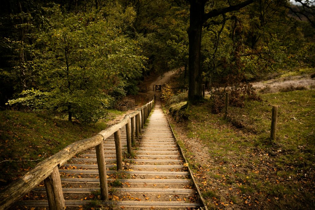
The Pennine Way is usually walked in 16 to 22 days, with daily stages shaped by fitness, accommodation, weather and how much time you want to spend exploring along the route.
This itinerary uses a challenging 16-day schedule from Edale to Kirk Yetholm, giving fit hikers a clear day-by-day plan while still showing where the hardest stages, best stops and possible adjustments fall.
For more on logistics, terrain and packing information, be sure to see the sister article ‘The Ultimate Pennine Way Guide: One of UK’s Most Iconic Long Distance Treks’
Trail Snapshot
Route: Edale to Kirk Yetholm
Distance: 268 miles / 431 km
Itinerary length: 16 days
Average daily distance: Around 16–17 miles
Longest day: Byrness to Kirk Yetholm, around 27 miles
Hardest days: Middleton-in-Teesdale to Dufton, Dufton to Alston, Byrness to Kirk Yetholm
Best for: Fit hikers wanting a demanding but efficient Pennine Way schedule
Better relaxed pace: 18–22 days
How Many Days Do You Need for the Pennine Way?
Most hikers take between 16 and 22 days to complete the Pennine Way.
A 16-day itinerary is generally the faster end of a normal walking schedule.
It suits fit hikers with some long-distance walking experience, but it leaves less room for bad weather, shorter days, rest stops or accommodation issues.
An 18 to 20-day itinerary is more comfortable for many walkers.
It allows you to split some of the longer stages, enjoy places like Malham, Hawes, Middleton-in-Teesdale and Hadrian’s Wall, and avoid turning the whole route into a mileage race.
A 21 to 22-day itinerary is best if you want a slower walking holiday feel, shorter days and more flexibility around weather.
“Avoid rookie mistakes. Our free ebook Hiking for Beginners shows you how.”
Pennine Way Stages at a Glance
| Day | Route | Distance | Elev. Gain | Elev. Loss | Est. Time |
| Day 1 | Edale to Crowden | 16.5 miles (26.5 km) | 2,280 ft (695 m) | 1,870 ft (570 m) | 7–9 hours |
| Day 2 | Crowden to Standedge | 11 miles (18 km) | 1,640 ft (500 m) | 1,640 ft (500 m) | 5–6 hours |
| Day 3 | Standedge to Hebden Bridge | 14 miles (22.5 km) | 1,870 ft (570 m) | 2,100 ft (640 m) | 6–7 hours |
| Day 4 | Hebden Bridge to Cowling | 15 miles (24 km) | 2,460 ft (750 m) | 2,300 ft (700 m) | 6–8 hours |
| Day 5 | Cowling to Malham | 14 miles (22.5 km) | 1,970 ft (600 m) | 1,800 ft (550 m) | 6–7 hours |
| Day 6 | Malham to Horton-in-Ribblesdale | 14.5 miles (23 km) | 2,790 ft (850 m) | 2,460 ft (750 m) | 6–8 hours |
| Day 7 | Horton-in-Ribblesdale to Hawes | 14 miles (22.5 km) | 2,625 ft (800 m) | 2,625 ft (800 m) | 6–8 hours |
| Day 8 | Hawes to Keld | 12 miles (19 km) | 2,130 ft (650 m) | 2,000 ft (610 m) | 5–7 hours |
| Day 9 | Keld to Bowes | 14 miles (22.5 km) | 1,640 ft (500 m) | 1,970 ft (600 m) | 6–7 hours |
| Day 10 | Bowes to Middleton-in-Teesdale | 13 miles (21 km) | 1,310 ft (400 m) | 1,310 ft (400 m) | 5–6 hours |
| Day 11 | Middleton-in-Teesdale to Dufton | 21 miles (34 km) | 2,625 ft (800 m) | 2,790 ft (850 m) | 8–10 hours |
| Day 12 | Dufton to Alston | 20 miles (32 km) | 4,100 ft (1,250 m) | 4,265 ft (1,300 m) | 8–10 hours |
| Day 13 | Alston to Greenhead (Hadrian’s Wall) | 16 miles (26 km) | 1,970 ft (600 m) | 2,130 ft (650 m) | 6–8 hours |
| Day 14 | Greenhead to Bellingham | 22 miles (35 km) | 2,300 ft (700 m) | 2,460 ft (750 m) | 8–10 hours |
| Day 15 | Bellingham to Byrness | 15 miles (24 km) | 1,970 ft (600 m) | 2,000 ft (610 m) | 6–7 hours |
| Day 16 | Byrness to Kirk Yetholm | 27 miles (43 km) | 4,265 ft (1,300 m) | 4,430 ft (1,350 m) | 10–13 hours |
A 16-Day Itinerary for the Pennine Way
A sixteen-day trek on the Pennine Way is generally regarded as the minimum number of days you want to take if you are an experienced and fit hiker.
The Cicerone guidebook gives 20 stages of the trail, but many of the shorter stages are combined into single days in order to make the trip a bit shorter.
If you have the time, splitting some of these days up and following the 20 stages can make for a more relaxed walk along the Pennine Way, however a sixteen-day itinerary is achievable for many hikers.
Day 1: Edale to Crowden
Distance: 16.5 miles (26.5 km)
Elevation Gain: 2,280 ft (695 m)
Elevation Loss: 1,870 ft (570 m)
Average Time to Hike: 7–9 hours
The historic start of the Pennine Way takes place at Kinder Scout.
This gritstone plateau was the site of the 1932 Mass Trespass, a defining moment in the public access movement in England, and is now used to celebrate that success even further.
This start isn’t a gradual introduction to the difficult trek ahead, it throws you right into the deep end.
The ascent from the Old Nag’s Head is steep and unrelenting through a navigational journey through peat haggs and groughs that can be nearly impossible to find your way through in the heavy mist.
The descent from Bleakflow Head will put your legs to the test after a difficult climb, but you’ll find a hostel and campsite waiting for you at the end in Crowden.
Day 2: Crowden to Standedge
Distance: 11 miles (18 km)
Elevation Gain: 1,640 ft (500 m)
Elevation Loss: 1,640 ft (500 m)
Average Time to Hike: 5–6 hours
The second day on the trail helps your body adapt to the rhythm of consistent movement on the trail.
The shorter distance takes you across Saddleworth Moor and through some of the most atmospheric moorland in the southern Pennines.
Here, you hit Standedge, one of the higher points in the southern section, at 450 meters.
At the end of the day, you will cross the A62 and hit civilization right before the trail dips down in the landscape of West Yorkshire.
Day 3: Standedge to Hebden Bridge
Distance: 14 miles (22.5 km)
Elevation Gain: 1,870 ft (570 m)
Elevation Loss: 2,100 ft (640 m)
Average Time to Hike: 6–7 hours
In West Yorkshire, the trail passes through mill towns and reservoirs, providing a unique landscape that is unlike the rest of the trail.
The Stoodley Pike monument can be found here, above Hebden Bridge, an obelisk from 1856 that is used as a landmark for miles.
Hebden Bridge is likely the most vibrant town to be found directly on the Pennine Way.
It has independent bookshops, delicious cafes, and a strong community that is always willing to help out.
If you want a day to regroup, Hebden Bridge is a great option for a quick rest day early on.
Day 4: Hebden Bridge to Cowling
Distance: 15 miles (24 km)
Elevation Gain: 2,460 ft (750 m)
Elevation Loss: 2,300 ft (700 m)
Average Time to Hike: 6–8 hours
As you leave the cozy town of Hebden Bridge, the route climbs immediately onto the exposed moorland, the defining landscape of the South Pennines.
This landscape is stark, windswept, and atmospheric, which can give it an eerie feel alongside remarkable views.
With a short detour from the trail, you can visit the ruins of Top Withins, the farmhouse that served as the inspiration for Wuthering Heights, and it’s well worth the short trip.
The end of the day lands you in the small but lively village of Cowling.
Day 5: Cowling to Malham
Distance: 14 miles (22.5 km)
Elevation Gain: 1,970 ft (600 m)
Elevation Loss: 1,800 ft (550 m)
Average Time to Hike: 6–7 hours
The Yorkshire Dales transition you from dark milestone grit to bright, pale limestone that now defines the landscape around you.
Halfway through the day, the trail reaches Malham Cove. This 260-foot curved limestone cliff is a breathtaking moment on the trail that sticks with you for the rest of the walk.
If you take a short detour to Gordale Scar, you’ll find something even more remarkable waiting for you there.
Once you arrive in Malham, there are plenty of pubs and options for accommodation alongside a National Park visitor center to learn more about what you’re immersed in.
Day 6: Malham to Horton-in-Ribblesdale
Distance: 14.5 miles (23 km)
Elevation Gain: 2,790 ft (850 m)
Elevation Loss: 2,460 ft (750 m)
Average Time to Hike: 6–8 hours
Today is a day filled with significant Pennine Way landmarks. The route passes Pen-y-Ghent, one of the Yorkshire Three Peaks.
At 694 meters, Pen-y-Ghent has a stepped profile that creates one of the most recognizable silhouettes in English upland walking.
There’s a steep and rocky ascent, but the path is well-kept, and the views at the top are remarkable.
Horton-in-Ribblesdale is a classic Pennine Way stop where you can stay at the famous Crown Hotel and get everything you need to refresh for another day.
Day 7: Horton-in-Ribblesdale to Hawes
Distance: 14 miles (22.5 km)
Elevation Gain: 2,625 ft (800 m)
Elevation Loss: 2,625 ft (800 m)
Average Time to Hike: 6–8 hours
One week in and hiking the Pennine Way doesn’t stop bringing remarkable views and plenty of highlights.
Today, it’s the crossing of Great Shunner Fell (716 meters).
This is a long and gradual ascent across frequently boggy terrain that demands hard work, but rewards you with open sky views across the North Yorkshire moorland.
The descent leads into Wensleydale and the small market town of Hawes.
There’s a good handful of accommodation options and plentiful options for resupply, so save some time to arrive and get your shopping done.
Day 8: Hawes to Keld
Distance: 12 miles (19 km)
Elevation Gain: 2,130 ft (650 m)
Elevation Loss: 2,000 ft (610 m)
Average Time to Hike: 5–7 hours
While today’s walk is a bit shorter than others, the scenery doesn’t come up short. From Hawes, the trail crosses to Hardraw.
Hadraw Force is the highest single-drop waterfall above ground in England, a sight to see before beginning the long ascent of the northern shoulder of Great Shunner Fell.
The descent into upper Swaledale brings you to the hamlet of Thwaite and then on to Keld.
Here, the Pennine Way crosses Alfred Wainwright’s Coast to Coast Walk, bringing a load of long-distance hikers into one spot.
The legendary overnight option is Tan Hill Inn, Britain’s highest pub, for those who are willing to push a few miles further north.
Day 9: Keld to Bowes
Distance: 14 miles (22.5 km)
Elevation Gain: 1,640 ft (500 m)
Elevation Loss: 1,970 ft (600 m)
Average Time to Hike: 6–7 hours
The trail climbs back onto the moorland as soon as you leave Keld and passes by Tan Hill Inn, if you hadn’t already stayed there the night before.
From there, the route enters the North Pennines AONB and follows the high moorland before dropping into the isolated settlement of Sleightholme.
The main route goes further north to cross God’s Bridge, a natural limestone crossing of the River Greta.
The final stretch takes you into Bowes, a small village with an old Norman castle and welcoming pub.
Day 10: Bowes to Middleton-in-Teesdale
Distance: 13 miles (21 km)
Elevation Gain: 1,310 ft (400 m)
Elevation Loss: 1,310 ft (400 m)
Average Time to Hike: 5–6 hours
With very little elevation today, you get to take a slight rest for your legs while enjoying some of the trail’s best scenery.
You start by crossing open pastoral moorland over to field paths and tracks that take you to the River Tees.
Here, you find Middleton-in-Teesdale, a charming market town with a good range of accommodation and services. This is the gateway to the magical waterfall country ahead of you.
Day 11: Middleton-in-Teesdale to Dufton
Distance: 21 miles (34 km)
Elevation Gain: 2,625 ft (800 m)
Elevation Loss: 2,790 ft (850 m)
Average Time to Hike: 8–10 hours
Frequently referred to as the most beautiful day on the Pennine Way, the long stretch out of Middleton-in-Teesdale lives up to the name.
The route heads upstream alongside the River Tees through a succession of waterfalls. You see Low Force, High Force (England’s most powerful waterfall), and Cauldron Snout.
These final falls are a crashing, tumbling cascade about Cow Green Reservoir that is hard to beat. After the falls, you climb up a glacial valley to the summit of High Cup Nick.
The view down into the void from here is astonishing. Your day ends in Dufton, a red-sandstone estate village home to a youth hostel and pub that will be well-loved after 21 miles of hiking.
Day 12: Dufton to Alston
Distance: 20 miles (32 km)
Elevation Gain: 4,100 ft (1,250 m)
Elevation Loss: 4,265 ft (1,300 m)
Average Time to Hike: 8–10 hours
While the previous day was long, today is harder. With 1,250 meters of climbing, this stage is easily the hardest day on the Pennine Way, and one of the hardest on any of the English National Trails.
The route crosses the High Cross Fell massif, the highest point on the Pennine Way at 893 meters, as well as Great Dun Fell and Little Dun Fell, the adjacent peaks.
The descent along the Maiden Way is long, relentless, and seemingly never-ending. Fortunately, the day does end in Alston, England’s highest market town. Be ready for a long, but beautiful day.
Day 13: Alston to Greenhead (Hadrian’s Wall)
Distance: 16 miles (26 km)
Elevation Gain: 1,970 ft (600 m)
Elevation Loss: 2,130 ft (650 m)
Average Time to Hike: 6–8 hours
Today you make your way toward another historic landmark and long-distance trek, Hadrian’s Wall.
The route follows the South Tyne valley and crosses the North Pennine moorland to get there, and once you’re there, it’s one of the most iconic Pennine Way experiences.
The Wall section follows the crest of the Whin Sill escarpment while passing Roman forts, turrets, and milecastles.
The day ends and you can hop into The Twice Brewed in near Once Brewed for a legendary Pennine Way stop and night of rest.
For more on Hadrians Wall, see our detailed guide and itinerary: Hadrian’s Wall Path Guide: Route Breakdown, Sites & 7-Day Plan
Day 14: Greenhead to Bellingham
Distance: 22 miles (35 km)
Elevation Gain: 2,300 ft (700 m)
Elevation Loss: 2,460 ft (750 m)
Average Time to Hike: 8–10 hours
Another long day takes you along the rest of Hadrian’s Wall before entering Northumberland National Park.
Here, you follow the wall for eight more miles before leaving the stones at Rapishaw Gap and heading north through Wark Forest.
The trail changes here into an emptier, greener, but more solitary experience.
Bellingham is a lovely small market town with a good cluster of services before you get into the more remote sections.
Day 15: Bellingham to Byrness
Distance: 15 miles (24 km)
Elevation Gain: 1,970 ft (600 m)
Elevation Loss: 2,000 ft (610 m)
Average Time to Hike: 6–7 hours
Today is a big transitional day with a crossing of Padon Hill and the edge of Redesdale Forest to get to the remote valley of River Rede.
Byrness is a small settlement, but it’s also your final stop before taking on the final big day.
There’s a village pub and hostel that does just enough to prepare you for one more day of walking.
Many hikers will split the final stage across two days, staying at the refuge hut in Uswayford, but it’s totally doable in one go, but you need to get a good rest in Byrness before heading out.
Day 16: Byrness to Kirk Yetholm
Distance: 27 miles (43 km)
Elevation Gain: 4,265 ft (1,300 m)
Elevation Loss: 4,430 ft (1,350 m)
Average Time to Hike: 10–13 hours
Day 16 is by far the longest day on the trail, and one of the longest of any English National Trail, but it’s one that you’ve been preparing for this entire time.
The route crosses Cheviot Hills, following a border ridge between England and Scotland.
The optional summit of The Cheviot (815 meters) will add a mile and a half of walking, but is worth it in good conditions.
There are two remote refuges here for emergency shelter if needed.
The final descent into Kirk Yetholm is an emotional one for just about every hiker on the Pennine Way.
The Border Hotel marks the official finish and you can take home a certificate of completion along with your free half pint first promised by Alfred Wainwright.
“From Alps to coastlines, our free Walking Holiday guide helps you plan smarter.”
Shorter and Longer Pennine Way Itinerary Options
A 16-day Pennine Way itinerary is a strong schedule, but it is not the only sensible way to walk the route.
Your best pace depends on fitness, accommodation, weather and whether you want the trail to feel like a challenge or a walking holiday.
16 Days: Combine Shorter Stages
This pace suits fit hikers who are comfortable combining shorter sections and walking long back-to-back days.
The easier places to make time are usually the shorter middle stages, such as Crowden to Standedge, Hawes to Keld, Keld to Bowes, and Bowes to Middleton-in-Teesdale.
The trade-off is that the harder days feel much harder. A 16-day plan leaves less room for slow boggy ground, bad weather, tired legs, or accommodation gaps.
18 to 20 Days: Split the Hardest Days
This is the best balance for most walkers. Instead of changing the whole route, split the longest or hardest sections into more manageable days.
Good candidates include Middleton-in-Teesdale to Dufton, Dufton to Alston, Greenhead to Bellingham, and Byrness to Kirk Yetholm.
These are the days where extra time can make the biggest difference.
21 to 22 Days: Slow the Whole Trail Down
A 21 to 22-day itinerary works best if you want shorter days, more village time and less pressure to keep moving in poor weather.
Rather than only splitting the hardest stages, this approach spreads the effort across the whole walk.
It gives you more time in places like Malham, Hawes, Middleton-in-Teesdale, Alston and Hadrian’s Wall country.
Final Stage Option: Split Byrness to Kirk Yetholm
The final stage from Byrness to Kirk Yetholm is one of the biggest decisions on the Pennine Way.
At around 27 miles, it is long, exposed and tiring, especially after two weeks of walking.
Many hikers split this section instead of forcing it into one huge final day.
If the weather is poor, or if you want to enjoy the Cheviots rather than simply survive them, this is one of the most sensible adjustments you can make.
🗒️ Free Checklist: “Pack light, pack right — download The Ultimate Hiking Packing List.”
Best Places to Take a Rest Day
Rest days are not essential on the Pennine Way, but they can make the whole route more enjoyable, especially if you are walking for three weeks or dealing with bad weather.
Hebden Bridge
Hebden Bridge is one of the best early rest-day options. It has cafés, shops, accommodation, transport links and enough character to make a short pause feel worthwhile.
Malham
Malham is a good choice if you want to slow down around one of the most scenic parts of the trail. Malham Cove, Gordale Scar and the surrounding limestone scenery are all worth extra time.
Hawes
Hawes is a classic Pennine Way stop with accommodation, food, shops and easy resupply. It works well as a practical reset after the first week of walking.
Middleton-in-Teesdale
Middleton-in-Teesdale is a useful place to rest before the long and scenic stage toward Dufton. It gives you time to prepare for some of the most memorable walking on the route.
Alston
Alston comes after one of the hardest days on the Pennine Way. It is a sensible recovery stop before continuing toward Hadrian’s Wall and the final northern stages.
FAQs About the Pennine Way Itinerary
How many days do you need for the Pennine Way?
Most hikers take 16 to 22 days to complete the Pennine Way.
A 16-day itinerary is possible for fit walkers, while 18 to 20 days gives more flexibility and a less pressured pace.
Is 16 days enough for the Pennine Way?
Yes, 16 days is enough for experienced and fit hikers, but it is a demanding schedule. Several days are long, and the final stage from Byrness to Kirk Yetholm is especially tough.
What is the hardest day on the Pennine Way?
Many hikers consider Dufton to Alston one of the hardest days because it crosses Cross Fell, the highest point on the Pennine Way.
The final day from Byrness to Kirk Yetholm is also extremely demanding because of its length and exposure.
Should you split the final stage from Byrness to Kirk Yetholm?
Many hikers do split the final stage because it is around 27 miles and crosses exposed terrain in the Cheviots. Splitting it can make the finish more enjoyable and less pressured.
What is the best section of the Pennine Way itinerary?
The Yorkshire Dales, Teesdale, Hadrian’s Wall and the final Cheviot crossing are often among the most memorable sections.
The best section depends on whether you prefer limestone scenery, waterfalls, history, moorland or remote upland walking.
Conclusion: Planning Your Pennine Way Itinerary
A 16-day Pennine Way itinerary gives you a clear and efficient way to walk from Edale to Kirk Yetholm, but it should be treated as a demanding schedule rather than the default option for everyone.
The route rewards steady pacing, flexible planning and respect for the terrain.
Some days are scenic and straightforward, while others are long, exposed and physically draining.
Whether you follow this itinerary exactly or stretch the route over 18 to 22 days, the goal is the same: to move steadily along England’s most iconic long-distance trail and arrive at Kirk Yetholm with enough energy left to enjoy the finish.
Where to Next?
If this itinerary has helped you map out the Pennine Way day by day, these related guides will help you plan the wider trip, compare nearby trails and explore more long-distance walking options.
Plan the Pennine Way
Pennine Way Guide
Start here for the broader planning guide, including difficulty, accommodation, navigation, packing, transport and when to hike.
Ultimate Guide to Hiking in England
A wider country guide for planning more routes across England’s National Parks, hills and long-distance trails.
Best Walks in Yorkshire
Experience Northen Englands most iconic walks & hikes
More Long-Distance Walks
West Highland Way
A classic Scottish trail with easier logistics and a more structured long-distance walking experience.
Cotswold Way
A gentler English National Trail with rolling countryside, historic villages and softer terrain.
Dingle Way
A scenic Irish walking route with coastal landscapes, mountain views and village-to-village accommodation.