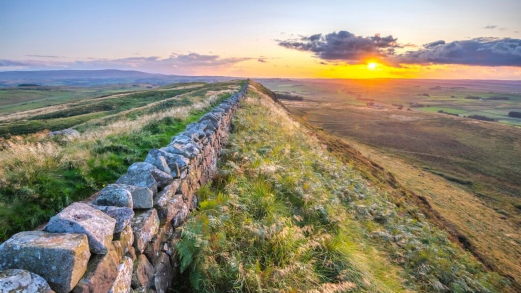
Walk the length of ancient Rome’s northern frontier on one of Britain’s most iconic trails. Hadrian’s Wall Path stretches 135 km coast-to-coast across northern England, tracing the remains of a 2,000-year-old Roman boundary.
This 7-day hiking guide covers everything you need to plan your walk—route breakdowns, must-see ruins, where to stay, and how to pace your days.
Whether you’re here for history, countryside, or a bit of both, Hadrian’s Wall delivers a journey through time, stone by stone.
- Introduction
- Quick Facts — Hadrian’s Wall Path
- Why Walk Hadrian’s Wall Path?
- How Long Does it Take?
- Which is the Best Direction to Hike Hadrian's Wall?
- My 7 Day itinerary
- Best Stops Along Hadrian’s Wall Path (Forts, Views, and Must-See Ruins)
- What I Would Have Done Differently
- Walking Hadrian's Wall as a Walking Holiday
- Planning and Logistics
- Packing List
- Transport
- Hadrian's Wall Path FAQ
- Would I walk Hadrians Wall again?
- Conclusion
- Where to Next in England?
Introduction
Just under two millennia ago, Hadrian—one of Rome’s so-called “five good emperors”—set out to reshape the Empire’s boundaries. Where his predecessor Trajan pushed for expansion, Hadrian chose consolidation.
On his tour of Roman Britain, he ordered the construction of a wall to mark the empire’s northern edge. Not just a barrier, but a symbol: this far, and no further.
Built by legionaries and engineers, Hadrian’s Wall stitched together forts, milecastles, and signal towers across nearly 73 miles (120km) of northern England. A deep ditch guarded its north side, and the vallum—a substantial earthwork—reinforced the south.
For nearly 300 years, it stood as Rome’s rugged frontier before falling into disrepair and eventually being cannibalised to build farms, churches, and homes still standing today.
Though the wall ran for 73 miles or 80 Roman Miles, the Hadrians Wall National Trail is a total length of 135 km / 84-mile
Stretching coast to coast between Wallsend and Bowness-on-Solway, the Wall may not match the scale of China’s—but it remains one of the largest, most iconic monuments left by the Roman Empire. Better still? It’s walkable.
Thankfully, the Romans had an eye for landscapes. Today, Hadrian’s Wall Path winds through one of Britain’s most beautiful regions.
The combination of rolling hills, quiet villages, working farms, and living history makes this one of the most rewarding long-distance hikes in the UK.
From bustling cities to peaceful estuaries, from museum treasures to misty ridge walks—you’ll cover ground that’s rich in story and easy on the eyes. It’s no wonder this trail draws walkers, history buffs, and weekend explorers from all over the world.
Quick Facts — Hadrian’s Wall Path
- Distance: 135 km / 84 miles (coast-to-coast)
- Typical time: 6–8 days (7 is the sweet spot)
- Start/Finish: Wallsend (Newcastle) → Bowness-on-Solway (Solway coast)
- Best bit: Housesteads–Steel Rigg–Cawfields (classic ridge walking + ruins)
- Difficulty: Moderate (more about distance + a few steep central climbs)
- Accommodation: Inns, B&Bs, bunkhouses, campsites (book early in peak season)
- Navigation: Well waymarked + lots of shared footpaths (stay alert at junctions)
Why Walk Hadrian’s Wall Path?
Hadrian’s Wall Path draws walkers, history lovers, and curious locals alike. It’s a trail where ancient ruins meet rolling landscapes, with forts and museums spaced just right to deepen the journey.
And best of all—it’s a manageable walk, even for beginners finding their stride on a longer-distance path.
This trail is close enough to other hubs to allow it to be tackled in segments, over several weekends or holidays for example. Another point of note is that the path is the only coast to coast trail that follows a UNESCO World Heritage Site.
What really separates this walk from a lot of other long-distance hikes, though, is how much the landscape changes around the history.
One day you’re following the River Tyne out of Newcastle, a few days later you’re climbing beside the Wall across exposed crags, and by the end you’re walking flat farmland towards the Solway Coast. It never really feels like you’re just ticking off kilometres.
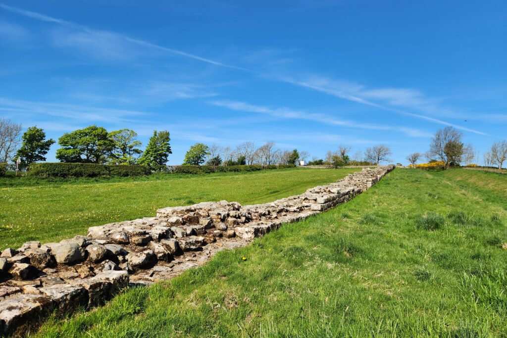
And then there’s the history itself. Forts, milecastles, turrets, the Wall, the ditch and the Vallum aren’t hidden away in a museum somewhere—you’re physically walking through what’s left of the Roman frontier.
Add in old villages, pubs, castles and later pieces of English history along the way, and there’s usually something to stop for before the next stretch of trail begins.
How Long Does it Take?
Most people walk Hadrian’s Wall Path in 6–8 days.
If you’re moving fast you can do it in 4–5 days, but you’ll miss a lot of the museums and the “stop-and-stare” moments.
If you want time for Vindolanda, the Roman Army Museum, and a slower pub pace, 8–10 days is ideal.
- Fast: 4–5 days
- Classic: 6–7 days
- Slower + sites: 8–10 days
“First time on the trail? Hiking for Beginners has your back.”
Which is the Best Direction to Hike Hadrian’s Wall?
There’s not necessarily a ‘traditional’ direction to do this walk, however the Romans built Hadrian’s Wall in segments that ended up joining together, they marked the structure from East to West with mile castles every Roman Mile (0.919 modern miles) so that’s the way I took.
While there are no rules here, feel free to walk it in whichever way suits, there are some things to consider:
Hadrian’s Wall Path: East to West
- Marked by the romans this way (though most aren’t visible)
- Finishes in a nicer areas of Bowness-on-Solway (instead of Newcastle Suburbs and industrial areas)
- Harder to find transport back to the main city of Carlisle at the end
Trail Tip: The Roman Army Museum film (narrated by Brian Cox) is unreal. If you walk East → West, the eagle-eye flyover helps bring the Wall to life because it retraces the ground you’ve already traced
Hadrian’s Wall Path: West to East
- Generally the wind is at your back in windy conditions
- Seemed to be the more popular route
- Ends up right next to a train station at Wallsend
My 7 Day itinerary
I followed a tried, tested and popular route that took 6 days to hike, with 1 off in the middle to explore Vindolanda and other nearby sites.
Unless you have accommodation right on the trail (which there definitely is) lodging availability can have you walking several more km’s every day to find a bed (which I definitely did!)
| 7 Day Hadrian’s Wall Path Hike | ||
| Section | Average Walking Time | Distance (km/miles) |
| Day One: Wallsend – Heddon on Wall | 6-7 hrs | 24km / 15mi |
| Day Two: Heddon on Wall – Chollerford | 6.5 – 7.5 hrs | 24 – 26 km / 15-16mi |
| Day Three: Chollerford – Once Brewed | 5 – 6 hrs | 19km / 12 mi |
| Day Four: Tour and Exploring Day | N/A | N/A |
| Day Five: Once Brewed to Walton | 6.5 – 7.5 hrs | 26km / 16.25mi |
| Day Six: Walton to Carlisle | 4.5 – 5.5 hrs | 18km / 11 mi |
| Day Seven: Carlisle to Bowness to Carlisle | 6 – 7 hrs | 24km/ 14.75 mi |
| Total | 34.5 – 40.5 | 135km / 83.8 mi |
Day One: Wallsend to Heddon-on-the-Wall
Section Snapshot
Distance: 24 km / 15 mi
Time on Feet: 6–7 hrs
Elevation: Mostly flat, gentle rise at the end
Terrain: Urban riverside → parks → farmland
Difficulty: Easy–Moderate (long but not technical)
Highlight: Crossing Newcastle’s bridges before the countryside opens up
Watch For: Milecastle 0 (short detour from Segedunum)
Hadrian’s Way begins at Segedunum, with a small stairway at the end of a no-through road leading to your first signpost. The route follows the River Tyne most of the day, alternating between broad city-edge paths and wooden boardwalks hugging the water.
You’ll cut straight through Newcastle—offering photo ops of bridges, the waterway, and the city skyline. Around the one-third mark, you’re in the heart of town. Stop for the cathedral, castle, or even a quick coffee—your call.
From there, the trail continues through parks and suburban lanes. It’s not until the final third that the urban sprawl fades, giving way to open fields and classic English countryside.
The day ends with a steady uphill stretch—rolling green fields worth of the local golf course as you crest the rise and arrive in Heddon-on-the-Wall, legs pleasantly spent.
Tip: Don’t miss mile castle 0. Technically not on the national trail, but about a 5 minute walk from Segedunum, with a tiled marker in the footpath showing where the outerwall once stood.
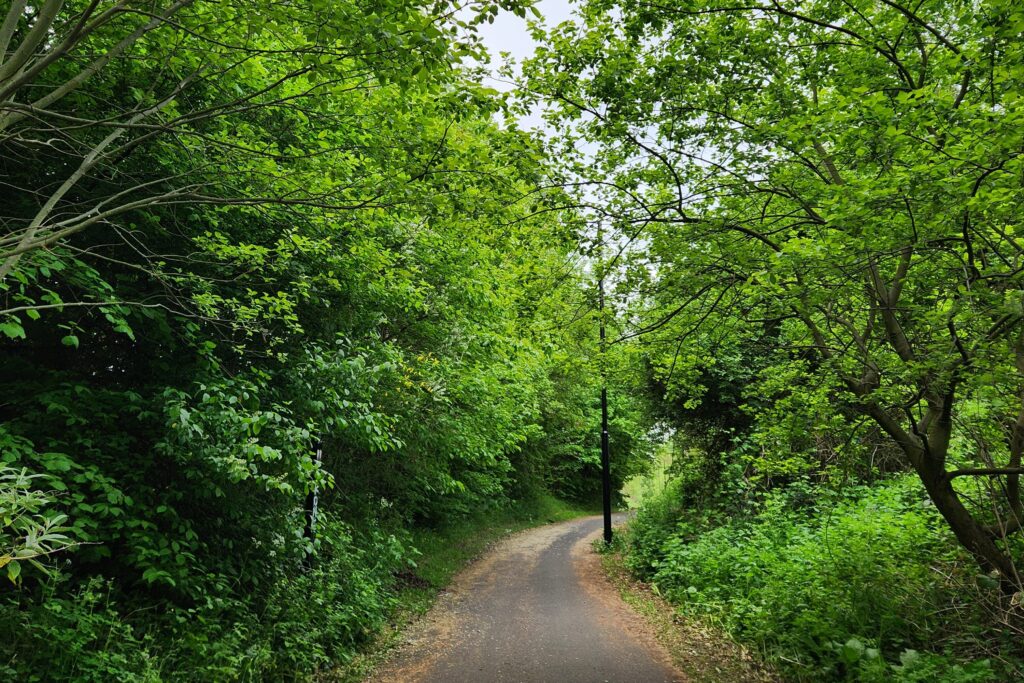
Day Two: Heddon on Wall – Chollerford
Section Snapshot
Distance: 24–26 km / 15–16 mi
Time on Feet: 6.5–7.5 hrs
Elevation: Rolling hills, gradual climbs
Terrain: Farmland, lanes, Military Road sections
Difficulty: Moderate (distance more than steepness)
Highlight: Broad Wall section + Brunton Turret
Watch For: A69 crossing and long open stretches with little shelter
This is where Hadrian’s Wall Path starts to feel more like the countryside walk you were hoping for. The trail loosely follows the B6318 Military Road, a later addition built over or beside the Roman frontier.
It’s not overly busy, but you’ll be glad to leave the louder stretches—like the A69 crossing—behind early in the day.
At approximately 26kms day two of this long distance trek is also one of the longer walking days. It’s not especially steep, but the distance adds up.
You’ll pass through fields, custom-built trail paths, and that familiar Roman ditch—still visible after nearly 2,000 years.
The landscape has fully opened up now. You’re deep in farm country, walking between stone walls, through wooden gates and stile ladders—just remember to close everything behind you.
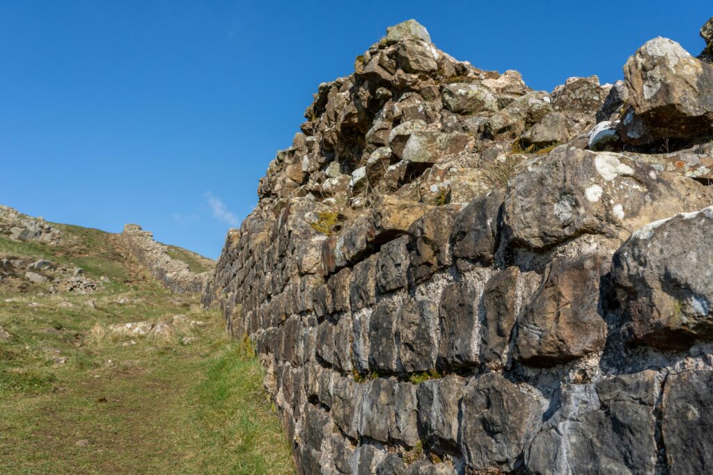
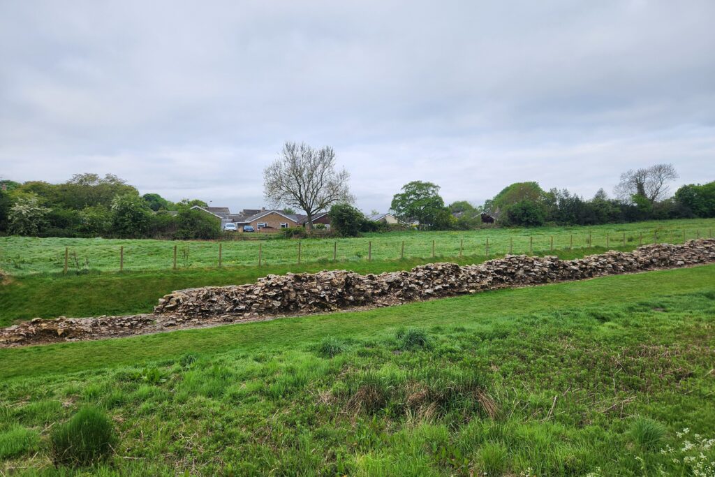
Don’t Miss: Keep an eye out in Heddon-on-the-Wall. Just behind a hedge, running quietly alongside the road, is one of the best-preserved sections of the original ‘broad wall’—built to 10 Roman feet wide (just under 3 metres) before plans were scaled back. It’s a subtle but powerful reminder of the ambition behind this structure.
There’s something calming about it all. The quiet rhythm of boots on earth, the sheep in the distance, and that timeless green rolling out to the horizon.
Good rest stops include the Robin Hood Inn and Errington Coffee House, both great for a warm bite and a breather.
Toward the end of the day, make time for two key sites: the Planetrees wall section and Brunton Turret. These remains were nearly lost to farmland until someone had the foresight to preserve them. They bring the Roman story back into focus just when your feet start to forget why you came.
You’ll finish the day crossing a lovely old stone bridge into Chollerford, a peaceful village and a well-earned place to stop. If I had the money I would have stayed at Chesters Stables, but the George Hotel is a perfectly good pot to stay
Tip/Note: There are some great sections of the original ditch in front of the wall for long stretches of the hike. that help to give a sense of how foreboding the wall would have looked from the Northern side.
Day Three: Chollerford – Once Brewed
Section Snapshot
Distance: 19 km / 12 mi
Time on Feet: 5–6 hrs (longer with site visits)
Elevation: Steeper central ridge section
Terrain: Crags, stone staircases, open moorland
Difficulty: Moderate–Challenging (short sharp climbs)
Highlight: Housesteads, Steel Rigg, Sycamore Gap ridge
Watch For: Wind exposure + slippery stone steps in wet weather
Tip: Look back often—the views of the Wall snaking their way across the landscape are some of the best on the whole trail.
Leaving Chollerford, the bridge and river look especially striking in the early mist—worth an early start if you’re up for it. Just note: Chesters Roman Fort doesn’t open until 10am, so time your visit if you’re keen to explore.
The path traces the Military Road on and off, weaving through farmland and open paddocks. About an hour in, you’ll reach one of the most striking preserved sections of the Wall—pause here to soak up the countryside and imagine what this frontier once looked like.
Eventually, you’ll cross the road to Carrawburgh Fort, with the Temple of Mithras tucked away on the far side. There’s usually a coffee van in the car park—worth the stop for a hot drink and a peek into the rituals of an ancient Roman cult.
This central stretch is rich with milecastles and turrets, still visible along the trail. Originally, the Romans built one milecastle and two turrets for every Roman mile—mini fortlets and watchtowers used for guarding and resting troops.
You’ll see plenty of them through here, especially around Grindon, where the trees offer a little shelter from wind and weather.
Note: There are alternate public footpaths running lower along the base of these hills. They’re not technically part of the Wall path, but they offer a gentler option if you’re having trouble with the stone stairs or are just after a more leisurely pace.
As you head west, the terrain shifts—rolling hills, farm tracks, and the Wall itself climbing steep ridgelines. This stretch uses the natural cliffs to dramatic effect. Some parts are near sheer drops, and you get a real sense of the Wall’s former might.
Eventually, you’ll reach Housesteads Fort, one of the major stops along the Wall. It’s easy to spend a couple of hours here, especially if you catch one of the excellent free tours.
Beyond Housesteads, the landscape stays hilly with rough stone staircases on steeper slopes. Take extra care here—wind, rain, and slick stones are a tricky combo. Hiking poles can help on descents.
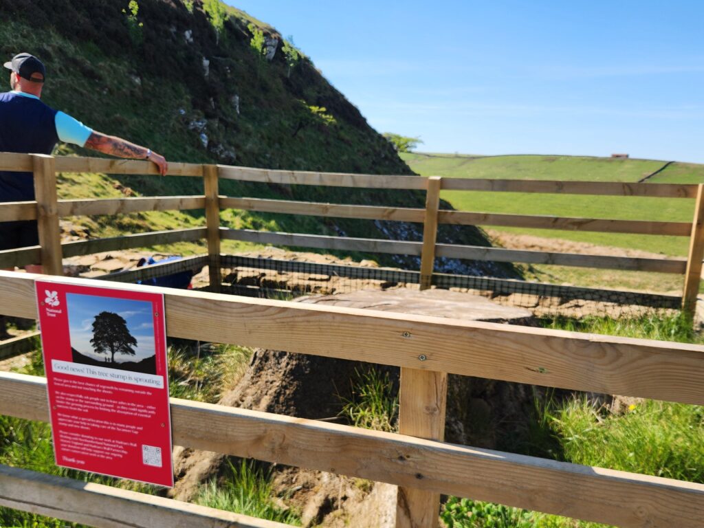
The final stretch—about 4.5 km—features one of the most photographed scenes: the remains of the Sycamore Gap Tree and the rugged outlook from Steel Rigg. Some of the best views of the entire trail live here.
Heads up: Depending on your accommodation, you may need to walk a few extra kilometres to find your bed for the night. I stayed in Bardon Mill, which added about 5 km to the day. If you’d rather not tack on another hour, taxis or local buses are worth looking into ahead of time.
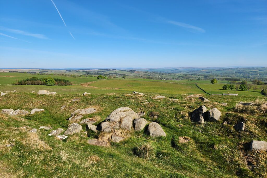
Day Four: Tour and Exploring Day
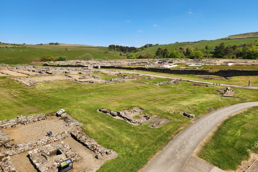
No hiking today, a sleep in followed by a leisurely stroll up to Vindolanda. Having breakfast and lunch at the cafe there with a free walking tour and wandering around the museum in between.
I highly recommend the 45 minutes free tour. Pat the volunteer was full of information about the fort and the local history.
Early dinner (and Pints :)) at The Bowes Hotel at Bardon Mill. Best day of walking yet!
Seeing the museum and doing the tour at Vindalonda really loaded me up with information about the Romans role in the area. Made me appreciate the rest of the sites on the wall for the rest of the trip
More Long-Distance Hikes in the UK
If Hadrian’s Wall has you thinking about your next multi-day walk, there are plenty more long-distance trails to tackle across the UK.
- West Highland Way – 154 km through some of Scotland’s most dramatic Highland scenery, from Milngavie to Fort William.
- Pennine Way – one of Britain’s classic long-distance trails, crossing the Pennines from Derbyshire to the Scottish border.
- Cotswold Way – a gentler multi-day walk through rolling countryside, historic villages and the Cotswold escarpment.
Day Five: Once Brewed to Walton
Section Snapshot
Distance: 26 km / 16.25 mi
Time on Feet: 6.5–7.5 hrs
Elevation: High point at Winshields Crags → long descent
Terrain: Ridge walking → gradual farmland transition
Difficulty: Moderate (long day, mixed terrain)
Highlight: Winshields Crags (highest point on the trail)
Watch For: “Ruin fatigue” — stay sharp for final hidden sites
Day five of the trip, and the fourth on trail. I’d stayed a few kilometres off-route the night before, which meant a morning hike back to Peel Gap.
Frustrating at first—but worth it. Coming at the Wall from north to south gave me one of the most commanding views yet, a reminder of just how imposing the wall was at its height (pardon the pun)
Once you’re back on track, make sure to look east. Seriously. It’s one of those views that a camera can’t do justice to—and it’s easy to see how George R.R. Martin found inspiration for his own Wall.
Not far along is Winshields Crags, the halfway and highest point of the entire trail. I’d recommend pausing here for a bit, really soaking up these highpoint views, before heading back down to sea level.
From here, the landscape slowly begins to level out—dropping around 300 metres in elevation across the day. The path still has its climbs and dips, but it’s a gentler rhythm overall.
If you’ve been taking in every stone, turret, and milecastle since Day One—fair warning: you might feel a little ‘ruin fatigue’ setting in. But stay tuned in. This is your last day with Hadrian’s Wall above ground, and some of these final sites are easy to miss.
Soon after, you’ll cross into Walltown Quarry, a lovely green space with paths, signage, and even a small maze if you fancy a detour. This is also home to the Roman Army Museum—a must-stop. Even if you only pop in for the short film, it’s well worth it.
Tip: Watch for Great Chesters Fort—it blends in with the farmland and could be mistaken for nothing more than a sheep field if you’re not paying attention, or haven’t studied your map.
The eagle-eye flyover of the Wall, overlaid with historical reconstructions, brings the last few days to life in a way nothing else does – just a bonus its narrated by Brian Cox!
About 15 minutes out after leaving the Roman Army Museum, through another field, has you passing by Thriwall castle, well worth a quick look for some non Roman history of the area, even if some of it was probably built by scavenging the wall!
The route leads through farmland and paddocks into Gilsland, where you’ll see Poltross Burn (Milecastle 48). Heads up here—I got distracted by a diversion and ended up halfway up the wrong hill before realising I’d missed the sign.
Between Gilsland and Birdoswald Fort, you’ll spot a few final turrets and wall remnants. If you’re museumed-out, don’t worry—Birdoswald’s ruins are visible from the main path. But if you do go in, it’s a solid final look at Roman life on the frontier.
Beyond Birdoswald, the ditch and vallum are still obvious. You’ll pass a farm campsite with an honesty shack—perfect for a snack stop—before joining the road for the final stretch.
Keep an eye out for the last standing turret, and don’t miss Hare Hill, a unique stretch where the wall still stands tall. Just before Walton, one final gem: the signal tower site at Pike Hill, pre-dating the Wall itself.
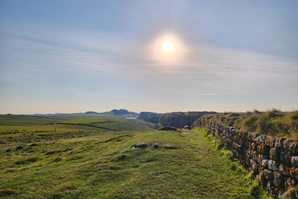
Day Six: Walton to Carlisle
Section Snapshot
Distance: 18 km / 11 mi
Time on Feet: 4.5–5.5 hrs
Elevation: Mostly flat
Terrain: Farmland, riverside paths, light tarmac
Difficulty: Easy
Highlight: River Eden approach into Carlisle
Watch For: Fewer visible wall remains — it’s more about landscape now
I’ve included most of the historical sites earlier in this guide, and for good reason—they’re easy to miss, even when they’re right beside you, tucked into the landscape.
From Walton to Carlisle, you’re leaving the physical remnants of the Wall behind.
There are no more above-ground sections from here, though you’ll occasionally spot raised turf or traces of the ancient ditch that once marked the Roman frontier.
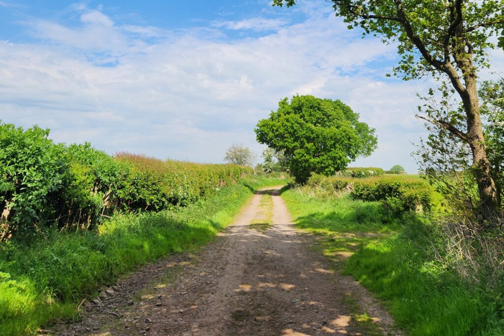
This second-to-last day of the trail returns you quickly to familiar territory—rolling farmland, deep green pastures, and the quiet company of sheep. You’ll notice a gradual shift, though: the terrain gives way to more tarmac, footpaths, and unsealed roads.
The path winds along the edges of farmland and through small villages, with lovely moments following the River Eden. It’s a gentler stretch, and Rickerby Park offers one final burst of green before the route leads you into the city.
There are a few options to peel off and head into Carlisle earlier, but I ended the day under the Eden Bridge, a fitting pause before rolling into town and finding my accommodation.
Tip/Note: You may want to catch a public bus, or arrange other transport if you don’t want to add any more km’s to your day.
Day Seven: Carlisle to Bowness-on-Solway
Section Snapshot
Distance: 24 km / 14.75 mi
Time on Feet: 6–7 hrs
Elevation: Flat estuary walking
Terrain: River paths → coastal road → farmland
Difficulty: Easy (but long, exposed stretches)
Highlight: Solway estuary finish at Bowness
Watch For: Limited transport at the finish — plan ahead
The last day of the Hadrian’s Wall Path! I set off from under Eden Bridge, following the River Eden out of Carlisle through lush, local parkland.
The path winds gently, crossing a mix of public and private land hemmed in by hedgerows, slowly leading you west toward Burgh by Sands.
The village has a medieval church partly built from stones taken from Hadrian’s Wall. It also marks the temporary resting place of King Edward I—yes, the same king portrayed in Braveheart. Well worth a wander around before heading on.
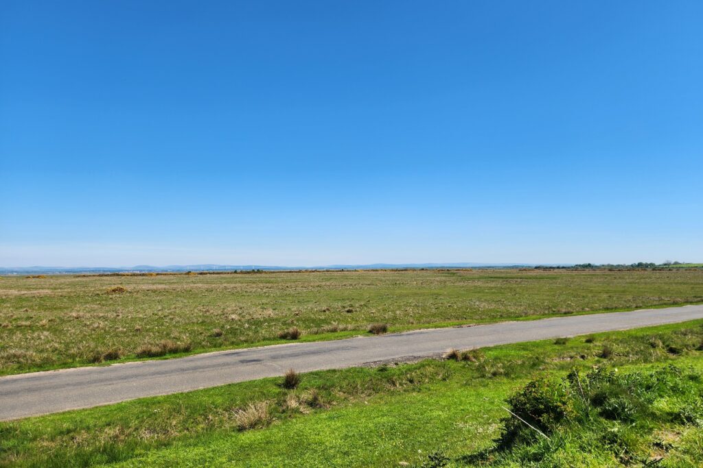
Leaving Burgh, you’re back where the Wall once stood—walking alongside the Solway Coast and a long, straight stretch of road.
After Drumburgh, the route veers slightly inland through more farmland and the small village of Glasson, bringing you close to the water again.
Once you round the bend at Port Carlisle, it’s just a couple of kilometres to go. And then, there it is—Bowness-on-Solway, tucked up at the edge of the sea.
Don’t miss the official start/end point sign, hidden just behind the seaside homes. It’s a quiet but meaningful finish to a long journey. Congratulations!
Tip: If you’re not staying the night in Bowness, plan your return to Carlisle in advance. Transport can be limited—especially on weekends—so it’s worth checking ahead.
Best Stops Along Hadrian’s Wall Path (Forts, Views, and Must-See Ruins)
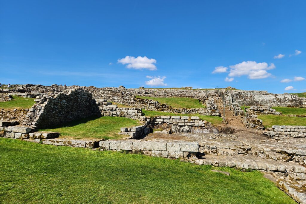
From a wealth of Roman history, to amazing view points and a very famous tree, there are plenty of places to stop and enjoy the views when hiking Hadrian’s Wall. Most, if not all of the below will be highlighted on any official Hadrian’s Wall Map.
Milecastle and Turrets
- Black Carts Turret (29A)
- Caw Gap Turret (41A)
- Cawfields Milecastle (42)
- Grindon Milecastle (34)
- Grindon Turret (34A)
- Sewingshields Milecastle (35)
- Sewingshields Turret (35A)
- Sycamore Gap (Milecastle 39)
- Walltown Crags Turret (45A)
- Willowford Turrets (48A & 48B)
- Harrows Scar Milecastle (49)
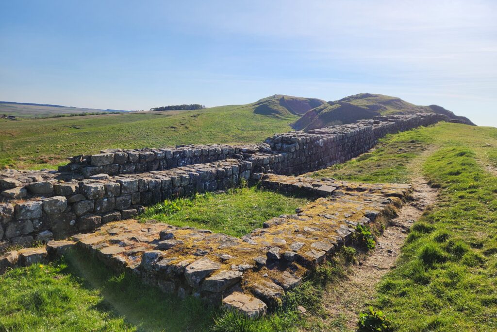
Roman Forts and Museums
- Wallsend (Segedunum)
- Great Chesters Roman Fort
- Vindalonda
- Housesteads Roman Fort
- Birdoswald Roman Fort
The Vallum and Roman Ditch
The Wall itself gets most of the attention, but keep an eye on the earthworks running alongside it as well.
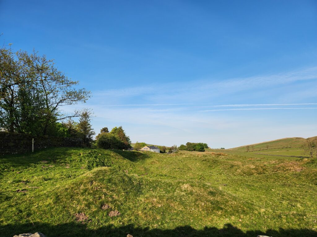
On the northern side, the Romans dug a defensive ditch in front of much of the Wall. South of it was another major piece of the frontier system known as the Vallum—a broad, flat-bottomed ditch with banks running along either side.
It was added after work on the Wall had already begun and probably helped define and control the military zone immediately behind the frontier. In places, access across it was deliberately channelled through causeways and crossings.
Nearly 2,000 years of farming and erosion have softened it considerably, so don’t expect another stone wall. Once you know what you’re looking for, though, sections of the Vallum become surprisingly obvious—particularly through the more open countryside.
For me, features like this helped make sense of the sheer scale of Hadrian’s Wall. It wasn’t simply one stone barrier running across England; it was an entire frontier system of walls, ditches, roads, forts, milecastles and watchtowers.
More than Roman History
Like the rest of the Country, this part of England is has many other historical sites from other parts of history.
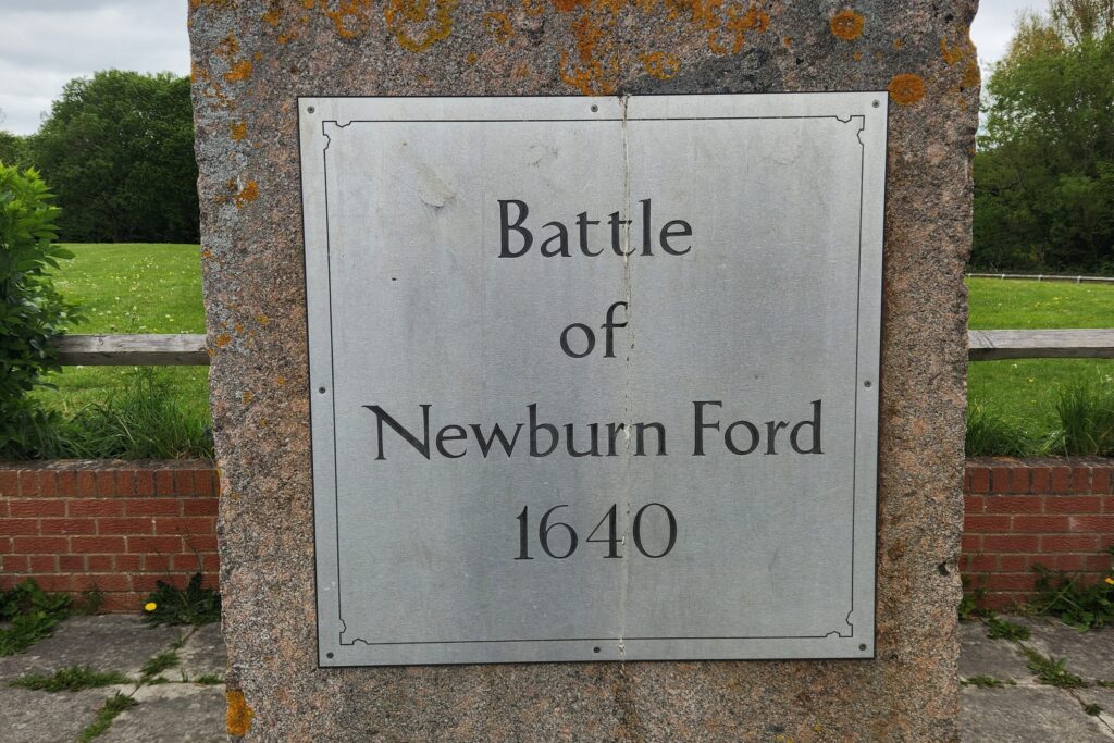
- The Site of the Battle of Newburn Ford
- St Michael’s Church in Burgh-by-Sands (A church partly built of visible Hadrians Wall stones, and where King Edward I laid in state after his death
- Old castles and homesteads dot the country side from various points in Englands rich past
Scenic Highlights Along the Wall
- Limestone Corner
- Sycamore Gap
- Housesteads Crags
- Cawfields Quarry
- Walltown Crags
- Winshield Crags (near Steel Rigg)
- Willowford Roman Bridge
What I Would Have Done Differently
A few things. I’d have taken an extra day on the Newcastle side, explored Segedunum properly (it opens at 10am), and used a baggage transfer service—lugging everything wasn’t necessary.
I also missed the Hadrian’s Wall Passport, I honestly couldnt tell you how i missed this, but I did – which would’ve been a fun souvenir stamped at each site.
Starting later in Wallsend and staying in Newcastle would have eased me into the longer stages and given me time to see more than the main strip of the city upon the Tyne.
Walking Hadrian’s Wall as a Walking Holiday
You don’t have to organise every part of Hadrian’s Wall Path yourself.
The trail is well suited to a self-guided walking holiday, where accommodation, baggage transfers and some of the transport logistics are arranged for you while you still walk the route independently.
Having carried my own bag and occasionally added several extra kilometres just to reach accommodation, I can definitely see the appeal.
Booking everything yourself gives you more control over your pace, rest days and where you stay. An organised walking holiday costs more, but removes a lot of the planning—particularly useful if you’re coming from overseas or simply want to concentrate on the walk rather than tomorrow’s bags, beds and transport.
I’ll be adding recommended Hadrian’s Wall walking holiday options here as I review suitable operators and routes.
“Plan less, walk more.” Pick a route, set your pace, and let Europe unfold under your boots: grab your free Walking Holiday ebook today”
Planning and Logistics
Before you book anything, think about three things:
- Your pace (and whether you want a rest day)
- How far your accommodation sits off-trail (this adds sneaky kilometres)
- Museum timing (some don’t open early, and you can lose half a day easily)
You’re never far from a pub, inn, or guesthouse in the UK, but its a good idea to book early—especially in peak season, as this is a very well know and trodden English trek.
Prices can be surprising in remote areas, and availability can be very tight, especially near the more popular areas.
Also, if your accommodation’s far off the trail, plan transport—I had to tack on several extra kms’ on more than one occasion.
Time your museum visits too—Vindolanda alone took me four hours with lunch and wandering. You might also want to explore beyond the Wall—places like the North Pennines, Northumberland National Park, or nearby manor houses are just a short detour away.
Weather
I was walking in early spring, hoping for crisp air and a bit of drizzle. Instead, I got blue skies and 23–25°C days—unusually warm for northern England. So, check the forecast and pack accordingly.
Accommodation
There’s a range—from campsites and bunkhouses to cosy pubs and boutique hotels. If you’re on a budget, camping is the cheapest option, but pub stays in quieter villages can get pricey (and book up fast). Always check ahead, especially during school holidays, and be ready to walk further or arrange lifts.
If you have the funds to upgrade your accommodation there are some absolutely lovely places to stay. There’s a whole range of high end accommodations in this part of the world: converted stables and old manorhouses
Food & Drink
One of the highlights. Pub meals are hearty and excellent, from hearty pies with homemade pastry to classic fish and chips. Plenty of stops offer packed lunches, and many villages have shops for snacks. I also passed several honesty boxes near campsites—stocked with everything from flapjacks, instant noodles and drinks
If you’re camping and cooking, stock up in bigger towns early and consider having gear shipped ahead—less to carry, more to enjoy.
Bag Shipping
I wish I’d used this. For £7–£10 per leg, you can send your bag ahead—even to campsites. It’s great value and spares you the burden of carrying everything.
Maps
Paper maps are available at the start or online, but I used GAIA GPS with offline maps—worked like a charm. I also recommend picking up one of the tourist-style brochures along the trail (mine came from a pub)—they’re full of local history and landmarks.

Packing List
Although my pack carried a lot of other things I needed for the rest of my holiday, you don’t need anything particularly specialised to walk Hadrian’s Wall Path—especially if you’re staying in pubs, inns or B&Bs rather than camping.
For most walkers, the basics are:
- Comfortable hiking shoes or lightweight boots
- Hiking socks and enough spares
- Waterproof jacket
- Lightweight layers for changing weather
- Hiking trousers or shorts
- Small daypack
- Water bottle or hydration bladder
- Snacks or packed lunch
- Phone with offline navigation
- Power bank
- Small first-aid and blister kit
- Sunscreen and hat
- Trekking poles if you prefer them on steeper or slippery sections
The biggest thing is packing for distance and changing weather, rather than technical terrain. Hadrian’s Wall isn’t a mountain trek, but walking 20–25 km day after day makes comfortable footwear, decent waterproofs and a pack that fits properly much more important.
🗒️ Free Checklist: Planning your next hiking trip?? Download our printable hiking checklist to make sure you don’t miss the essentials.
Transport
If you’re not walking the whole Wall in one go, the AD122 bus between Hexham and Haltwhistle is a game-changer—perfect for shorter sections or alternate overnights.
Trains also run nearby for easy returns to larger cities. Just note: transport to/from Bowness-on-Solway can be tricky, especially on weekends, so plan ahead.
Hadrian’s Wall Path FAQ
Is Hadrian’s Wall Easy to Follow?
Yes—Hadrian’s Wall Path is well-posted and generally easy to follow, especially in the central section where the trail hugs the visible remains. I wandered off once or twice, but that was more from being on autopilot than poor signage.
Just keep an eye on the wooden markers—other public footpaths share the same posts, so stay alert and double-check at junctions.
Best Time of Year to Walk Hadrian’s Wall Path
Late spring (May–June) and early autumn (September) are ideal for walking Hadrian’s Wall. You’ll get mild temperatures, longer daylight hours, and fewer crowds compared to peak summer.
July and August bring warmer days but also busy trails and booked-out accommodations. Expect more midges in summer too.
Winter hikes are possible but come with limited daylight, boggy paths, and closed attractions. Always check museum opening hours and public transport schedules—some routes run seasonally.
If you’re after wildflowers, crisp mornings, or golden evening light, late May or early September is hard to beat. Bring layers, whatever the month.
Is Walking Hadrian’s Wall Hard?
Not exactly—but it does require some stamina. The trail isn’t mountainous, but it’s long, with a few steep stair climbs and some very full days, especially in the middle. For most reasonably fit walkers, it’s more about pacing than endurance.
Take breaks, don’t rush, and let the history and landscape unfold at your feet. The real challenge? Giving yourself enough time to soak it all in.
How to Shorten the Hike
The obvious way is skipping a rest day, but I’d recommend keeping it if you want time to explore Vindolanda or just let your legs recover. If you’re aiming to speedrun it, you could do the walk in four days with careful planning and evenly spread distances—but expect long hauls and early starts.
How to Lengthen the Hike
If you want to wander every ruin and linger in every pub garden, ten days is ideal—enough time to walk, rest, eat, and explore without rushing. You could stretch it to two weeks if you’re really in no hurry. Starting at Tynemouth also adds a symbolic coast-to-coast dimension.
Can You Wild Camp on Hadrian’s Wall?
Technically, no. The trail crosses a lot of private farmland and common land, and wild camping isn’t permitted. You could head further off-trail—but be prepared to explain yourself to a very unimpressed farmer.
Would I walk Hadrians Wall again?
If I was to go back to this part of the world, I would definitely do the hike again, with a bit of a caveat…
I would stick to the middle sections. This is where most of the walls, spectacular views and ridge walking is (along with a good part of the museums)
When you think of or see images of the wall – this is where they are. If your short on time you can even tackle parts of these famous sections in half a day or so
Though I quite enjoy any hiking in England, surrounded by that lush greenery synonymous with the island, the days either side of the main wall consists of a lot of country lanes, farmland and tarmac roads – again not bad, but those are 3 days I could be visiting other areas that grab my interest.
One last bit of advice though, if it’s your first time doing it, just do the whole thing. The sense of completion carries a pleasant weight of its own
Conclusion
Hadrian’s Wall isn’t just a walk—it’s a thread through time. You’ll pass crumbling forts and quiet fields, wind-swept crags and stone-patched villages, all stitched together by the rhythm of your steps.
Whether you’re here for the Roman history, the English countryside, or the chance to unplug and move through it all at your own pace—this trail delivers.
Take your time, bring good boots, and keep looking back every so often. The Wall may be behind you, but the journey stays with you long after Bowness. You’ll end with tired legs, a full camera, and that rarest of things—a sense of having really gone somewhere.
Where to Next in England?
Hadrian’s Wall only scratches the surface of walking in England. From northern national parks to southern coastal paths, there’s plenty more countryside to explore.
- Yorkshire – explore the Yorkshire Dales, North York Moors and some of northern England’s best countryside walks.
- Lake District – head west for mountain hikes, lakeside walks and some of England’s most famous fell country.
- The Cotswolds – a change of pace with rolling hills, stone villages and easier countryside walking.
- Cornwall – coastal paths, rugged headlands and some of the best seaside hiking in southern England.