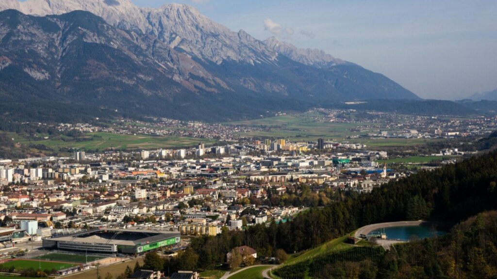
Innsbruck puts some of Austria’s best mountain hiking within easy reach of the city.
From gentle panoramic trails and short hut walks to high Alpine ridges and overnight adventures, these seven hikes cover some of the best ways to explore Innsbruck and the surrounding Tyrolean mountains on foot.
- Why Hike in Innsbruck?
- Best Hikes in Innsbruck at a Glance
- 1. Zirbenweg Trail
- 2. Goetheweg Trail
- 3. Rauschbrunnen Hike
- 4. Seegrube to Höttinger Alm
- 5. Innsbruck City Loop
- 6. Glungezer Hut Trek
- 7. Kellerjoch Summit via Loassattel
- When Is the Best Time to Hike in Innsbruck?
- What to Pack for Hiking in Innsbruck
- One City, Seven Trails, Endless Alpine Magic
- Where to Next?
Why Hike in Innsbruck?
If you’ve landed in Innsbruck with your boots laced and your daypack ready, you’re in for an absolute treat.
This Alpine gem isn’t just surrounded by mountains. It’s woven into them.
From quick urban loops to full-day mountain missions and everything in between, Innsbruck’s trail menu is as rich and varied as a Tyrolean lunch plate (and just as satisfying).
So whether you’re here for a half-day hike, a full-body alpine workout, or just need to stretch your legs between schnitzels, these trails are ready when you are.
Let’s get into it!
“Every hiker starts somewhere — grab your free Hiking for Beginners guide.”
Best Hikes in Innsbruck at a Glance
- Best easy panoramic hike: Zirbenweg
- Best high-Alpine hike: Goetheweg
- Best short hut hike: Rauschbrunnen
- Best lift-assisted walk: Seegrube to Höttinger Alm
- Best easy city walk: Innsbruck City Loop
- Best overnight hike: Glungezer Hut
- Best summit hike: Kellerjoch
Comparison table
| Hike | Difficulty | Distance | Time | Elevation Gain | Best For |
|---|---|---|---|---|---|
| Zirbenweg Trail | Easy | 7 km / 4.3 mi | 2.5 hrs | 200 m / 656 ft | Easy panoramic hiking |
| Goetheweg to Pfeishütte | Difficult | 5.2 km / 3.2 mi one way | Approx. 5 hrs return | 769 m / 2,523 ft | High-Alpine scenery |
| Rauschbrunnen Hike | Easy | 8.8 km / 5.5 mi | 3.5 hrs | 470 m / 1,542 ft | Mountain hut walk |
| Seegrube to Höttinger Alm | Moderate | — | Approx. 1 hr | — | Short lift-assisted walk |
| Innsbruck City & River Loop | Easy | Approx. 6 km / 3.7 mi | 1.5–2.5 hrs | Approx. 180 m / 590 ft | Easy urban walking |
| Glungezer Hut Hike | Moderate | 7.3 km / 4.5 mi one way | Approx. 3 hrs | 982 m / 3,222 ft | Overnight hut hiking |
| Kellerjoch via Loassattel | Moderate | 7.7 km / 4.8 mi | 4.5 hrs | 585 m / 1,919 ft | Summit hiking |
1. Zirbenweg Trail
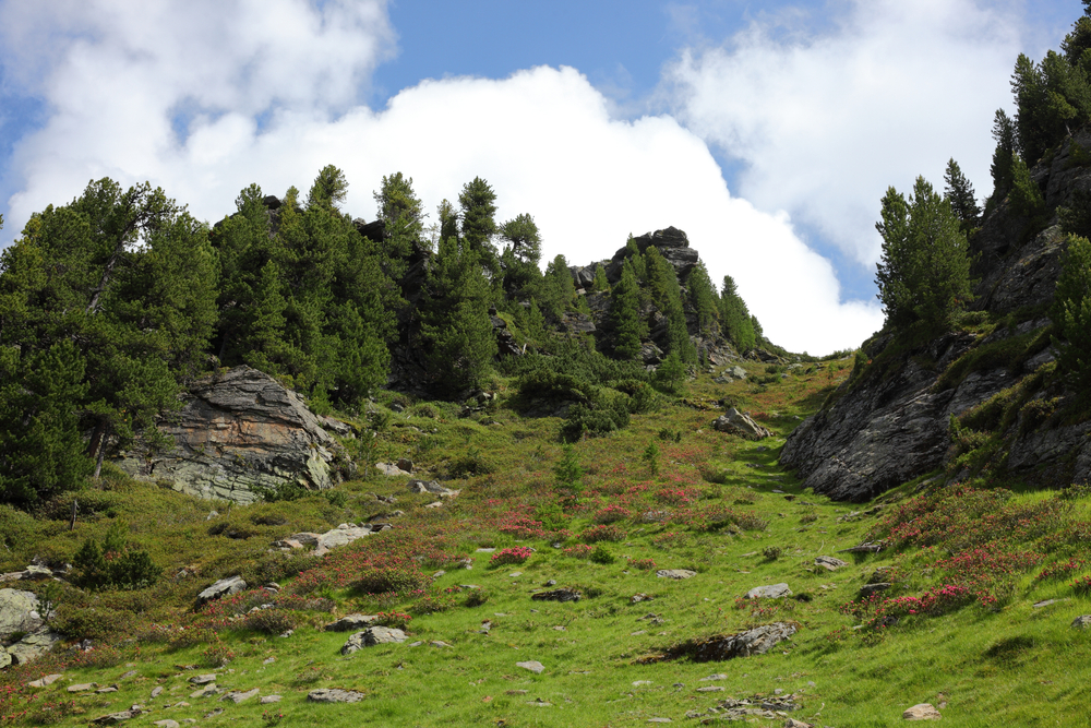
This high-altitude gem is a favourite among locals and first-time hikers alike.
The Zirbenweg (Stone Pine Trail) sits just above Innsbruck, and it traces the mountain ridge between Patscherkofel and Glungezer.
You’ll find it well-marked, mostly level, and packed with jaw-dropping panoramic views over the Inn Valley, and all while weaving through ancient stone pine forests that smell as good as they look.
The trail itself is particularly lovely in late spring and early autumn when wildflowers bloom or the larches start turning golden.
It’s also dotted with rest spots and traditional huts that serve all the Alpine food you didn’t know you needed.
Easy on the knees and heavy on the views, this trail is your go-to if you’re dipping your toes into Tyrolean hiking for the first time.
Zirbenweg Trail Details
- Difficulty: Easy
- Average time: 2.5 hours
- Distance: 7 km / 4.3 miles
- Elevation gain: Approx. 200 m / 656 ft
- Elevation loss: Approx. 100 m / 328 ft
- Route type: Point-to-point
- Start point: Patscherkofel cable car summit station
- End point: Glungezer cable car summit station
- Best for: Easy panoramic hiking and first-time visitors
- Highlights: Ancient stone pine forests and panoramic Inn Valley views
- Trail highlight: Stop at one of the mountain huts along the route for a snack with a view.
2. Goetheweg Trail
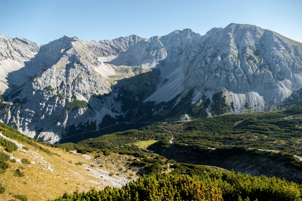
Perched high above the city on the spine of the Nordkette mountains, the Goetheweg Trail is a classic Innsbruck hike that delivers dramatic Alpine scenery and without requiring mountaineering legs.
You can begin by riding the Nordkette cable car all the way to Hafelekar (2,256 m), where the trail kicks off with breathtaking ridgeline views.
From there, the route heads east across proper high-Alpine terrain, with some steeper and more demanding sections along the way.
The effort pays off with a cinematic sweep over the Karwendel range and the Inn Valley below.
The path is well-marked, but this is a step up from Innsbruck’s easier panoramic walks and is better suited to experienced hikers who are comfortable spending several hours in mountain terrain.
It’s one of those “wow” hikes that feels far more remote than the city sitting below would suggest.
Goetheweg Trail Details
- Difficulty: Difficult
- Average time: Approx. 5 hours return
- Distance: 5.2 km / 3.2 miles one way
- Elevation gain: Approx. 769 m / 2,523 ft
- Elevation loss: Approx. 764 m / 2,507 ft
- Route type: Out-and-back
- Start point: Hafelekar cable car summit station
- Turnaround point: Pfeishütte
- Best for: Experienced hikers looking for dramatic high-Alpine scenery
- Highlights: Exposed-feeling ridgeline scenery, Karwendel views and the Pfeishütte mountain hut
- Trail highlight: The high route above Innsbruck offers some of the most dramatic mountain views in the area.
3. Rauschbrunnen Hike
Are you short on time but still want that Alpine payoff? The Rauschbrunnen hike is a local go-to for a quick escape into nature without leaving the city behind.
Starting from the Sadrach area on Innsbruck’s northern edge, this forested trail winds steadily uphill toward the Rauschbrunnen alpine hut, a rustic mountain tavern perched above Innsbruck with sweeping valley views.
It’s a popular post-work or early-morning walk, and especially for those of you who want to trade pavement for pine trees without committing to one of Innsbruck’s bigger high-Alpine adventures
The hut itself is a reward worth the effort because it offers cold drinks, warm food, and some of the best views that are around and for minimal uphill sweat to boot.
Rauschbrunnen Hike Details
- Difficulty: Easy
- Average time: 3.5 hours round trip
- Distance: 8.8 km / 5.5 miles
- Elevation gain: Approx. 470 m / 1,542 ft
- Elevation loss: Approx. 404 m / 1,325 ft
- Route type: Out-and-back
- Start point: Innsbruck Sadrach
- Best for: A shorter mountain-hut hike close to the city
- Highlights: Peaceful forest paths, city views and a traditional mountain hut
- Trail highlight: Grab a seat at Rauschbrunnen and enjoy the panoramic view over Innsbruck.
Want to turn a few great day hikes into a longer trip? See our Walking Holiday in Austria guide for more ideas on exploring the Austrian Alps on foot.
4. Seegrube to Höttinger Alm
This family-friendly hike mixes high-mountain magic with forested charm, and all without requiring mountain goat genetics.
You’ll begin at the Seegrube station (accessible by funicular and cable car from the city), and then you’ll follow a gentle descending trail that winds across alpine meadows and into a pine-dotted forest toward Höttinger Alm.
Along the way, you’ll get wide-open views of Innsbruck below and the Karwendel mountains stretching out in every direction.
The trail is well-maintained and wide in most places, which makes it perfect for kids, grandparents, and anyone who prefers their hikes scenic but not sweaty.
Höttinger Alm is a welcoming hut with snacks, sunshine, and cows. Not a bad combo!
Seegrube to Höttinger Alm Details
- Difficulty: Moderate
- Average time: Approx. 1 hour to Höttinger Alm
- Route type: Point-to-point, predominantly downhill
- Start point: Seegrube cable car station
- End point: Höttinger Alm
- Best for: A shorter lift-assisted Alpine walk
- Highlights: Nordkette scenery, mountain views and a traditional Alpine hut
- Trail highlight: Stop at Höttinger Alm for food and panoramic views over the Inn Valley.
5. Innsbruck City Loop
Not every great hike has to involve glaciers and gondolas.
The Innsbruck City Loop is perfect for those of you who want a walk that blends history, architecture, and nature, and all without ever leaving the city limits.
This loop weaves through the Old Town, along the banks of the River Inn, and up through the Hofgarten park.
Then it starts circling around to the scenic panoramic paths above the city in the Weiherburg and Alpenzoo area.
It’s a surprisingly green and peaceful route with just enough elevation to get your heart rate up, and plenty of benches and viewpoints for lazy lingering.
This hike is also perfect for rest days or rainy days, or for those of you who just want to stretch your legs without strapping on a full pack!
Innsbruck City Loop Details
- Difficulty: Easy
- Average time: Approx. 1.5–2.5 hours
- Distance: Approx. 6 km / 3.7 miles
- Elevation gain: Approx. 180 m / 590 ft
- Route type: Loop
- Start/end: Central Innsbruck
- Best for: Rest days, poor mountain weather and easy urban walking
- Highlights: Old Town, River Inn, Hofgarten and views towards the Nordkette
- Trail highlight: Climb towards the Weiherburg/Alpenzoo area for elevated views over Innsbruck.
6. Glungezer Hut Trek
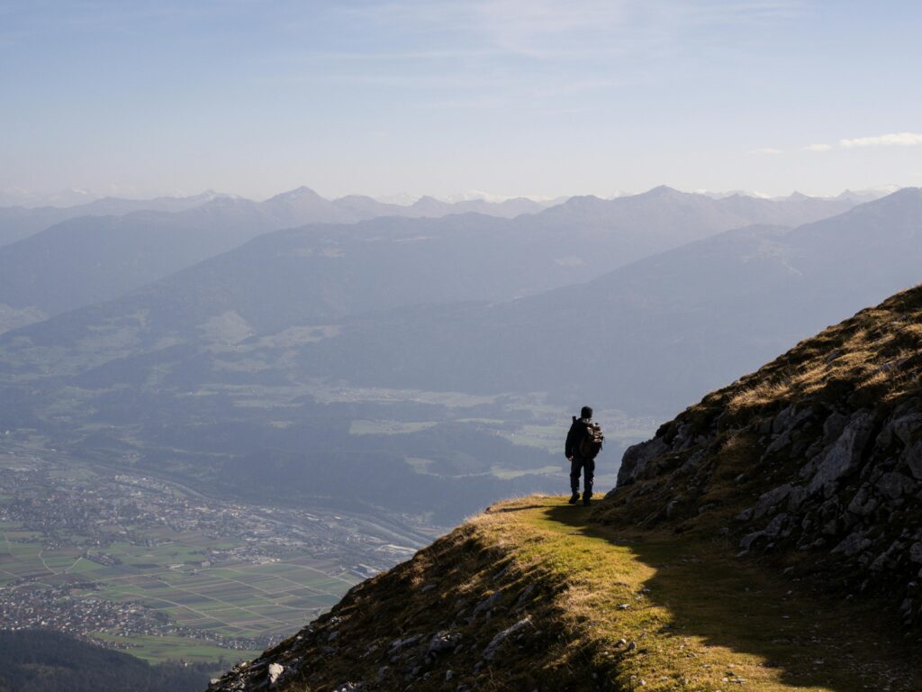
For those ready to trade the comfort of city beds for a starry night in the mountains, the hike to Glungezer Hut (Glungezer Hütte) is a perfect introduction to overnight Alpine trekking.
Starting from Patscherkofel Schutzhaus, this route climbs steadily through high-Alpine terrain toward Glungezer Hütte, a cosy mountain hut tucked beneath the Glungezer summit.
The path is well-marked and serves up wide views across the Inn Valley, with the landscape becoming increasingly rugged as you gain elevation.
The hut itself is welcoming and rustic-like with warm food, cold drinks, and beds that feel five-star after a day on your feet.
You’ll wake up early for sunrise views that’ll make you forget what time it is (or care).
Glungezer Hut Trek Details
- Difficulty: Moderate
- Average time: Approx. 3 hours one way
- Distance: 7.3 km / 4.5 miles one way
- Elevation gain: Approx. 982 m / 3,222 ft
- Route type: Point-to-point / overnight hut hike
- Start point: Patscherkofel Schutzhaus
- End point: Glungezer Hütte
- Highest point: Approx. 2,605 m / 8,547 ft
- Best for: A first overnight Alpine hut experience
- Highlights: High-Alpine scenery, ridgeline views and an overnight mountain-hut stay
- Trail highlight: Stay overnight at Glungezer Hütte and explore the nearby summit viewpoints.
“Turn your dream trek into a plan — get your free Plan Your Own European Walking Holiday ebook ”
7. Kellerjoch Summit via Loassattel
For hikers who are looking for a full Alpine experience with summit vibes and fewer fellow boot tracks, the Kellerjoch hike delivers in spades.
Starting from the Loassattel near Schwaz (a short train and taxi ride from Innsbruck), the trail climbs steadily through larch forests and open ridgelines up to the striking Kellerjoch Chapel perched near the summit.
From there, a short final push will lead you to panoramic views that you’ll find stretching across the Inn Valley and deep into the Zillertal Alps.
This hike is ideal for those of you who want the thrill of a proper mountain climb without needing specialist climbing gear.
Expect rocky ground and a few steeper sections along the way, but the views make the effort more than worthwhile
It’s challenging but manageable, and absolutely stunning from start to finish!
Kellerjoch Summit via Loassattel Details
- Difficulty: Moderate
- Average time: Approx. 4.5 hours
- Distance: 7.7 km / 4.8 miles
- Elevation gain: Approx. 585 m / 1,919 ft
- Elevation loss: Approx. 565 m / 1,854 ft
- Route type: Loop
- Start/end: Loassattel car park
- Highest point: 2,212 m / 7,257 ft
- Best for: A quieter summit hike and panoramic ridge walking
- Highlights: Kellerjoch summit scenery, rocky mountain terrain and sweeping views across the Inn Valley
- Trail highlight: The Kellerjoch Chapel makes a memorable high-mountain stopping point.
When Is the Best Time to Hike in Innsbruck?
For most of the mountain hikes around Innsbruck, summer and early autumn offer the easiest conditions, with warmer weather, longer daylight hours and better access to higher trails.
June to August is the main hiking season, although it is also the busiest time on popular routes. Late spring and September into early autumn can be excellent for quieter trails, but snow can linger or arrive early at higher elevations.
Lower walks around Innsbruck have a much longer season, while some routes can also be enjoyed as dedicated winter walks once snow arrives. Higher trails such as Goetheweg require much more care when snow or ice is present.
Lift opening dates also affect access to several hikes in this guide, so always check current trail, weather and cable-car conditions before heading into the mountains.
Planning the rest of your trip? My Hiking in Innsbruck: A City Guide covers where to stay, getting around, seasonal planning and using the city as a base for exploring the surrounding mountains.
What to Pack for Hiking in Innsbruck
What you need will depend on whether you’re taking an easy city walk or heading onto one of Innsbruck’s higher Alpine trails, but mountain weather can change quickly even when conditions in the valley look settled.
For most day hikes, consider carrying:
- Comfortable hiking shoes or boots suited to the terrain
- A waterproof jacket for sudden changes in weather
- A lightweight insulating layer for higher elevations
- A 20–30L daypack for water, food and spare layers
- Sun protection, including sunscreen and sunglasses
- Plenty of water and trail snacks
- Offline navigation or a GPS device, particularly on longer mountain routes
- Hiking poles if you prefer extra support on steep climbs and descents
🗒️ Free Checklist: Planning your next hiking trip?? Download our printable hiking checklist to make sure you don’t miss the essentials.
One City, Seven Trails, Endless Alpine Magic
And there you have it: seven hikes that show just how much Innsbruck and its surroundings have to offer, whatever your pace, plans or level of hiking bravado.
From an easy walk through the city to panoramic pine forests, mountain huts and proper Alpine summit days, Innsbruck makes it unusually easy to build a hiking trip around the type of walking you actually enjoy.
If you’re planning to stay for a few days, have a look at my Hiking in Innsbruck: A City Guide for more on where to stay, getting around and using Innsbruck as your base in the mountains.
Otherwise, lace up the boots, pick a trail and leave enough room for the Kaiserschmarrn afterwards.
Where to Next?
Planning more hiking in Austria? Continue your trip with these guides:
- Hiking in Innsbruck: A City Guide — plan where to stay, when to visit and how to use Innsbruck as a hiking base.
- Ultimate Guide to Hiking in Austria — a broader introduction to Austria’s main hiking regions, landscapes and trails.
- Best Hikes in Austria — compare more of the standout day hikes and mountain routes around the country.
- Walking Holiday in Austria — ideas for turning a few day hikes into a longer walking trip.