

Wales is a fantastic place for anyone who loves to hike. This commonly overlooked country in the United Kingdom has trails that cater to everyone from seasoned adventurers to those who are just looking for a peaceful and scenic walk.
Whether you’re aiming to summit the highest peaks in Snowdonia, take a leisurely stroll along the beautiful Pembrokeshire Coast Path, or wander through the serene woodlands of the Brecon Beacons, there’s probably a trail in Wales waiting for you.
In this guide, we’ll explore some of the best hikes in Wales. Specifically, we’ll highlight a mix of routes that offer something special for everyone. Each hike comes with its own unique charm by blending gorgeous views with fascinating history.
Why Hike in Wales?
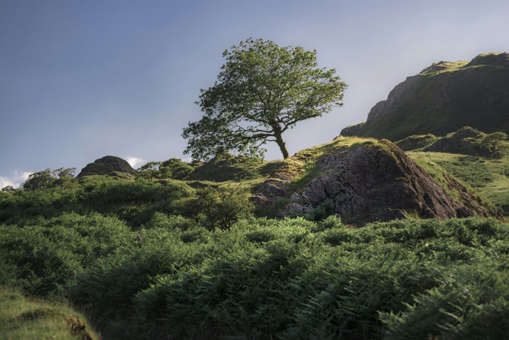
Wales stands out for its wildness and character. Much of the country remains sparsely populated, giving hikers access to remote-feeling landscapes without extreme logistics.
National parks like Snowdonia and the Brecon Beacons protect vast areas of mountain and moorland, while coastal paths trace some of the most dramatic shorelines in Britain.
What truly sets Wales apart is its sense of story. Many trails are tied to ancient legends, early settlements, and centuries-old routes used by shepherds and traders.
Add in well-marked paths, accessible trailheads, and scenery that shifts quickly from peaks to sea, and Wales becomes one of the most rewarding hiking destinations in the UK.
Companion Article: Ultimate Guide to Hiking in Wales
If you’re planning a hiking trip to Wales, it helps to understand the regions, seasonal conditions, and trail etiquette before you go.
From mountain weather and navigation tips to choosing the right routes for your ability, preparation makes all the difference.
Our Ultimate Guide to Hiking in Wales covers terrain, safety, and planning advice — the perfect companion to the hikes below.
The Best Hikes in Wales
Wales’ best hikes range from iconic mountain ascents to coastal paths and wild ridge walks. These routes showcase the country’s most memorable landscapes and walking experiences.
1. Snowdon via the Watkin Path
Snowdon, or Yr Wyddfa as it’s known in Welsh, is the tallest mountain in Wales and one of the most iconic hikes in the country. The Watkin Path specifically is one of the most scenic and challenging routes to the summit.
This trail takes you through a variety of landscapes, from lush woodlands and cascading waterfalls to rocky scree slopes and rugged ridgelines.
Trail Snapshot
Difficulty: Challenging
Distance: 13 km (8 miles) round trip
Elevation Gain: ~1,015 m (3,330 ft)
Start / End: Watkin Path car park (Nant Gwynant)
Highlights: Waterfalls, historic quarry ruins, summit views
Difficulty/Recommended Fitness Level
The Watkin Path is a challenging hike and is best suited for hikers with a good level of fitness. That’s because the path has steep sections, loose scree, and requires a bit of scrambling near the summit. As a result, it’s best for those who are comfortable with more demanding terrain.
Distance
The Watkin Path is approximately 8 miles/13 km round trip.
Elevation Gain
You’re looking at an elevation gain of around 3,330 feet (1,015 meters) from start to finish.
Start and End Point
The hike starts and ends at the Watkin Path car park near Nant Gwynant, which is easily accessible by car. There’s also a nearby bus stop if you’re using public transport.
Highlights & Landmarks
Oak woodland, Gladstone Rock, and a dramatic final ascent to the summit.
2. The Pembrokeshire Coast Path – St. David’s Head to Porthgain
The Pembrokeshire Coast Path is famous for its stunning sea views, dramatic-looking cliffs, and diverse wildlife. The section from St. David’s Head to Porthgain is one of the most picturesque stretches and offers a mix of rugged cliffs, hidden coves, and historic sites.
This hike is perfect for those looking to experience the best of Wales’s coastal beauty without taking on the entire path.
Trail Snapshot
Difficulty: Moderate
Distance: 14.5 km (9 miles) one way
Elevation Gain: ~305 m (1,000 ft)
Start / End: St David’s Head → Porthgain
Highlights: Sea cliffs, hidden coves, seals
Difficulty/Recommended Fitness Level
The path is well-maintained for the most part, but it includes some steep ascents and descents along the cliffs, which can be challenging in places.
Distance
The hike from St. David’s Head to Porthgain is approximately 9 miles/14.5 km one way.
Elevation Gain
You’re looking at a moderate elevation gain of about 1,000 feet/305 meters, with several ups and downs as you navigate the coastal cliffs.
Start and End Point
The hike starts at the Whitesands Bay car park near St. David’s Head and ends in the small fishing village of Porthgain.
There are options for public transport or a shuttle service to return to the starting point if you’re not up for the round trip.
Highlights & Landmarks
Iron Age forts, dramatic headlands, and a rewarding finish in a historic fishing village.
3. Pen y Fan via the Corn Du Horseshoe
Pen y Fan is the highest peak in southern Britain and a favorite among hikers in the Brecon Beacons National Park. The Corn Du Horseshoe route is a scenic loop that offers a more adventurous approach to the summit.
This hike is perfect for those who want to experience the beauty of the Beacons while tackling a moderately challenging route.
Trail Snapshot
Difficulty: Moderate–Challenging
Distance: 11 km (7 miles)
Elevation Gain: ~550 m (1,800 ft)
Start / End: Pont ar Daf car park
Highlights: Twin summits, open ridgelines, wide valley views
Difficulty/Recommended Fitness Level
This hike is moderately challenging, suitable for hikers with a reasonable level of fitness. There are some steep sections and uneven terrain, but the well-defined paths make it accessible to most.
Distance
The Corn Du Horseshoe route covers approximately 7 miles/11 km round trip.
“Avoid rookie mistakes. Our free ebook Hiking for Beginners shows you how.”
Elevation Gain
You’re looking at an elevation gain of around 1,800 feet/550 meters, with steady climbs up to the peaks of Corn Du and Pen y Fan.
Start and End Point
The hike starts and ends at the Pont ar Daf car park, which is conveniently located off the main road and accessible by car. There are also public transportation options available to get to the trailhead.
Highlights & Landmarks
Corn Du, Pen y Fan summit, and panoramic views across southern Wales.
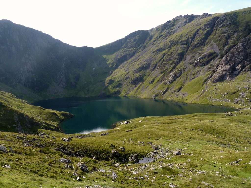
4. Cadair Idris via the Minffordd Path
Cadair Idris, located in southern Snowdonia, is one of the most iconic mountains in Wales. The Minffordd Path is a popular route that will take through beautiful woodlands, past tranquil lakes, and up steep, rocky paths to the top of the mountain.
Trail Snapshot
Difficulty: Challenging
Distance: 9.5 km (6 miles)
Elevation Gain: ~875 m (2,870 ft)
Start / End: Minffordd car park
Highlights: Llyn Cau, glacial cirque, folklore
Difficulty/Recommended Fitness Level
The Minffordd Path is considered a challenging hike, suitable for experienced hikers with a good level of fitness. The trail involves steep ascents and descents, and some sections require a bit of scrambling.
Distance
The Minffordd Path is approximately 6 miles/9.5 km round trip.
Elevation Gain
You’re looking at a significant elevation gain of about 2,870 feet/875 meters, making for a steep and strenuous climb.
Start and End Point
The hike starts and ends at the Minffordd car park, located near Tal-y-llyn Lake. The car park is accessible by car, and there are bus services to nearby towns for those using public transport.
Highlights & Landmarks
Woodland approach, dramatic cwm, and legendary summit linked to Welsh myth.
5. The Glyders via the Devil’s Kitchen
The Glyders are located in Snowdonia National Park and offer some of the most dramatic and rugged landscapes in Wales.
Hiking via the Devil’s Kitchen (or Twll Du) is a thrilling adventure that takes you past graceful lakes and up to the spectacular summits of Glyder Fawr and Glyder Fach.
Trail Snapshot
Difficulty: Challenging
Distance: 8 km (5 miles)
Elevation Gain: ~885 m (2,900 ft)
Start / End: Ogwen Cottage car park
Highlights: Devil’s Kitchen, Glyder Fawr & Fach
Difficulty/Recommended Fitness Level
The Devil’s Kitchen route to the Glyders is challenging. The trail includes steep ascents and rocky paths, especially near the summits.
Distance
The hike to the Glyders via the Devil’s Kitchen is approximately 5 miles/8 km round trip.
Elevation Gain
You’re looking at an elevation gain of around 2,900 feet/885 meters, with some steep climbs that require good endurance and strength.
Start and End Point
The hike starts and ends at the Ogwen Cottage car park, located along the A5 near Llyn Ogwen. This spot is easily accessible by car and has bus services from nearby towns like Betws-y-Coed and Bangor.
Highlights & Landmarks
Twll Du gorge, Cantilever Stone, Castell y Gwynt rock formations.
6. The Beacons Way – Black Mountain Section
The Beacons Way is a long-distance trail that traverses the Brecon Beacons National Park. The Black Mountain section, in the western part of the park, offers a fantastic hike that takes you over rugged moorlands and past ancient cairns.
Trail Snapshot
Difficulty: Moderate
Distance: 13 km (8 miles) one way
Elevation Gain: ~670 m (2,200 ft)
Start / End: Llangadog → Llyn y Fan Fach
Highlights: Moorland ridges, ancient cairns, open views
Difficulty/Recommended Fitness Level
This hike is moderately challenging and best suited for hikers with a decent level of fitness.
Distance
The Black Mountain section of the Beacons Way is about 8 miles/13 km one way. If you plan to hike it as an out-and-back, you’ll cover roughly 16 miles/26 km.
Elevation Gain
You’re looking at an elevation gain of around 2,200 feet/670 meters, with several climbs and descents along the ridge.
Start and End Point
The hike starts at the car park near the village of Llangadog and follows the Beacons Way trail westward, ending near Llyn y Fan Fach.
You can arrange transport back or hike back along the same route if you’re up for a longer trek.
Highlights & Landmarks
Remote uplands, glacial lakes, and landscapes steeped in legend.
What to Bring for Hiking in Wales
Wales’ weather can change quickly, especially in the mountains.
- Footwear: Waterproof hiking boots with good grip
- Clothing: Layered system with windproof and waterproof shell
- Backpack: Daypack with water, food, and spare layers
- Other Essentials: Map or GPS, sun protection, whistle, trekking poles
🗒️ Free Checklist: “Never forget the essentials — grab your free Ultimate Hiking Packing List.”
Walking Holidays in Wales
Wales is exceptionally well suited to walking holidays, thanks to its compact size, varied landscapes, and well-established network of long-distance trails.
In a single trip, you can move from mountain ridges to coastal cliffs, through quiet valleys and historic villages, without ever feeling rushed or disconnected from civilization.
One of the biggest draws is how naturally Wales supports point-to-point walking. Routes like the Pembrokeshire Coast Path and the Beacons Way allow hikers to travel village to village, often ending each day near accommodation, pubs, or transport links.
In Snowdonia and the Brecon Beacons, walking holidays blend mountain scenery with cultural depth, passing ancient cairns, Roman roads, and Welsh-speaking communities along the way.
“From Alps to coastlines, our free Walking Holiday guide helps you plan smarter.”
Conclusion
Hiking in Wales is all about discovering the unexpected. No matter if you’re a seasoned hiker looking for a challenge or just someone who loves a good scenic walk, Wales has something that will fit the bill.
From scaling the heights of Cadair Idris and scrambling up the Glyders, to walking the windswept paths of the Black Mountain, each hike will be truly rewarding.
Where to Next?
- Best Hikes in England – From coastal paths to historic long-distance routes like the Cotswold Way and Hadrian’s Wall
- Best Hikes in Northern Ireland – Rugged coastlines, myth-filled mountains, and iconic walks like the Giant’s Causeway
- Walking Holidays in France – Multi-day routes through alpine valleys, vineyards, and historic pilgrimage paths
- Best Hikes in Scotland – Wild highlands, lochs, and long-distance trails for adventurous hikers


