
Sarajevo is surrounded by some of Bosnia and Herzegovina’s most accessible mountain scenery, with forest trails, traditional highland villages and rugged Dinaric peaks all within reach of the city.
These hikes around Sarajevo range from easy urban and park walks to full-day mountain routes across Trebević, Bjelašnica and the surrounding highlands.
- Why Hike in and around Sarajevo?
- 1. Best Mountain Escape from Sarajevo: Trebević Mountain
- 2. Best Full-Day Hike from Sarajevo: Umoljani to Lukomir
- 3. Best Beginner Walk Near Sarajevo: Vrelo Bosne and Velika Aleja
- 4. Best High-Mountain Hike from Sarajevo: Bijele Vode to Bjelašnica Summit
- 5. Best Urban Hike in Sarajevo: Yellow Bastion, White Fortress and Grdonj
- When Is the Best Time to Hike Around Sarajevo?
- What to Pack for Hiking Around Sarajevo
- Conclusion
- Where to Next?
Why Hike in and around Sarajevo?
Sarajevo might be known for its rich history and complex past (and incredible ćevapi too), but for those of you who enjoy spending your weekends in hiking boots instead of museum lines, the surrounding hills and mountains offer something even better: hiking trails.
You see, this is a city that is literally hugged on all sides by rugged beauty, and with routes that begin right at the edge of a café terrace and end on a mountain ridge.
If you’re planning a broader hiking trip beyond the capital, our guide to hiking in Bosnia and Herzegovina covers some of the country’s most spectacular mountain landscapes and trail networks.
Many trails wind through old Austro-Hungarian roads, wartime ruins, and even ancient villages where time seems to have politely stopped for a breather.
And if you’re the kind of person who hikes for the reward at the end (think mountain teas, fresh air, and maybe a rakija or two), Sarajevo won’t disappoint you either!
So, whether you’ve got a full day, just a few hours, or a whole weekend to kill, these are the hikes around Sarajevo that bring the views and the charm (and just the right amount of sweat to boot).
Also, for more information on what to do in this southeastern European country when you visit, don’t hesitate to check out our article on the Sarajevo city guide for hikers!
1. Best Mountain Escape from Sarajevo: Trebević Mountain
Just above Sarajevo, Trebević is the city’s classic mountain escape and one of the easiest places to swap busy streets for proper forest trails.
Starting higher on the mountain around Brus, the route climbs through woodland towards the summit, with increasingly wide views across Sarajevo and the surrounding ranges.
Along the way, you can expect to find locals jogging, kids kicking soccer balls in clearings, and plenty of shady spots to catch your breath.
At the summit, you’re rewarded with a panoramic view over Sarajevo that makes every step worth it.
Trebević’s Olympic history is never far away either, with remnants of the 1984 Winter Games scattered around the mountain.
Before heading out, make sure you’re carrying the essentials by reviewing our guide on things to bring on a day hike.
Trebević Mountain Details
- Difficulty: Moderate
- Average time: Approx. 3.5 hours
- Distance: Approx. 10 km / 6.2 miles
- Elevation gain: Approx. 490 m / 1,608 ft
- Route type: Loop / return circuit
- Start/end: Brus area
- Highest point: Trebević summit, approx. 1,600 m / 5,250 ft
- Best for: An accessible mountain hike close to Sarajevo
- Highlights: Forest trails, mountain views and Trebević summit
- Trail highlight: Reaching a proper mountain summit while remaining only a short distance from Sarajevo is what makes Trebević such a distinctive city hike.
“Avoid rookie mistakes. Our free ebook Hiking for Beginners shows you how.”
2. Best Full-Day Hike from Sarajevo: Umoljani to Lukomir
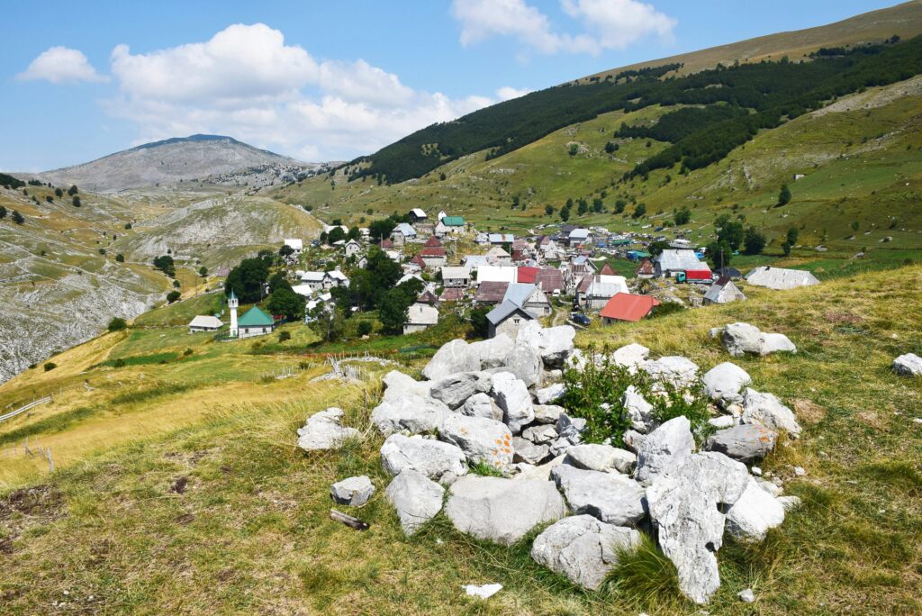
For those of you who enjoy hikes with a hefty dose of tradition and timeless scenery, the trail to Lukomir is as authentic as it gets.
Bosnia’s highest and (one of the) most isolated mountain villages sits at 1,495 meters (or 4,905 feet) and is perched on the edge of the dramatic Rakitnica Canyon like it’s been guarding it for centuries.
The trail begins from the Bjelašnica ski resort area before gradually winding through some alpine meadows, grazing sheep, and ancient footpaths until the stone houses of Lukomir come into full view.
This is not just a hike. It’s a time machine! The village has no glitz, no cell service, and no hurry…which is all exactly what makes it magical.
The locals still wear traditional clothing and tend to flocks, and they’ll welcome hikers like you with homemade pita and some wine.
If Lukomir leaves you wanting more, check out our roundup of the best hikes in Bosnia and Herzegovina for additional mountain trails and scenic adventures across the country.
Umoljani to Lukomir Details
- Difficulty: Moderate
- Average time: Approx. 5–5.5 hours
- Distance: 15.1 km / 9.4 miles
- Elevation gain: 782 m / 2,566 ft
- Elevation loss: 785 m / 2,575 ft
- Route type: Loop
- Start/end: Umoljani
- Highest point: Approx. 1,866 m / 6,122 ft
- Best for: Mountain scenery, traditional villages and a full-day hike
- Highlights: Oblj ridge, Lukomir, mountain pastures and views into Rakitnica Canyon
- Trail highlight: Approaching Lukomir across the high plateau gives this hike one of the strongest combinations of landscape and traditional village scenery near Sarajevo.
3. Best Beginner Walk Near Sarajevo: Vrelo Bosne and Velika Aleja
Vrelo Bosne is one of the easiest and most relaxed walking options near Sarajevo, making it a great choice for beginners, families, or anyone who wants a gentler day outdoors.
Starting around the spring-fed pools of Vrelo Bosne, the walk follows shaded paths and the famous Velika Aleja, a long tree-lined avenue that connects the park with Ilidža.
Along the way, you’ll pass streams, picnic areas, broad lawns and plenty of places to stop, with the surrounding mountain scenery giving the route a much more scenic feel than a typical city park walk.
It’s more of a leisurely walk than a mountain hike, but that’s exactly why it works well in this list: not every day around Sarajevo needs to involve a big climb.
Vrelo Bosne and Velika Aleja Details
- Difficulty: Easy
- Average time: Approx. 1.5–2 hours
- Distance: Approx. 5–6 km / 3.1–3.7 miles
- Elevation gain: Minimal
- Route type: Out-and-back
- Start/end: Ilidža / Velika Aleja
- Best for: Beginners, families and an easy recovery-day walk
- Highlights: Vrelo Bosne springs, Velika Aleja, shaded parkland and mountain views
- Trail highlight: The long plane-tree avenue leading towards Vrelo Bosne makes this one of the most distinctive easy walks near Sarajevo.
“From Alps to coastlines, our free Walking Holiday guide helps you plan smarter.”
4. Best High-Mountain Hike from Sarajevo: Bijele Vode to Bjelašnica Summit
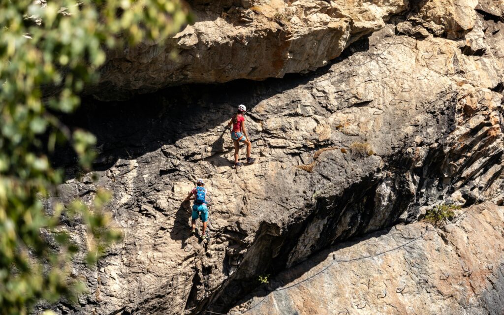
For those of you who enjoy a hike that leans into the “hold on tight” category, the Bijele Vode via ferrata on Mount Bjelašnica delivers the goods.
This is mountain hiking with a twist (and by twist, we mean iron cables, ladders, and rocky scrambles that get the heart rate up before the altitude does).
Starting out from the Bijele Vode valley, the trail climbs steadily through alpine terrain, with the via ferrata section adding a dose of controlled thrill and unbeatable views over the Dinaric Alps.
What sets this one apart is the feeling of real adventure that comes without needing to be a full-blown mountaineer.
This is the hike for those of you who like to mix a little challenge with your mountain air and don’t mind earning every single panoramic photo along the way.
Sarajevo is one of the region’s best hiking bases, but you’ll find plenty of other unforgettable adventures in our guide to the best hikes in the Balkans.
Bijele Vode to Bjelašnica Summit Details
- Difficulty: Moderate
- Average time: Approx. 4 hours
- Distance: Approx. 9.6 km / 6 miles
- Elevation gain: Approx. 700 m / 2,297 ft
- Route type: Mountain route
- Start point: Bijele Vode mountain lodge
- Highest point: Bjelašnica summit area, approx. 2,094 m / 6,870 ft
- Best for: A proper high-mountain day close to Sarajevo
- Highlights: Bjelašnica summit, wide views across the Dinaric ranges and high mountain terrain
- Trail highlight: From the upper mountain, the views open towards several of Bosnia and Herzegovina’s major surrounding ranges.
5. Best Urban Hike in Sarajevo: Yellow Bastion, White Fortress and Grdonj
For those of you who like your hikes with a side of espresso and city views, this trail is the perfect blend of history, incline, and convenience.
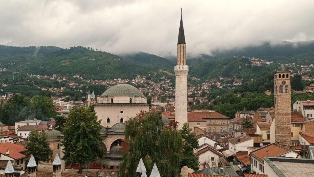
Starting from the bustling Baščaršija in Sarajevo’s Old Town, the route will take you uphill past Ottoman-era cemeteries, cobbled lanes, and quiet residential pockets, and then all the way to two of the city’s best viewpoints: the Yellow Bastion and the White Fortress.
It’s short, it’s sweet, and it serves up postcard-worthy views with very little effort.
This hike is ideal for early risers who want to spend their mornings chasing sunrise or sunset seekers who just want the perfect golden hour shot over Sarajevo’s skyline.
Along the way, you’ll catch glimpses of minarets, steeples, and tiled rooftops that are layered all across the valley.
Yellow Bastion, White Fortress and Grdonj Details
- Difficulty: Easy
- Average time: Approx. 3 hours
- Distance: 9.9 km / 6.2 miles
- Elevation gain: 375 m / 1,230 ft
- Route type: Loop
- Start/end: Sarajevo Old Town
- Highest point: Grdonj, approx. 923 m / 3,028 ft
- Best for: Combining Sarajevo sightseeing with a proper hill walk
- Highlights: Yellow Bastion, White Fortress, Zmajevac viewpoint and views over Sarajevo
- Trail highlight: Few hikes combine Sarajevo’s history and geography as clearly as climbing directly from the Old Town into the hills overlooking the valley.
When Is the Best Time to Hike Around Sarajevo?
Late spring through early autumn generally offers the best hiking conditions around Sarajevo, with June to September providing the widest access to higher mountain routes.
May and June bring green forests, wildflowers and comfortable temperatures, making them particularly good for Trebević and lower routes. Snow can linger on higher ground earlier in the season.
July and August usually offer the most reliable access to Bjelašnica, Lukomir and other highland routes, although exposed sections can become hot during the middle of the day.
September and early October are excellent for cooler temperatures, clearer walking conditions and autumn colour across the surrounding mountains.
Late autumn through early spring brings a very different experience. Lower walks around Sarajevo may remain accessible, but snow and ice can significantly affect higher mountain trails.
Weather can also change much faster in the mountains than it does in Sarajevo itself, so check current conditions before committing to a longer route.
Planning the rest of your stay? My Sarajevo for Hikers: A City Guide covers transport, where to stay, reaching the surrounding mountains and how to use Sarajevo as a hiking base.
What to Pack for Hiking Around Sarajevo
Sarajevo’s hikes range from easy city-edge walks to full days above 1,500 metres, so what you carry should reflect the route you choose.
For most mountain hikes around Sarajevo, consider packing:
- Hiking shoes or boots with reliable grip for rocky, muddy and uneven trails
- A lightweight waterproof jacket for fast-changing mountain weather
- A practical layering system for the temperature difference between Sarajevo and the higher mountains
- A 20–30L daypack for water, food and spare clothing
- Sun protection, particularly on the exposed highlands around Bjelašnica and Lukomir
- Enough water for the full route, especially where there are few reliable services
- Offline maps or GPS navigation for quieter mountain areas and routes with multiple trail junctions
- Trekking poles for longer climbs, rough terrain and sustained descents
Carry some cash as well. Mountain huts, village cafés and smaller local businesses may not always accept cards, and you shouldn’t rely on finding food or water once you’re away from the more popular trailheads.
🗒️ Free Checklist: “Pack light, pack right — download The Ultimate Hiking Packing List.”
Conclusion
For those of you who like to keep things casual, the urban hikes and gentle forest walks around Sarajevo serve up plenty of charm without the burn.
And for the more ambitious types out there, the mountains surrounding the city deliver just the right mix of challenge and beauty and bragging rights in equal measure.
Trebević rises directly above the city, the hills begin almost at the edge of the Old Town, and within a relatively short journey you can be walking through Bjelašnica’s highlands or approaching traditional villages above the Rakitnica Canyon.
That range is what makes Sarajevo such a rewarding base. You can keep things easy with a walk through Vrelo Bosne, combine history and hills above the Old Town, or turn the day into a proper mountain adventure farther into the Dinaric Alps.
For hikers who want dramatic scenery without giving up culture, food and one of the Balkans’ most distinctive cities, Sarajevo offers an unusually strong combination.
Where to Next?
Planning more hiking in Bosnia and Herzegovina? These guides will help you continue the trip:
- Sarajevo for Hikers: A City Guide — plan transport, accommodation and how to reach the surrounding mountain areas.
- Ultimate Guide to Hiking in Bosnia and Herzegovina — explore the country’s main mountain regions, seasons and practical hiking information.
- Best Hikes in Bosnia and Herzegovina — discover more standout ridges, waterfalls and mountain trails beyond Sarajevo.
- Walking Holiday in Bosnia and Herzegovina — combine mountain villages, cities and scenic trails into a longer walking-focused trip.
- Best Hikes in the Balkans — broaden the trip with standout trails across southeastern Europe.


