The Snowdonia Slate Trail is a distinctive, yet underrated, long-distance walk crossing 83 miles through the rugged heart of Eryri (Snowdonia). Starting and finishing near Bangor, the landscape it loops through was once an industrial engine and tells the story alongside gorgeous mountains and hillsides.
To bring walkers through the slate villages of northern Snowdonia, the Snowdonia Slate Trail Trust officially opened the trail in 2016. Their hope was to bring people to see the landscape, but also to understand it. Since then, the popularity of the trail has grown, with a significant benchmark of being awarded UNESCO World Heritage Site in 2021. Now, as one of the most culturally significant walking destinations in the UK, the Snowdonia Slate Trail is one to put on your list if you’re looking for something a bit different than just a long-distance hike in the UK.
Many other trails chase high peaks with dramatic ridgelines, but the Snowdonia Slate Trail isn’t that type of trail. It hops from quarry to valley and from forest to ridge while moving through terrain that would otherwise go unseen by someone visiting Llanberis or Betws-y-Coed. The route’s highest point is just 526 meters, so it is clearly not defined by its challenging climbs. Rather, it is defined by character, history, and a wide variety of landscapes packed into a short distance of only 83 miles.
We’re going to cover everything you need to plan your own trek on the Snowdonia Slate Trail. From the logistics of getting to the start, all the way to a day-to-day itinerary, this guide is meant to get you prepared to take on a cultural trek through beautiful terrain.
- The Need-To-Know for Hiking the Snowdonia Slate Trail
- Navigation on the Snowdonia Slate Trail
- The Terrain of the Snowdonia Slate Trail
- When to Hike the Snowdonia Slate Trail
- Getting There and Back
- What to Pack to Hike the Snowdonia Slate Trail
- How long does it take to hike the Snowdonia Slate Trail?
- What is the best part of the Snowdonia Slate Trail?
- Summary
- Where to Next?
The Need-To-Know for Hiking the Snowdonia Slate Trail
Distance and Elevation
From the same corner of North Wales, the Snowdonia Slate Trail covers 83 miles in a single loop. Starting at Porth Penrhyn near Bangor, and finishing in Bethesda, the route forms a wide clockwise loop through the national park. It creates a remarkable cross-section giving you a taste of everything that Eryri has to offer.
The total elevation gain is minimal, yet the current readings vary. Some sources put it at 2,777 meters, while others are closer to 4,450. Either way, the elevation profile is gentle with no long, grinding days above 800 meters, no exposed ridges that demand serious mountain experience, and no technical sections demanding a high skill level. The trail climbs steadily, offers a few views, and then drops into the following valley. This doesn’t bring any huge summits, but it does create a huge amount of variety that adds its own flavor to the trail.
The highest point on the route is 526 meters in the moorland sections between Waunfawr and the Nantlle Valley. This figure alone tells you that the Snowdonia Slate Trail is considerably more accessible than most of the multi-day Welsh long-distance treks. However, no matter the route, 5-7 days of continuous hiking is substantial, and a baseline level of fitness is important to have.
Navigation on the Snowdonia Slate Trail
Although this isn’t a waymarked National Trail, it’s considerably well-marked, and navigation is quite manageable. Some sections have inconsistent waymarking, particularly on the more remote and southerly sections of the route through Penmachno and the forests above Ffestiniog.
The Snowdonia Slate Trail is divided into 13 official sections, each around 10 kilometers in length. This structure helps hikers plan and prepare while navigating section by section. The Snowdonia Slate Trail official website has GPX files available to download and use alongside maps.
For proper navigation, it’s important to carry with you:
- The official Snowdonia Slate Trail guidebook by Aled Owen
- OS Explorer maps OL17 and OL18 at 1:25,000 scale
- A device with the GPX track downloaded
- A physical compass for backup
The Terrain of the Snowdonia Slate Trail
One of the best parts of the Snowdonia Slate Trail is how the terrain shifts constantly. The route moves through seven distinctive landscapes, and repetition is not something you’ll find often. For hikers looking to explore beyond this route, there are plenty of other great Welsh hikes worth adding to your itinerary. and repetition is not something you’ll find often.
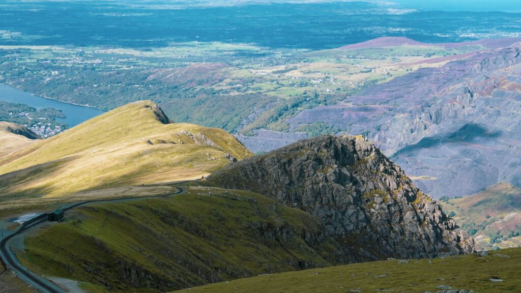
In the north, from Bangor through Bethesda and Llanberis, you’ll walk through the most industrially saturated part of the route. The trail follows the old Penrhyn Quarry Railway, passes below the fortress walls of Penrhyn Castle, and alongside the blue-grey spoil tips of Bethesda. These are manmade landscapes that show off what the area was truly like during the peak of the slate industry’s days. The Dinorwig quarry above Llanberis is home to the National Slate Museum, where you can start to grasp the scale of what was once the world’s largest slate quarry.
In the west, the trail provides the most scenically beautiful sections of the route. The trail passes through small communities where the mountains press in closely. You can see the ridgeline above the Nantlle Valley throughout the region, providing a dramatic backdrop to your hike.
The rest of the trail offers an entirely different character. In the south and the east, you will find Ancient Welsh rainforest, river gorges, waterfalls, and long forest tracks that provide a staggering difference to the slate quarries of the north. The final sections wrap you back around through the Ogwen Valley with the big mountain views of the Glyderau and Carneddau ranges rising dramatically on all sides.
“First time on the trail? Hiking for Beginners has your back.”
Finding Accommodation
Overall, finding accommodation along the Snowdonia Slate Trail is quite easy, particularly in the northern half of the route. The trail connects a string of towns and villages that are happy to be welcoming hikers for generations.
Most of the major stopping points have abundant options from B&Bs and guesthouses to hostels, bunkhouses, and campsites. This makes the route a good option for anyone planning a longer walking holiday in Wales, particularly if you prefer staying in local accommodation rather than carrying camping gear.
Llanberis is the most service-rich stop along the route, but there’s also Betws-y-Coed toward the end of the route, which also has plentiful options. With the high number of accommodation options and the frequency of encountering them, you can usually find something in your price range and not have to worry about carrying a large amount of food while hiking.
In the south, you may need to give accommodation a bit more thought. There are smaller and more spread out villages, which can make things more difficult. Things get even more difficult in the summer when the national park is busy and places fill up fast. Resupplying can be more crucial as you may need to carry a full day’s worth of food before hitting another village in certain areas.
Wild camping is another option, so long as you follow the same rules in the rest of Wales and England. The law says that you are allowed to wild camp on private land with landowner consent, but the practice is widely tolerated on open upland far away from farmland and buildings.
When to Hike the Snowdonia Slate Trail
Like most long-distance treks in the UK, May through September is the recommended hiking window for those attempting the Snowdonia Slate Trail. Inside of that window, May, June, and early September are the best options.
In May and June, you get longer daylight hours, wildflowers in full bloom, and quieter trails before the school holiday. July and August can be incredibly busy in the national park, making accommodation more difficult and bringing crowds that change the feeling of the trail.
At the tail end of the window, September offers a different atmosphere. The heather is changing color, temperatures are cooling down, and the rush of school holiday travelers has come and gone. There is a phenomenal light that comes this time of year in North Wales, giving a warmth and clarity that makes the mountain views even more special.
October and November are possible, but the likelihood of poor weather increases. There are, however, incredible autumn colors in the woodlands around Betws-y-Coed and the Conwy valley, but you’ll have to plan more carefully around the shorter daylight hours.
Winter hiking on the Snowdonia Slate Trail is possible, but it’s suggested to have a higher level of experience, and you’ll need to carry more equipment. There will be snow and ice in the high sections, days are short, and serious weather is always a possibility.
Getting There and Back
The easiest way to get to the Snowdonia Slate Trail is by taking public transport to the main station in Bangor. From here, you can grab a ride, or simply walk, to Porth Penrhyn, the official start of the trail.
Because the trail starts and ends in the same spot, transportation is simple. After completing the route, you head back to Bangor and catch a ride on a train or bus out. The connections from Bangor are plentiful and it’s easy to get just about everywhere. If you choose to finish in Bethesda, you can grab an easy bus back to Bangor and head home from there.
A 7-Day Itinerary for the Snowdonia Slate Trail
Hiking the Snowdonia Slate Trail is typically done in between 5-7 days. For those who are looking for a challenge, many sections can be combined to make a five-day itinerary. A week out on the trail is a great way to take it a bit slower, following the breakdown provided by the official Snowdonia Slate Trail Trust, and soak it all in without rushing.
This is a breakdown of the seven-day itinerary, but it only serves as a guideline. If you’re planning a multi-day trek, it’s worth considering factors such as daily mileage, accommodation, resupply points, and how much gear you’ll need to carry.How you choose to experience the trail is up to you, and all of these can be played with and combined to change the mileage.
| Day | Route | Distance | Elev. Gain | Elev. Loss | Est. Time |
| Day 1 | Bangor to Llanberis | 21.5 miles (34.6 km) | 2,395 ft (730 m) | 2,165 ft (660 m) | 8–10 hours |
| Day 2 | Llanberis to Nantlle | 12.4 miles (20 km) | 2,100 ft (640 m) | 2,230 ft (680 m) | 5–7 hours |
| Day 3 | Nantlle to Beddgelert | 9.6 miles (15.5 km) | 1,640 ft (500 m) | 1,805 ft (550 m) | 4–6 hours |
| Day 4 | Beddgelert to Tanygrisiau | 10 miles (16 km) | 1,970 ft (600 m) | 1,805 ft (550 m) | 5–6 hours |
| Day 5 | Tanygrisiau to Betws-y-Coed | 15 miles (24 km) | 1,640 ft (500 m) | 2,100 ft (640 m) | 6–8 hours |
| Day 6 | Betws-y-Coed to Capel Curig | 7.5 miles (12 km) | 1,148 ft (350 m) | 985 ft (300 m) | 3–4 hours |
| Day 7 | Capel Curig to Bethesda | 7 miles (11 km) | 984 ft (300 m) | 1,312 ft (400 m) | 3–4 hours |
Day 1: Bangor to Llanberis
Distance: 21.5 miles (34.6 km)
Elevation Gain: 2,395 ft (730 m)
Elevation Loss: 2,165 ft (660 m)
Average Time to Hike: 8–10 hours
The first day of the Snowdonia Slate Trail doesn’t ease you into the swing of things, it throws you straight in. At 21.5 miles, the first day will be your longest day on the trail. This can be great for anyone coming in fit and experienced, but can prove to be a challenge for anyone trying this trail as a first longer trek.
From the start at Porth Penrhyn, the route follows alongside the old Penrhyn Quarry Railway. This track was once used to carry slate all the way to the coast, and now acts as a guide for hikers. The trail then passes the high walls of Penrhyn Castle. The castle itself is worth taking a break at and appreciating. It’s a neo-Norman mansion built in the early 19th century that was funded by earnings taken from the slate industry and, darkly, plantations owned by the family in Jamaica,, but the building itself is beautiful.
After Bethesda, the trail climbs upwards, surrounded by the quarried flanks of Elidir Fawr and the blue-grey spoil terraces of Penrhyn quarry. This was the world’s largest open cast slate quarry for most of the 19th century, and still dominates the skyline in this region.
As you descend into Llanberis, you will pass the Llyn Padarn and the National Slate Museum, another spot well-worth stopping. There are well-preserved Victorian workshops and an enormous waterwheel that paint a full picture of how this region looked when the industry was in full swing. Llanberis is a lively and well-serviced town where you’ll find plenty of options for food, accommodation, and a place to rest well after a hard first day.
Day 2: Llanberis to Nantlle
Distance: 12.4 miles (20 km)
Elevation Gain: 2,100 ft (640 m)
Elevation Loss: 2,230 ft (680 m)
Average Time to Hike: 5–7 hours
After such a long first day, the second day provides a reprieve with a distance that is almost half of your first. The route climbs out of Llanberis through the small village of Waunfawr as it heads southwest in the heart of the Nantlle Valley. This is one of the most culturally rich and visually striking stretches of the entire trail.
After Waunfawr, the path heads out across open moorland before dropping into the old slate-quarrying landscape of the Nantlle Ridge foothills. The many quarries here provide an eerie and vast atmosphere, some of them flooded and providing an even larger reflection of the world around you. The Nantlle Valley itself has been inhabited since the Bronze Age, and you can see traces of the place’s long history all over in the language, landscape, and overall feel.
“Plan less, walk more.” Pick a route, set your pace, and let Europe unfold under your boots: grab your free Walking Holiday ebook today”
Day 3: Nantlle to Beddgelert
Distance: 9.6 miles (15.5 km)
Elevation Gain: 1,640 ft (500 m)
Elevation Loss: 1,805 ft (550 m)
Average Time to Hike: 4–6 hours
The shortest day on the trail is up next, but the length doesn’t hold anything back. The scenery along this stretch is intensely satisfying as it travels through one of the quieter and more rural parts of the national park. The route starts by descending from the Nantlle Valley through Rhyd Ddu, following a section of trail that runs in the shadow of Yr Wyddfa (Snowdon). The mountain’s southern flanks rise dramatically to the east, making your stretch of trail feel infinitely small.
The trail soon arrives in Beddgelert, a much-loved small village that is nestled at the confluence of the Glaslyn and Colwyn rivers. It’s famous for the legend of Gelert, the faithful hound of Prince Llywelyn who was killed in a tragic misunderstanding. The grace is only a short walk from the village center and is worth a visit. The charm of the village makes it an easy choice for anyone looking for somewhere to stay the night.
Day 4: Beddgelert to Tanygrisiau
Distance: 10 miles (16 km)
Elevation Gain: 1,970 ft (600 m)
Elevation Loss: 1,805 ft (550 m)
Average Time to Hike: 5–6 hours
After a night in the charming village of Beddgelert, the trail heads off through Beddgelert Forest before it crosses into the Moelwyn mountains, then drops toward Tanygrisiau on the edge of Blaenau Ffestiniog.
Today’s highlight is the pass of Croesor. The old quarrying village Croesor sits at the foot of the Moelwyns and once was home to a large quarrying community producing slate that was exported via the Ffestiniog Railway. Today, it’s been largely forgotten, but the walk up to and through the pass gives you a magnificent view back toward Cnicht, the “Matterhorn of Wales”. If you turn your eyes forward, you can see the dramatic landscape around Tanygrisiau Reservoir and the Ffestiniog pumped-storage power station. It provides a stark contrast of the old quarries, still mountain lakes, and modern infrastructure.
Day 5: Tanygrisiau to Betws-y-Coed
Distance: 15 miles (24 km)
Elevation Gain: 1,640 ft (500 m)
Elevation Loss: 2,100 ft (640 m)
Average Time to Hike: 6–8 hours
The fifth day on the trail is a great transition from the slate heartland into ancient forests and river gorges and on to the lively walking hub of Betws-y-Coed. At the start, the route passes through Llan Ffestiniog and into the woods around Penmachno before dropping through the Afon Machno valley and joining the River Conwy. The Afon Cynfal gorge is one of the great hidden gems found along the trail. Here, ancient oak woodland clings to the sides of steep valleys surrounded by moss and lichen covered surfaces everywhere, all while the river crashes through a series of falls down below.
As the day progresses, the trail hits Betws-y-Coed. This is the town that takes the reputation as the gateway to Snowdonia, and the town infrastructure reflects that. There are pubs aplenty, restaurants, outdoor shops, and a wide range of accommodation. If you take a small detour, you can check out the famous Swallow Falls before coming back to town for the night.
Days 6 & 7: Betws-y-Coed to Bethesda via Capel Curig and the Ogwen Valley
Day 6 Distance: 7.5 miles (12 km) | Day 7 Distance: 7 miles (11 km)
Total Elevation Gain: Approx 2,132 ft (650 m)
Average Time: 3–4 hours per day
The final two days on the trail are incredibly short and can be easily combined. These stages pass through what many consider to be the most visually stunning landscapes of the entire journey. The Ogwen Valley can easily be enjoyed in two days’ time, but for those looking to shorten the trip, this is the best spot to do it.
When the trail leaves Betws-y-Coed behind, it climbs northwest to Capel Curig. This is another small, but well-known outdoor hub that provides great access to beautiful nature all around it. From here, the route follows the ancient road to the west and along the floor of the Ogwen Valley. Here, the towering walls of the Glyderau on the left are mirrored by the long Carneddau ridge on the right. At the head of the valley you’ll find Llyn Ogwen, a high lake associated with the legend of King Arthur, supposedly being where Sir Bedivere threw Excalibur.
The trail now follows the Lôn Las Ogwen cycle path through the Nant Ffrancon valley, a glacially carved corridor that leads back to Bethesda. The final miles back into town are quiet and make a fitting end to the circuit. Here, you will find a sense of completion that also started your journey, but you come back more fulfilled and together with the large history of this stunning area.
What to Pack to Hike the Snowdonia Slate Trail
The Snowdonia Slate Trail has great access to resupply, accommodation, and all kinds of services, so packing for it can actually be a bit tricky. It’s about finding the balance between the necessary items to have with you all day, everyday, and the smaller items that you may be able to find along the way. Here’s a gear breakdown that fits the specific demands of this trail.
🗒️ Free Checklist: “Never forget the essentials — grab your free Ultimate Hiking Packing List.”
Backpack
If you are planning on staying in local lodging each night, a 35-liter backpack will be more than enough for your trek. How you organize that space matters too, so it’s worth learning how to pack a hiking backpack efficiently before setting out.If you are wanting to camp along the way, you need more room and will benefit from a 50-liter pack to fit your tent and sleeping gear.
This route doesn’t demand that you go with ultralight gear. However, the difference between 12 kilograms and 18 will be felt quickly after a week of hiking mixed terrain.
Footwear
The Snowdonia Slate trail is made up of quite mixed terrain from loose slate paths to rocky quarry paths and boggy moorland. Waterproof and supportive hiking boots are a great choice to get your feet safely to the end without trench foot or an ankle injury. However, many people still prefer to hike in trail runners that are lightweight and breathable. This ends up being difficult in the famously-wet country of Wales, but can be doable.
Clothing
Following the standard layering system of most long-distance treks is the best way to pack for the Snowdonia Slate Trail. Pack yourself a moisture-wicking base, an insulating mid-layer made of fleece or lightweight down, and a hardshell that is completely waterproof.
Pack yourself a moisture-wicking base, an insulating mid-layer made of fleece or lightweight down, and a hardshell that is completely waterproof. In the summer, temperatures can still drop quickly when clouds roll in and you’ll be grateful for the extra warmth another layer can bring.
Rain Gear
Rain gear on the Snowdonia Slate Trail is non-negotiable. This is a wet country and it’s unlikely that you will get away with a week of hiking and not be rained on. A waterproof jacket and waterproof trousers should be in your bag and ready to grab at all times. Gaiters are also worth carrying for the boggier moorland sections.
Navigation Tools
As mentioned before, the trail requires active navigation so you want to make sure you have everything you need to find your way, including a backup system. Pack yourself some maps, a compass, a GPX track downloaded onto a GPS device, and the guidebook previously mentioned.
Food and Water
Along the route you’ll find plenty of water sources, but you will want to be able to treat some of the water you come across. A small filter or purification tablets will make your trek more flexible since you can’t always be certain of the water quality in these rural areas. Plan as well to carry enough food for a full day between resupply points, however you will be able to find food in pubs and restaurants every night along the trail unless you are planning on wild camping. The stretch from Beddgelert into the southern forests is the longest stretch without reliable shops, but is still quite manageable.
First Aid
The trail is easily accessible if you ever need medical treatment, but it’s necessary to always carry a small basic first aid kit on any multi-day trail. This should include:
- Blister treatment
- Pain relief (NSAIDs)
- Bandages and wound care
- Antiseptic wipes
- Personal prescription medication
FAQ
How difficult is the Snowdonia Slate Trail?
The Snowdonia Slate Trail is rated as moderate. It’s less technically demanding than many of the other long-distance treks in Wales and focuses more on the cultural richness of the area.
Can beginners hike the Snowdonia Slate Trail?
The Snowdonia Slate Trail is a great choice for beginners as it is incredibly accessible and can be adjusted to make shorter days as you plan.
Is wild camping allowed on the Snowdonia Slate Trail?
Technically, wild camping is not allowed in Wales unless it is on private land with the landowners permission. However, it’s common to camp away from farmlands and other buildings, so long as you are respectful and practice Leave No Trace principles.
What gear is essential for the Snowdonia Slate Trail?
The non-negotiables for the Snowdonia Slate Trail are a seriously-good set of waterproof jacket and pants, as well as the proper maps and navigation tools.
How long does it take to hike the Snowdonia Slate Trail?
Most walkers will complete the Snowdonia Slate Trail in five to seven days.
What is the best part of the Snowdonia Slate Trail?
While this is a very personal question, the Snowdonia Slate Trail was made for its cultural richness as well as its natural beauty. Many hikers will talk about the walk through Ogwen Valley on the final days as the most visually dramatic section, but everyone will value each section differently.
Where to Next?
- Ultimate Guides – your gateway to hiking across Europe
- Hikes & Trails – curated lists of the best hikes and local gems
- Walking Holidays – extended journeys for when a single day just isn’t enough
- General Blog – all the extras: gear reviews, planning tips, and personal stories
Summary
The Snowdonia Slate Trail is not a trail that claims to take you up big mountains or boasts a massive expedition style trek. It’s a trail that takes you behind and beneath the more famous views of Snowdonia. It passes through the quarrying communities and industrial landscapes that formed the region and made it what it is today.
With a UNESCO World Heritage Site designation, the landscape has finally made it to the stage of global significance, but this has been a place of heart, soul, and hard work for as long as time remembers.
Now, whether you walk it in five or seven days, camp on the wild moorland or sleep in a B&B, it’s your opportunity to feel what it’s like to be a part of this area that has so much more to share. And if the Snowdonia Slate Trail has you thinking about your next trip, there are plenty more walking holidays in Wales to explore.