
Italy’s hiking trails wind through some of Europe’s most diverse landscapes — from the limestone cliffs of the Amalfi Coast to the glacial valleys of the Dolomites. Ancient paths once walked by shepherds and traders now lead modern hikers through UNESCO-listed scenery, mountain villages, and coastlines that feel made for exploration. Whether you’re chasing summits, sea views, or slow-paced cultural walks, Italy has a trail that fits the mood.
Why Hike in Italy?
Italy is a country that is renowned for its rich history, art, and cuisine. But lesser known to some is how it’s also a hiker’s dream destination. From the rugged peaks of the Dolomites in the northern regions of the country to the serene coastal paths of the Amalfi Coast, the Italian peninsula offers a diverse array of hiking experiences that cater to all levels of adventurers. In this guide, we’ll introduce you to some of the best hikes in Italy, each hike offering a unique way to experience the country’s stunning landscapes and cultural heritage.
Companion Article: Ultimate Guide to Hiking in Italy
If you’re planning a longer hiking trip or want to understand Italy’s hiking regions, seasons, and terrain in more depth, check out our Ultimate Guide to Hiking in Italy. It pairs perfectly with this list, covering where to go, what to expect, and how to plan your route.
The Best Hikes in Italy
Italy’s best hikes span everything from high-alpine circuits to seaside cliff walks. The trails below showcase the country’s mix of challenge and charm — some are quick day hikes, others are long-distance adventures — each one offering a distinctly Italian perspective on nature, history, and culture.
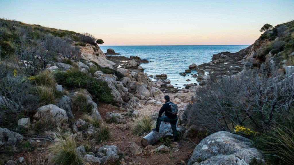
The Path of the Gods (AKA Sentiero degli Dei)
The Path of the Gods is one of the most iconic hikes in Italy. It offers truly unparalleled views of the Amalfi Coast, the island of Capri, and the sparkling Tyrrhenian Sea.
Trail Snapshot
• Difficulty: Moderate
• Distance: 8 km (5 mi)
• Elevation Gain: 650 m (2,130 ft)
• Start / End: Bomerano → Nocelle (Amalfi Coast)
• Highlights: Cliffside views, Capri and Positano vistas, Mediterranean scenery
Difficulty/Recommended Fitness Level
The Path of the Gods is a moderately difficult hike. It’s a good pick for hikers with a basic to moderate fitness level.
Distance
The trail is approximately 5 miles/8 km long, which makes it a manageable day hike that typically takes 3 to 5 hours to complete depending on your pace.
Elevation Gain
The hike has an elevation gain of around 650 meters/2,130 feet. The trail includes some steep sections, especially at the beginning, but levels out to offer a more relaxed walk along the cliffs.
Start and End Point
The hike traditionally starts in the town of Bomerano and ends in Nocelle, which is a small village above Positano. From Nocelle, you can either walk down to Positano via a series of stairs or take a bus. Both towns are well-connected to the Amalfi Coast’s transportation network, so access is easy.
Getting to the Trailhead
Start in Bomerano, where the trail begins right from the village edge and is clearly signed toward Nocelle. Coastal buses connect the Amalfi Coast towns to Bomerano, making it an easy hop if you’re staying nearby. At the finish in Nocelle, descend the steps to Positano or use the local bus for a quick ride down.
Highlights & Landmarks
One of the highlights is reaching Nocelle, where you can enjoy a well-deserved rest with a traditional Italian meal or refreshing drink. The descent to Positano provides a perfect end to the hike, with the vibrant town offering opportunities to relax by the sea. Alternatively, you can explore its winding streets and colorful houses.
")
Tre Cime di Lavaredo Loop
The Tre Cime di Lavaredo is one of the most famous and photographed mountain formations in the Dolomite Mountains, and it is a UNESCO World Heritage Site. The loop trail offers some of the best hiking in Europe, with breathtaking views of the jagged peaks, alpine meadows, and distant mountain ranges along almost the entire route.
Trail Snapshot
• Difficulty: Moderate
• Distance: 10 km (6.2 mi) loop
• Elevation Gain: 400 m (1,312 ft)
• Start / End: Rifugio Auronzo (Dolomites)
• Highlights: Alpine scenery, Rifugio Locatelli viewpoint, WWI history
Difficulty/Recommended Fitness Level
The Tre Cime di Lavaredo Loop is a moderately challenging hike. It’s one of the best day hikes in Italy and offers stunning alpine scenery without requiring advanced mountaineering skills.
Distance
The loop is approximately 6.2 miles/10 km long, which makes it a perfect day hike that typically takes 4 to 5 hours to complete on average.
Elevation Gain
The hike involves an elevation gain of about 400 meters/1,312 feet. While there are some steep sections, the trail is well-maintained and accessible to most hikers.
Start and End Point
The hike starts and ends at Rifugio Auronzo, which is accessible by car or shuttle from nearby towns such as Misurina. The loop trail circles the iconic Tre Cime di Lavaredo (or the Three Peaks of Lavaredo), which provides 360-degree views of these towering limestone formations.
Getting to the Trailhead
Begin at Rifugio Auronzo, the classic start/end point for the loop. It’s reached via the paved access road or a seasonal shuttle from Misurina; parking and services sit beside the rifugio. The loop signage is obvious from the hut terrace—follow the marked path toward Rifugio Locatelli for the best viewpoints.
Highlights & Landmarks
Along the trail, you’ll pass by several mountain huts (rifugi), where you can stop for a meal or refreshment while taking in the stunning scenery. Rifugio Locatelli, in particular, offers an incredible viewpoint of the Three Peaks and is a popular spot for photographers.
This area is also rich in history, as the Tre Cime di Lavaredo was a significant battleground during World War I. You can still see remnants of military fortifications, tunnels, and trenches along the trail.

The Alta Via 1
The Alta Via 1 is one of the most iconic treks in the Dolomite Mountains and is often referred to as the “Classic High Route.” The trail takes you through some of the most stunning landscapes in all of Italy.
Trail Snapshot
• Difficulty: Challenging
• Distance: 120 km (75 mi)
• Elevation Gain: Variable — up to 1,000 m per day
• Start / End: Lago di Braies → Belluno
• Highlights: Multi-day trek, rifugi huts, classic Dolomites views
Difficulty/Recommended Fitness Level
The Alta Via 1 is a challenging long-distance hike that is excellent for experienced hikers with a good level of fitness.
Distance
The full trail covers approximately 75 miles/120 km and typically takes about 10 to 12 days to complete. However, the trail can be broken into shorter sections if you prefer a multi-day hike without committing to the entire route.
Elevation Gain
The hike features a significant elevation gain, with some sections involving climbs of up to 1,000 meters/3,280 feet in a single day.
“Every hiker starts somewhere — grab your free Hiking for Beginners guide.”
Start and End Point
The Alta Via 1 starts at Lago di Braies (Pragser Wildsee) in the northern Dolomites and ends in Belluno, which is a picturesque town on the southern edge of the Dolomites. The trail is typically done as a hut-to-hut hike, with accommodations available at mountain refuges along the way.
Getting to the Trailhead
The traditional start is Lago di Braies (Pragser Wildsee)—trail markers pick up just beyond the lakeshore. Many hikers overnight nearby so they can step straight onto the route in the morning. End logistics are simple: the trek finishes around Belluno, with regular onward transport once you come off the final stage.
Highlights & Landmarks
One of the highlights of the hike is the opportunity to stay in traditional mountain huts, known as rifugi, where you can enjoy hearty Italian meals and experience the warm hospitality of the Dolomites. These huts offer a comfortable resting place each night, making the hike more accessible even in its more challenging sections.

Cinque Terre Coastal Trail
The Cinque Terre Coastal Trail is one of the most famous hikes in Italy. It has breathtaking views of the Ligurian Sea, dramatic cliffside paths, and charming coastal villages that seem to cling to the rocks. Each village along the trail has its own character, which you’ll get to see for yourself when you go there.
Trail Snapshot
• Difficulty: Moderate
• Distance: 12 km (7.5 mi)
• Elevation Gain: 600 m (1,970 ft)
• Start / End: Monterosso → Riomaggiore
• Highlights: Five villages, sea views, Ligurian cuisine
Difficulty/Recommended Fitness Level
The Cinque Terre Coastal Trail is a moderately difficult hike that is suitable for hikers with a basic to moderate fitness level. It’s one of the best hikes in Italy for those who want to experience the country’s stunning coastal scenery without the ‘intensity’ of alpine trails.
Distance
The full trail spans approximately 7.5 miles/12 km, linking the five picturesque villages of Cinque Terre. Most hikers complete the entire trail in about 5 to 6 hours, though it’s common to explore the route over a day or two if you make stops in each village.
Elevation Gain
The elevation gain across the entire trail is about 600 meters/1,970 feet. The trail involves several steep ascents and descents, especially between the villages, but the well-maintained paths make it accessible to most hikers.
Start and End Point
The hike typically starts in the village of Monterosso al Mare and ends in Riomaggiore, but it can be done in either direction. Each village along the route (Monterosso, Vernazza, Corniglia, Manarola, and Riomaggiore) offers its own unique charm and opportunities to rest, eat, and explore.
Getting to the Trailhead
Most hikers begin in Monterosso and walk village-to-village to Riomaggiore (you can also reverse it). Trail access is from each village center, with wayfinding boards at the edge of town. The route is broken into signed sections, so you can start/stop where you like and link back to your base easily.
Highlights & Landmarks
One of the highlights of this hike is the opportunity to explore each of the Cinque Terre villages. Monterosso is known for its wide beach and historical center, Vernazza for its picturesque harbor, Corniglia for its elevated position and panoramic views, Manarola for its iconic postcard-worthy scenery, and Riomaggiore for its vibrant houses and lively atmosphere.
The trail also offers numerous spots to stop and enjoy local delicacies, such as fresh seafood, pesto, and the region’s famous Sciacchetrà wine. These villages are car-free, so hiking is one of the best ways to explore the area and experience the unique culture of the Cinque Terre.

Monte Baldo Ridge Hike
Monte Baldo is often referred to as the “Garden of Europe” due to its incredible biodiversity. The ridge hike offers sweeping views of Lake Garda (Italy’s largest lake) and on clear days, you can see as far as the Dolomite mountains to the north and the Apennine mountains to the south.
Trail Snapshot
• Difficulty: Moderate–Challenging
• Distance: 10 km (6 mi)
• Elevation Gain: 500 m (1,640 ft)
• Start / End: Monte Baldo Cable Car (Malcesine)
• Highlights: Lake Garda views, alpine-to-Mediterranean landscapes
Difficulty/Recommended Fitness Level
The Monte Baldo Ridge Hike is a moderately challenging hike, suitable for hikers with a moderate level of fitness. It’s one of the best hikes in Italy for those seeking panoramic views and a mix of alpine and Mediterranean landscapes.
Distance
The hike covers approximately 6 miles/10 km along the ridge, but it can be extended if you choose to explore additional trails in the area.
Elevation Gain
The hike involves an elevation gain of about 500 meters/1,640 feet, with some steep sections along the ridge. The trail is generally well-maintained, but the elevation changes require a good level of stamina.
Start and End Point
The hike typically starts at the top of the Monte Baldo cable car, which you can access from the town of Malcesine on the shores of Lake Garda. The trail then follows the ridge of Monte Baldo and ends back at the cable car station.
Getting to the Trailhead
Ride the Monte Baldo cable car from Malcesine to the upper station—you step off almost on the ridge. From there, follow the waymarked paths along the crest and loop back to the cable car. If you’re based around Lake Garda, Malcesine access is straightforward along the lakeside.
Highlights & Landmarks
One of the highlights of this hike is the descent back down to Malcesine, where you can explore this charming medieval town with its narrow streets, historic castle, and vibrant waterfront.
")
The Gran Paradiso National Park Hike
Gran Paradiso National Park is Italy’s oldest national park. It was originally established in 1922 to protect the endangered Alpine ibex. Today, the park is a haven for wildlife, including ibex, chamois, marmots, and golden eagles.
Trail Snapshot
• Difficulty: Moderate
• Distance: 13 km (8 mi) loop option
• Elevation Gain: 700 m (2,300 ft)
• Start / End: Cogne village (Aosta Valley)
• Highlights: Wildlife, Alpine vistas, traditional villages
Difficulty/Recommended Fitness Level
The Gran Paradiso National Park Hike is a moderately difficult trek, and is ideal for hikers with a good level of fitness.
Distance
This hike can vary in length depending on the route you choose, but a popular day hike is approximately 8 miles/13 km round-trip.
Elevation Gain
The day hike typically involves an elevation gain of about 700 meters/2,300 feet. The trails can be steep in sections, especially as you approach higher altitudes.
Start and End Point
A common starting point for a day hike in Gran Paradiso National Park is the village of Cogne, which is known as the gateway to the park. The hike can be a loop or an out-and-back, depending on the route you take, with options to return to Cogne or finish in nearby villages/
Getting to the Trailhead
A popular jumping-off point is Cogne, the park’s main gateway, with trailheads signed from the village. From Cogne, follow the waymarked route for your chosen loop or out-and-back, returning to the same valley. If you’re linking villages, plan your finish in advance—most routes drop back toward Cogne for easy wraps.
Highlights & Landmarks
The hike offers breathtaking views of the Gran Paradiso massif, which is the only mountain entirely within Italy that rises above 4,000 meters/13,000 feet. The trails that are in Gran Paradiso also pass through traditional Italian Alpine villages, where you can experience the local culture and perhaps enjoy some regional specialties like Fontina cheese or polenta dishes.

What to Bring for Hiking in Italy
Before you set out on some of the best hikes in Italy, it’s important to be well-prepared with the right gear and clothing:
- Footwear
- As you probably guessed already, you don’t want to embark on Italy’s hiking trails without a solid pair of hiking boots! Italy’s trails can vary from rocky mountain paths to uneven coastal routes, so choose boots with good ankle support and a durable sole. For the easier and flatter trails, sturdy hiking shoes may be better.
- Clothing
- The key to staying comfortable (and warm) while hiking on the trail is layering. Start with a moisture-wicking base layer to keep sweat off your skin, then add an insulating layer for warmth, and then finish with a waterproof/windproof jacket. Even on sunny coastal hikes, weather can change quickly, so it’s best to come with warm clothing just in case.
🗒️ Free Checklist: Planning your next hiking trip?? Download our printable hiking checklist to make sure you don’t miss the essentials.
- Backpack
- A comfortable daypack is a must regardless of whether you’re tackling a short hike or a longer trek.
- Other Essentials
- Don’t forget to also bring a hat and sunglasses for sun protection, sunscreen, and a map or GPS device to keep you on track. Trekking poles can be particularly useful on steep or uneven terrain, and a reusable water bottle or hydration system is a must to stay hydrated in Italy’s (often) warm climate.
Italy’s landscapes are diverse and everything from gentle walks to world-famous hikes that will challenge even the most experienced trekkers. If you bring the above items you should be in good shape. Our product review page can be found here if your looking for more details on a varitety of hiking kit and gear.

Walking Holidays in Italy
Beyond its famous day hikes, Italy is made for walking holidays that unfold at a slower pace. The Dolomites’ Alta Via 1 offers multi-day mountain views and cozy rifugi stays, while routes like the Via Francigena trace centuries-old pilgrimage paths through rolling Tuscan hills. In the north, the lakes and Alpine valleys invite hut-to-hut trekking; in the south, coastal routes combine sunshine with Mediterranean charm. Whether you’re drawn to mountain passes or village-to-village journeys, Italy rewards hikers who linger.
“Turn your dream trek into a plan — get your free Plan Your Own European Walking Holiday ebook ”
Conclusion
Whether you’re seeking challenging treks or leisurely day hikes, these six trails collectively are some of the best and most versatile hikes that Italy has to offer. As you explore these stunning landscapes, you’ll discover exactly why the Italian peninsula attracts hikers from across the globe.
Where to Next?
- Rome: A City Guide for Hikers
- Ultimate Guide to Hiking in Switzerland
- Walking Holidays in France
- Best Hikes in Austria


