
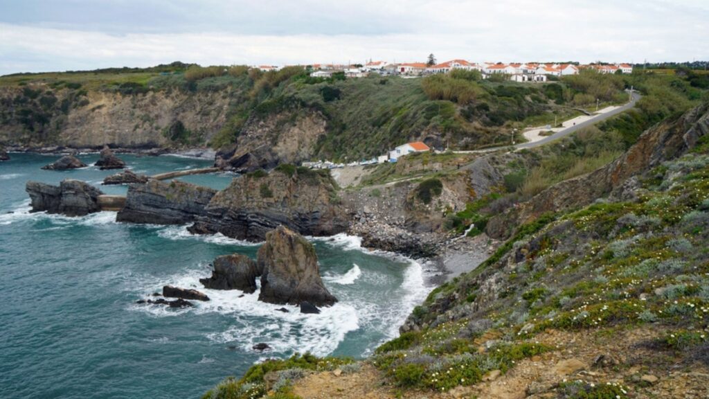
Standing out as one of Europe’s most spectacular long-distance hiking routes, the Rota Vicentina weaves through the most majestic parts of Portugal, giving hikers a trek unlike any other. The trail weaves across a rugged network of both coastal and inland trails across the Alentejo Coast, the Atlantic shoreline, and the rolling countryside in the Southwest of Portugal. From seaside cliffs and small traditional fishing villages to remote forests, the Rota Vicentina brings a bit from every corner of the country to those willing to take it on.
This guide is here to walk you through everything you need to know to start planning and executing your own long-distance trek across Portugal. With over 750 kilometers of trail and two main routes to choose from, getting yourself ready and informed to tackle the trail is one of the most crucial parts of the entire hike.
- Overview of the Rota Vicentina
- The Fishermen's Trail (Trilho dos Pescadores)
- The Historical Way (Caminho Histórico)
- The Need to Know for the Rota Vicentina
- Overall Difficulty
- Navigation
- Weather
- Itineraries for the Rota Vicentina
- Fishermen’s Trail Itinerary
- Historical Way Itinerary
- What to Pack for the Rota Vicentina
- Where to Stay on the Rota Vicentina
- FAQs
- Heading to the Rota Vicentina
- Where to Next?
Overview of the Rota Vicentina
The Rota Vicentina is a network of over 750 kilometers of trails that run along the coast and through the interior of southwest Portugal. The network is split into two primary routes, the Fishermen’s Trail (226 kilometers), and the Historical Way (263 kilometers) that take you through the stunning nature of Southwest Alentejo and the Vicentine Coast Natural Park.
The Fishermen’s Trail (Trilho dos Pescadores)
This coastal route takes you past massive seaside cliffs and stunning beaches on your way from Porto Covo to Lagos. The rugged scenery complimented by sandy beaches and dramatic views of the Atlantic make this trail one of the absolute best picks out of all the Portugal coastal trails.
The Historical Way (Caminho Histórico)
On the other hand, you have the choice to trek inland a bit where the Historical Way links traditional villages, farmland, and old cork forests. It runs roughly parallel to the coast, but brings a quieter, more culturally focused alternative to the more challenging and rugged coastal route.
Both of these routes cross and intersect at various points, making it possible to mix and match your entire trail. Start on the Fishermen’s Trail, and on the Historical Way, or vice versa. This gives hikers great options to take a few days to hike some sections, to take on the bigger multi-day hike Portugal has to offer.
The Need to Know for the Rota Vicentina
Overall Difficulty
Due to the various paths that you can choose from while hiking the Rota Vicentina, the overall difficulty varies and can be matched to the difficulty you’re looking for! Regardless, all hikers should be comfortable walking around 15-25 kilometers per day on uneven ground.
The Fishermen’s Trail is considered to be more challenging than its counterpart, with daily stages that range from 10-22 kilometers on soft sand and uneven cliffs. There are some short, but steep climbs, but nothing dramatic.
The Historical Way is longer, but still easier. This is considered to be an easy to moderate route where you hike along dirt tracks and forest paths that are perfect for beginners or anyone looking for more gentle terrain.
Navigation
The routes throughout the Rota Vicentina don’t share trail markers, which can make things a bit confusing if you are wanting to switch up your routes, but make it super clear when following a certain path. The Fishermen’s Trail holds blue and green markers, while the HIstorical Way has red and white GR11 markers. Both routes are well marked and easy to follow.
Carrying a map is always a good idea for any long distance trek, but you can compliment the map with a GPS app that functions offline. It’s not ideal to rely on cell phone signal out on the trails, and can be difficult to access at all times. Knowing your route and being able to follow a map are great skills to bring with you when embarking on a grand adventure like this one.
Weather
Throughout the year, the weather in Southwest Portugal can swing from mild and wet temperatures to hot and dry days in the summer. The spring is ideal for most hikers as you have temperatures ranging from 15–25°C with wildflowers blooming all around you.
The summer brings hot days inland, sometimes reaching up to 30–40°C. While the coastal areas will be cooler, it’s still a good idea to start and finish early so you aren’t hiking in the heat of the day.
Autumn is another lovely time of the year to take on the Rota Vicentina. The days are warm, but not too hot, and the crowds are fewer. In the winter, you’re likely to find that many services will be closed and inaccessible due to the rainy and windy weather that keeps tourists away.
“First time on the trail? Hiking for Beginners has your back.”
Itineraries for the Rota Vicentina
The way that the Rota Vicentina in Portugal is set up, you can make a million variations of a single itinerary and still never come up with every possible combination. The classic routes are, as mentioned, the Fishermen’s Trail and the Historical Way, and even parts of these can be mixed and matched to form another itinerary.
The two following itineraries for hiking the Rota Vicentina are based on a traditional structure of each route that comprises 13 stages each. For the Fishermen’s Trail, it’s pretty straightforward. The Historical Way has some optional stages and add-ons that make it reach the 13-stage mark, but can be slimmed down easily to 11.
These stages can all be combined and sectioned up to make an itinerary that matches your own speed and goals for the trail. You can hike 15 kilometers a day, or you can push to hike closer to 50, if you’re feeling ambitious. In general, it’s not a bad plan to save a whole day for each stage so you can truly enjoy the beauty that comes along with the trek itself, but not all of us have the time for that and need to push to get the kilometers under boots.
Fishermen’s Trail Itinerary
Stage 1: São Torpes to Porto Covo (10 kilometers)
This short segment is a great intro to the Fishermen’s Trail. It starts just south of Sines in Praia de São Torpes, where you quickly leave the city behind and enter into natural terrain. These dirt tracks and sandy beaches are just a glimpse into the hike that you have ahead of you.
As soon as you take on the short climb into the fishing village of Porto Covo, you can notice the transition from land to sea. The sea breeze and the salty air set the tone for the rest of the trail with a beautiful village to experience it in.
The 10-kilometer walk gives you the chance to shake off any dust and get yourself feeling ready for longer days ahead while still recovering from travel and getting yourself oriented.
Stage 2: Porto Covo to Vila Nova de Milfontes (19.6 kilometers)
Widely viewed as on the most classic stages of the Fishermen’s Trail, the second stage takes you on a winding and epic journey through sand dunes, paths meandering along cliffside edges, and massive stretches of beach. The beach of Malhão gives you a solid taste of what it’s like to walk on pristine and sandy beaches, which can be even more exhausting than you believe, while also letting you immerse in the coastal beauty.
Working that hard for a 20-kilometer hike is rewarded by sweeping views of the Atlantic, rugged cliffs, and a sense of remoteness that may surprise you when you stumble upon a small village seemingly out of nowhere.
Vila Nova de Milfontes is a lively coastal town with a gorgeous old quarter, plenty of options for oceanfront bars and restaurants, and any amenity that you may crave after a hard day of walking.
Stage 3: Vila Nova de Milfontes to Almograve (15 kilometers)
This stage can feel gentler after a long trek through the sand the day before. The hike starts off crossing the Mira River estuary by bridge or a small ferry-taxi. Once you get to the other side, the trail passes through farmland, pastures, and coastal vegetation. You begin to move between beaches and stable paths, getting a taste for everything.
The easier terrain and shorter distance make it a nice recovery day to get ready for another longer day on Stage Four.
Stage 4: Almograve to Zambujeira do Mar (22 kilometers)
Right out of Almograve and toward Foz dos Ouriços, you follow paths that trace the lines of cliffs and rocky outcrops while exploiting the wild beach edges of the Atlantic. The terrain moves back and forth between sand, rock, and dirt tracks. There are some steady, but modest, ascents and descents along this stage to make it possible to navigate the coves, headlands, and dunes that you come across.
Zambujeira do Mar is one of the trail’s most iconic villages. The whitewashed houses complement a relaxed coastal rhythm, all building up to powerful sunsets almost every night. The transition into a cozy coastal village makes this place feel even more special after putting in the work to get there. While beautiful, this stage can be difficult and it’s important to prep for sun exposure and a mix of terrain over a longer distance by bringing plenty of water, snacks, and setting a slow and steady pace.
Stage 5: Zambujeira do Mar to Odeceixe (19 kilometers)
This stage brings a pleasant mix of the coast and calmer paths that run alongside it. You pass smaller beaches, coastal shrubland, and rocky shoreline before you arrive at Odeceixe. Here, the river meets the sea, making a scenic and tranquil environment for a village to sit in. There’s a bit of up and down in this stage, but nothing significant enough to make it feel more difficult than others.
Odeceixe is a natural halfway point for a lot of thru-hikers. The combination of the beaches, river, small cafes, and restful vibes means that you could take a few days to rest here. It also acts as the endpoint for those taking a shorter walk on the Fishermen’s Trail, as after Odeceixe, the landscape begins to change from the Alentejo coast to the Algarve style.
Stage 6: Odeceixe to Aljezur (23 kilometers)
After a restful stop in Odeceixe, the trail takes you a bit inland to mixed terrain where you’ll cross farmland, coastal shrub, and small villages. Eventually, you’ll reach Aljezur, a good base camp with plenty of amenities and transport links to either shift your itinerary or make it a terminus.
Many people will take a stop here to rest and get a solid resupply before moving forward. You can take the time to explore castle ruins after a more demanding trek over mixed terrain.
Stage 7: Aljezur to Arrifana (17 kilometers)
This moderate route wanders, like others, from coast to inland tracks. The trail departs from the Aljezur market area and heads toward fields and small settlements. It follows the sea until you reach the resort-village of Arrifana. This village is well known for its surf culture, as a result of being perched right above a magnificent surf beach.
While the track isn’t super long, it can follow rockier paths with occasional gravel and road sections, making it varied and slightly more difficult than smooth terrains.
Stage 8: Arrifana to Carrapateira (20 kilometers)
Across the tops of cliffs, the eighth stage of the Fishermen’s Trail gives another splendid tour of the wild Atlantic coast. There, you walk between dunes, cliffs, and sandy beaches alike. There are some sections of crumbly rocks that wind around headlands, demanding careful footing. At the end of the stage, you find Carrapateira, a lovely rustic village with plenty of coastal beauties to be enjoyed.
“Plan less, walk more.” Pick a route, set your pace, and let Europe unfold under your boots: grab your free Walking Holiday ebook today”
Stage 9: Carrapateira to Vila do Bispo (15 kilometers)
While this path is shorter than many others, there’s a lot of variety over the walk. The trail moves from dunes to the inland terrain of low hills and farmland before descending into Vila do Bispo. Even with low elevation gain over all, it’s done in a stacked manner, with bits of up and down spread out the whole way, which can add up for many hikers.
Stage 10: Cila do Bispo to Sagres (20 kilometers)
As you head toward the southwestern extremity of Europe, the trail draws you close to famous capes, with cliffs skyrocketing higher and higher as you progress. Here, the Atlantic shows its wild side and you should expect strong sea breezes along coastal headlands and many rocky outcrops that can be tricky to navigate.
Sagres itself has a strong history with a fortress and easy access to all the coastal vistas and services you could want. It’s a great place to enjoy high quality seafood and watch the Atlantic come to life.
Stage 11: Sagres to Salema (20 kilometers)
Many will call this stage the most difficult of the entire Fishermen’s Trail. The coastline is rugged with steep cliffs, frequent and repeated ups and downs, rocky trails, and very few chill stretches. Here you walk around headlands, drop down to beaches, head back up, and often find yourself walking over unstable rock and gravel. Add in the weather and ocean spray, and you have a tough stretch of walking.
The relief of Salema is welcome. This small beach village has a few amenities, but mostly offers tranquility. There’s plenty of wildness and raw beauty along this stretch, but you definitely need to work hard for it.
Stage 12: Salema to Luz (12 kilometers)
A much easier and shorter stage follows the next day. It follows the coast for most of the stretch, and you’ll pass by plenty of small beaches, rocky outcrops, and small seaside towns before you finish up for the day. Luz (Praia de Luz) is a resort village that is a great end point for the shorter distance as it has all of the relaxing amenities you could imagine available.
Stage 13: Luz to Lagos (11 kilometers)
The final stretch is a short walk along the ocean that has all of the good you’ve been experiencing the whole time, but highlighted by all of the hard work you’ve put in since the beginning. You arrive in Lagos after a mostly manageable stretch of trail, made easier by having the end in sight the whole walk.
When you get into Lagos, you’re surrounded by history, great food, and all the comforts you could ask for. There’s no better place to wrap up the 230 kilometer journey as you reflect on what you’ve just done and prepare for the next adventure.
Historical Way Itinerary
Stage 1: Santiago do Cacém to Vale Seco (18 kilometers)
The town of Santiago do Cacém marks a majestic start to the Historical Way with castles looking from the top over the rolling countryside of cork forests, fields, and rural tracks. This first stage is gentle walking through a classic landscape. You pass old farms and stone walls from centuries before, with the Serra do Cercal hills spattering the backdrop.
As your hike continues, the path slowly takes you further into remote and peaceful territory with long stretches on dirt roads. Arriving in Vale Seco doesn’t get rid of the remoteness feeling. This is a tiny settlement that is no more than a cluster of houses, but it provides a nice point of transition between the town and country.
Stage 2: Vale Seco to Cercal do Alentejo (23 kilometers)
Open landscapes slowly become filled by Alentejo’s cork and holm oak woodlands along this stage of walking. The route rises and falls gently across farmlands with small valleys and tucked away groves of trees. Many storks like to nest in these trees and on rooftops along the way, enjoying the slow rhythm of the country life all around you.
Outside of Cercal do Alentejo, you start to find mixed terrain from streams and low hills. Cercal is small, but has some lovely cafes with a nice central square to relax in.
Stage 3: Cercal do Alentejo to São Luís (20.5 kilometers)
After Cercal, the landscape begins to transform into a more intimate environment with a mix of eucalyptus and cork trees dotted around agricultural lands. The trail winds through rolling hills and small pockets of forest, making it feel tucked in and comfortable like the feeling of these villages. There are some slightly steeper ascents along the way, but nothing too strenuous.
Stage 4: São Luís to Odemira (22.5 kilometers)
The foothills and forests between São Luís and the Mira River valley form the path that stage four takes. There are woodland tracks, but also valleys densely packed with shrubs, and other landscapes that are wide open. The longer track means a more varied landscape, but also some longer climbs and descents.
Odemira is one of the larger stops on the Historical Way. It sits along the river with whitewashed houses and is always bustling with the busyness of everyday life.
Optional Stage 5: Odemira to Sabóia (33 kilometers)
This section of the trail isn’t necessary, but many hikers choose to walk it as it is both the longest and most remote section on the Historical Way. The rural tracks pull you deep into the countryside with long stretches through dense forests and quiet valleys without seeing much civilization at all.
The second half of the stage has more ups and downs as you weave through wooded hills and approach Sabóia. While this stage is a test of endurance, it’s also one of the most wild-feeling parts of the trail and can be worth the extra push.
Stage 6: Odemira to São Teotónio (19 kilometers)
If you choose to skip out on Sabóia, you can move straight on to São Teotónio. If you take the extra walk to Sabóia, the distance remains about the same to get to São Teotónio and back on track.
Either way, the trail is very similar. You are given a short reprieve from the long haul of yesterday and follow rolling countryside toward São Teotónio. Here, you can find local markets, cafes, and tons of friendly locals that are more than happy to make you feel at home.
Stage 7: São Teotónio to Odeceixe (17 kilometers)
Moving a bit more toward the coast, the seventh stage brings a rich blend of the beautiful landscape covering the previous half of the Historical Way. This section is simple with very few short climbs, but nothing that will put you to the test or wear you down.
The approach to Odeceixe is one of the top highlights of the entire Historical Way. The landscape opens up into a wide open view across the Ribeira de Seixe valley where you can often see the whitewashed houses perched up on the hillside. The marvelous view is second only to the charm and high energy atmosphere of the town itself.
Stage 8: Odeceixe to Aljezur (19.5 kilometers)
As soon as you start out on this stage, you can tell that it’s one of the more scenic ones on this inland route. The rolling valleys and lush riverbanks make for a greener trek with breezy hillsides catching the wind from the ocean. Along the way you can spot a few glimpses of the coastline, a nice reminder of how close it is.
Small streams and tranquil dirt roads define the track through groves of eucalyptus and farmland as you get closer into Aljezur. You’ll glimpse the old castle and tiled houses up on the hillside as the town approaches and you complete the final stretch on the valley floor.
Stage 9: Aljezur to Arrifana (12 kilometers)
While this stage is incredibly short, it’s still packed with beauty. You climb out of town to shrubland and pine forest before your descent to a dramatic coastline with brand new landscapes surrounding you.
Later, you take high plateaus with grand views over the Atlantic to walk to Arrifana. Here, you’ll find a small village with a dramatic bay and relaxed vibe, one that comes from the surf culture that’s strong here.
Stage 10: Arrifana to Carrapateira (24 kilometers)
Dramatic cliffs and wide open plateaus offer a contrast to the rest of the Historical Way along this stage. The trail stays inland for most of the time, but weaves outward toward the coast over and over to give views of hidden coves and sweeping beaches. The mix of sandy tracks and dirt paths can give a more strenuous feel to the track, although it isn’t overly difficult.
Small dunes line the way to Carrapateira, a tiny settlement nestled between Bordeira and Amada, two of the most beautiful beaches in Portugal.
Stage 11: Carrapateira to Vila do Bispo (21.5 kilometers)
The southwest Algarve is characterized by broad and windswept plateaus, a feature that’s obvious on this stretch. Long open tracks with views in every direction define the trail as you pass isolated farms and patches of Mediterranean scrub. Here, you feel small in the immense space.
Stage 12: Vila do Bispo to Cabo de São Vicente (14 kilometers)
The classic route of the Historical Way takes you from Vila do Bispo to Cabo de São Vicente (the terminus) past small farms and some occasional stone walls in the open countryside. This way is straightforward and offers a relaxed pace with plenty of time to enjoy the environment around you.
If you’re looking for a wilder finish to the trail, making your way to Raposeira right before Vila do Bispo provides the opportunity to see rugged and wild landscapes right at the end.
Stage 13: Raposeira to Cabo de São Vicente (13.2 kilometers)
This variant to the final stage of the Historical Way is one for those who are looking to get back out toward the coast and experience the raw wild power of the Atlantic Ocean one last time. The route swings along the curve of the coast and brings you along long stretches of exposed plateau and wild views of the ocean. There tend to be fewer hikers that take this path, which can be the perfect time for some reflection upon finishing the trail.
Regardless of the path you choose, the finale of finally walking into Cabo de São Vicente is something that you’re certainly going to feel accomplished with after putting so much effort into so many kilometers that are now behind you.
What to Pack for the Rota Vicentina
Like any other long-distance trek in Europe, the Rota Vicentina has a detailed list of things to pack when you’re getting ready for a thru-hike. If you’ve ever hiked a long distance trail, the list won’t look much different from what you probably took with you on that route, but it’s always a good reminder to read lists and double check what works well for you, and what you can leave behind.
🗒️ Free Checklist: “Never forget the essentials — grab your free Ultimate Hiking Packing List.”
Footwear
Many hikers nowadays will choose between trail runners or lightweight hiking boots. These two options vary greatly in what they can offer, and your choice between them is usually highly personal due to opinion.
Trail runners are incredibly lightweight and dry quickly, while hiking boots are the exact opposite. However, hiking boots offer ankle support that can’t be matched by trail runners, so hikers with ankle issues will choose boots every time.
The thing you need to consider for the right footwear on the Rota Vicentina is the sand. What shoes will be more friendly for the beaches? Many will take their shoes off to walk to coastal stretches, but some want more protection where sand can’t get through to your feet.
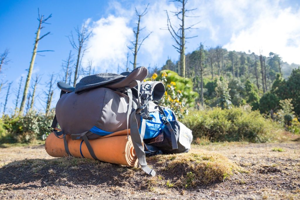
Backpack
A thirty to forty-liter backpack will suffice for hikers that are on their own. Towns along the way have plenty of amenities, meaning that when you sleep in lodging every night, it eliminates the need for sleeping gear like a tent and sleeping bag.
However, if you are using a luggage transfer between stops, you can easily pack a small daybag to carry along with you to carry snacks, water, first aid, extra layers, and navigation. This will lighten your load dramatically, and it can be a great feeling to hike with a daypack, but still have everything you need at the end of the day.
Clothing
Breathable layers, waterproof layers, warm layers, and all of the accessories will play a part on the Rota Vicentina. The weather along the coast, especially in the shoulder seasons, can change quickly and dramatically, so it’s important to have the right clothes to adapt as you go.
One important part that’s easy to forget is swimwear. This trail has infinite possibilities for times you can hop in the ocean, and having a dedicated swimsuit is well worth the small extra weight.
Hiking Poles
The sandy beaches and dunes can make for some unstable walking terrain, especially when you’re tired after long days. This is where hiking poles can play a great role in providing extra support for anyone crossing more difficult terrain. You may feel like you don’t need them on the hard-packed dirt tracks, but as soon as you hit rocky and sandy terrain, they can be a lifesaver.

Navigation
An offline Rota Vicentina map is the key to keeping yourself on the route for the entirety of your hike. This can be either as an app or as a paper map, but either way, it needs to work without connectivity. This way, if you’re lost in a no-service zone, you can still find your way to the closest town where you can likely hook up and figure out where you went wrong.
Food and Water
Even if you’re hiking with a luggage transfer, bringing food and water on the hiking sections is an absolute necessity. Snacks and energy bars will give you the extra boost you need during a long hike, while water will be invaluable, especially on the longer days in the summer heat. It’s best to carry between two and three liters of water at all time so that you can make the longer stretches that don’t have access to freshwater.

Personal Items
The little bits and bobs that are often forgotten are possibly the most important to write out a list for. Things like sunscreen, medications, sunglasses, a first aid kit, a trowel, and any other optional items, can easily go forgotten when you aren’t paying deliberate attention to them.
Where to Next?
- Ultimate Guides – your gateway to hiking across Europe
- Hikes & Trails – curated lists of the best hikes and local gems
- Walking Holidays – extended journeys for when a single day just isn’t enough
- General Blog – all the extras: gear reviews, planning tips, and personal stories
Where to Stay on the Rota Vicentina
FAQs
How difficult is the Rota Vicentina?
The network of trails offers the chance to make a hike that matches almost anyone’s ability level. The Fishermen’s Trail is more of a moderately hard trail, while the Historical Way is an easy-moderate route, primarily due to the different terrain you find on each path.
Can beginners hike the Rota Vicentina?
Beginners can absolutely hike the Rota Vicentina. The Historical Way is rated as an easy to moderate trail, and the Fishermen’s Trail has several sections where beginners are going to handle the trail easily. Simply try to plan shorter days with buffer time to recover when needed.
Is wild camping allowed on the Rota Vicentina?
No. Wild camping is prohibited in the protected natural park. Staying in Rota Vicentina accommodation is the best option (guesthouses, rural tourism farms, hostels, small hotels).
What gear is essential for the Rota Vicentina?
All of the basics are necessary when packing for the Rota Vicentina. Things like nice trail shoes, a backpack, hiking poles, food and water, and protection from the elements are all key.
How long does it take to walk the Rota Vicentina?
The Rota Vicentina can take anywhere from a day to over two weeks, depending on how you choose to hike it. The Fishermen’s Trail can take between ten and fourteen days to complete, the Historical Way can take twelve to fifteen days, and you can choose to hike small sections just as a dayhike whenever you want.
What is the most beautiful part of the Rota Vicentina?
While the entire network of trails is beautiful, many people talk explicitly about their love of the Cabo Sardão cliffs, the Odeceixe river mouth, the cliffs between Carrapateira and Vila do Bispo, and the Praia do Malhão dunes. However, it would be easy to make a postcard from a photo taken at just about any spot along the trail.
What’s the difference between the Fishermen’s Trail and the Historical Way?
The Fishermen’s Trail is a coastal, sandy, cliffside route that stays next to the Atlantic, while the Historical Way is an easier, inland walk that takes you through villages and dense pockets of forest along the way. Both of these are part of the Rota Vicentina trail network in Southwestern Portugal.
Heading to the Rota Vicentina
The Rota Vicentina is special in the way that it’s not a single trail. This network of trails brings opportunities for hikers of all different levels to challenge themselves or simply enjoy a walk in the beauty of Southwestern Portugal. There’s something along this route to be found for everyone, whether you want to take a route along the coast or stick inland and explore the true rural parts of the country.
No matter what you decide to make your itinerary, the Rota Vicentina is going to deliver a beautiful, quaint, and unforgettable experience that will be a once-in-a-lifetime chance to trek these hills.


